Weston, Staffordshire
| Weston | |
 The Parish Church of Saint Andrew |
|
 Weston |
|
| Population | 965 |
|---|---|
| District | Stafford |
| Shire county | Staffordshire |
| Region | West Midlands |
| Country | England |
| Sovereign state | United Kingdom |
| Post town | STAFFORD |
| Postcode district | ST18 |
| Dialling code | 01889 |
| Police | Staffordshire |
| Fire | Staffordshire |
| Ambulance | West Midlands |
| EU Parliament | West Midlands |
|
|
Coordinates: 52°50′30″N 2°02′07″W / 52.8417°N 2.03536°W
Weston is a village and Civil Parish.[1] within the English county of Staffordshire.[2][3] The Parish is in the Local Authority of Stafford (Non-Metropolitan District).
Location
The village is 4.6 miles (7.4 km) north east of the town of Stafford, and 9.5 miles (15.3 km) south west of Uttoxeter. The village of Gayton is 1.5 miles (2.4 km) to the north east. The nearest railway station is at Stafford. The nearest main roads are the A51.[4] which skirts the north eastern boundary of the village.
Population
The 2011 census recorded a population of 965[5] in 422 Households. The parish comes under the Stafford Non-Metropolitan District.


History
The ancient village and parish of Weston was a forest clearing on the outskirts and was part of the Chartley Estate which was sold off in 1904. The high ground meant that the surrounding land was well drained with a good water supply from the nearby River Trent. This small settlement was also located at the intersection of the London - Lichfield - Chester road and the Shrewsbury - Stafford - Derby road (the current A51 and A518 respectively). The road from Stafford originally forded the Trent. In the late 18th Century a flood washed away the bridge there. It was later replaced by a single arch stone bridge in the 19th century.
Domesday Book
Weston on Trent is mentioned in the Domesday Book of 1086.[6] In the survey the village is recorded as being as the holding of one of King William's thegn's named Sperri, having previously being held by a Saxon named Wulfhelm. Assets of the village were listed as half a virgāta of land. Land for one plough, one villager or villein, 3 acres of meadows.[7] There was one Household in the village and the amont of tax per household was calculated at one-eighth of one 'hide'. The gross taxable value of the village was calculated at 0.1 geld units, with a Value to lord of the manor in 1086 of £0.1.
Saint Andrew's Parish Church
The Parish Church of St. Andrews was restored by George Gilbert Scott in the 1860s and by William Butterfield in the 1870s.[8] Butterfield's restoration revealed some of the original Norman work. The bell tower dates from the early 13th Century. The tower holds two bells; "Ave Maria" dating from 1402 and "Ann Shaw" dating from 1962. A third bell, "Katerina", dating from 1500, can be found cracked upon the floor. The church also houses a silver communion paten dating from the early 15th Century. The Parish registers, kept by Staffordshire Record Office, date from 1581.
Notable Buildings and Structures
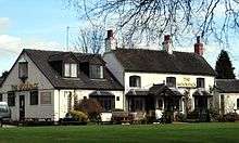
In the village, the present thatched "Manor House", which has been used as a farm building in the past, dates from the 16th Century. In the mid 19th Century it was used as the national School and school keeper's cottage, then as a Wesleyan Methodist meeting house until the present Methodist Church was built at the start of the 20th Century along the main London - Chester road.
References
| Wikimedia Commons has media related to Weston, Staffordshire. |
- ↑ "Weston with Gayton Community online" (.). Weston with Gayton Parish and village information. Retrieved 2013-04-17.
- ↑ OS Explorer Map 244: Cannock Chase & Chasewater: (1:25 000) :ISBN 0 319 46269 2
- ↑ Map Details retrieved 11 April 2013
- ↑ - Staffordshire A-Z County Atlas: 2011 Edition: Scale:3.8 inches to 1 mile (5.9cm to 1km)ISBN 978 1 84348 748 7
- ↑ "Census population and household counts for parish of Kingstone" (Neighbourhood Statistics webpage). Office for National Statistics Census (2011). Retrieved 2013-04-16.
- ↑ The Domesday Book, Englands Heritage, Then and Now, Editor: Thomas Hinde,Norfolk page 194 ISBN 1858334403
- ↑ "Hixon" (by Anna Powell-Smith. Domesday data created by Professor J.J.N. Palmer, University of Hull.). Open Domesday. Retrieved 2013-04-15.
- ↑ Staffordshire (The Buildings of England): Author: Nikolaus Pevsner: Publisher: Pevsner Architectural Guides; 1st edition (27 May 1976): ISBN 0140710469