Weston, Massachusetts
| Weston, Massachusetts | ||
|---|---|---|
| Town | ||
|
Town Hall | ||
| ||
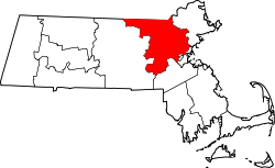
 Location in Middlesex County in Massachusetts | ||
| Coordinates: 42°22′00″N 71°18′11″W / 42.36667°N 71.30306°WCoordinates: 42°22′00″N 71°18′11″W / 42.36667°N 71.30306°W | ||
| Country | United States | |
| State | Massachusetts | |
| County | Middlesex | |
| Settled | 1642 | |
| Incorporated | 1713 | |
| Area | ||
| • Total | 17.3 sq mi (44.9 km2) | |
| • Land | 17.0 sq mi (44.1 km2) | |
| • Water | 0.3 sq mi (0.8 km2) | |
| Elevation | 180 ft (55 m) | |
| Population (2010) | ||
| • Total | 11,261 | |
| • Density | 650/sq mi (250/km2) | |
| Time zone | Eastern (UTC-5) | |
| • Summer (DST) | Eastern (UTC-4) | |
| ZIP code | 02493 | |
| Area code(s) | 781 / 339 | |
| FIPS code | 25-77255 | |
| GNIS feature ID | 0618245 | |
| Website |
www | |


Weston is a town in Middlesex County, Massachusetts, United States in the Boston metro area. The population of Weston, as of the 2010 U.S. Census, was 11,261.[1]
Weston is among the 10 most affluent towns with 1,000 or more households in the United States and is the third-most affluent town with a population of at least 10,000 in the United States.[2] Weston is among the nation's 100 most expensive ZIP codes, with a median home price of well over $2 million.[3] It is the only town in the Boston Area to have private roads, with state of the art police patrolling 24/7.
Despite a population of just 11,261, Weston's area is only slightly smaller than that of its neighbor town, Newton, Massachusetts which accounts for a much higher population of about 90,000. As a result, Weston's houses are on average much larger than those present in nearby towns, with considerable space between each individual residence. It has one of the lowest crime rates among Metro-west Boston suburbs.
Weston was a dry town from 1838 until 2008.[4] Incorporated in 1713, the town is located on a rugged upland plateau.[5]
History
The town of Weston was originally established as the West Precinct of Watertown in 1698. The town was separately incorporated as the town of Weston in 1713.
Weston is located on a rugged upland plateau. Early settlers discovered that the amount of useful agricultural land was limited as was the waterpower potential in the town. But colonists moving in from Watertown in the mid-17th century established scattered farms in Weston, and by 1679, a sawmill, several taverns, some doctors, and according to the historians, "probably some lawyers," had settled in Weston.
By the 18th century, residents were profiting by the traffic on the Boston Post Road. Taverns of great historic importance were established on the Road. The Golden Ball Tavern, built in 1750, and the Josiah Smith Tavern, built in 1757, still exist in the town. Unfortunately, commercial stagnation followed the loss of business after the opening of the Worcester Turnpike in 1810 drew commercial traffic from the Boston Post Road. Townspeople turned to boot and shoe making, and the manufacturing of cotton and woolen mill machinery. By 1870, substantial country estates were being built in Weston by Bostonians, establishing a prosperous residential character for the town. Farming continued to be a significant support for the local economy, and an organ factory opened in 1886 which employed some residents. The Weston Aqueduct and Reservoir were built in 1903 and the Hultman Aqueduct followed in 1938 to bring Quabbin Reservoir water into Boston. In exchange, Boston residents continued to build homes in Weston, many of them architect designed.
Some famous architects such as McKim and Richardson designed luxurious houses in the town, which witnessed a rapid increase in population from 1920 to 1935, and then again after World War II. The Boston oriented suburbanization has continued as a major factor in the town's development. Residents are very proud of the town's school system and the handsome homes in quiet, well-kept neighborhoods, but tend to brush off the town's reputation as one of the most affluent communities in the state. Weston has carefully retained significant amounts of open space and maintains over 60 miles of hiking and horseback riding trails, playgrounds, ball fields, golf courses and cross-country skiing areas.[6][7]
Weston was also the home of the E. and G.G. Hook & Hastings organ company until a fire destroyed the factory in the early 1900s. After the fire broke out the fire department responded however the water source (Stony Brook) was just on the other side of the railroad tracks. As the firemen were fighting the fire a train came along and cut all the hoses leaving the firemen without water and having to scurry to replace the cut hoses. Unfortunately for the factory this required more time and the fire consumed the wooden factory.
Weston is also home to many important events regarding the revolutionary war, with the most important being a through way for the Noble Train of Artillery led by Henry Knox.[8] Along with several other towns along the route that Knox took, Weston serves as an important reminder of this selfless and punishing act that helped the revolutionaries win the war.
Geography
According to the United States Census Bureau, the town has a total area of 17.3 square miles (45 km2), of which 17.0 square miles (44 km2) is land and 0.3 square miles (0.78 km2), or 1.85%, is water. The town has a serious problem with deer overpopulation, and is using controlled bow hunting to address the problem.[9]
Demographics
| Historical population | ||
|---|---|---|
| Year | Pop. | ±% |
| 1850 | 1,205 | — |
| 1860 | 1,243 | +3.2% |
| 1870 | 1,261 | +1.4% |
| 1880 | 1,448 | +14.8% |
| 1890 | 1,664 | +14.9% |
| 1900 | 1,834 | +10.2% |
| 1910 | 2,106 | +14.8% |
| 1920 | 2,282 | +8.4% |
| 1930 | 3,332 | +46.0% |
| 1940 | 3,590 | +7.7% |
| 1950 | 5,026 | +40.0% |
| 1960 | 8,261 | +64.4% |
| 1970 | 10,870 | +31.6% |
| 1980 | 11,169 | +2.8% |
| 1990 | 10,200 | −8.7% |
| 2000 | 11,469 | +12.4% |
| 2010 | 11,261 | −1.8% |
| * = population estimate. Source: United States Census records and Population Estimates Program data.[10][11][12][13][14][15][16][17][18][19] | ||
As of the census[20] of 2000, there were 11,469 people, 3,718 households, and 2,992 families residing in the town. The population density was 674.0 people per square mile (260.2/km²). There were 3,825 housing units at an average density of 224.8 per square mile (86.8/km²). The racial makeup of the town was 90.26% White, 1.18% African American, 0.05% Native American, 6.82% Asian, 0.05% Pacific Islander, 0.43% from other races, and 1.21% from two or more races. Hispanic or Latino of any race were 1.90% of the population.
There were 3,718 households out of which 42.3% had children under the age of 18 living with them, 73.1% were married couples living together, 5.6% had a female householder with no husband present, and 19.5% were non-families. 17.2% of all households were made up of individuals and 10.5% had someone living alone who was 65 years of age or older. The average household size was 2.85 and the average family size was 3.21.
In the town the population was spread out with 28.0% under the age of 18, 7.3% from 18 to 24, 20.4% from 25 to 44, 27.8% from 45 to 64, and 16.5% who were 65 years of age or older. The median age was 42 years. For every 100 females there were 86.6 males. For every 100 females age 18 and over, there were 79.6 males.
The median income for a household in the town was $153,918 and the median income for a family was $200,000+, figures that had risen to $189,041 and over $230,000 by 2007. Males had a median income of $100,000 versus $58,534 for females. The per capita income for the town was $79,640. About 2.1% of families and 2.9% of the population were below the poverty line, including 1.8% of those under age 18 and 3.9% of those age 65 or over.
Weston was ranked as the 87th-wealthiest US ZIP Code in a Forbes survey in 2015.[21]
Politics
Weston has 8,179 registered voters. There are 2,006 Democrats 24.53%; 1,537 Republicans 18.79%; and 4,611 voters are Unenrolled 56.38% {Feb. 2014}.
Katherine Clark carried Weston with 59% of the vote in the special election to fill Ed Markey’s Congressional seat, on December 10, 2013. In 2012, Weston supported Democrat Barack Obama 51.8% to Republican Mitt Romney 48.2% in the presidential election; however, Weston supported Republican Scott Brown 54.8% to Democrat Elizabeth Warren 45.2% in the 2012 Senatorial election.[22]
Like much of New England, Weston has trended strongly Democratic on the federal level in recent years. Weston supported Ronald Reagan in 1980 and 1984, as well as George H.W. Bush in 1988, against homestate Governor Mike Dukakis for president of the United States. However, it supported Bill Clinton in 1992, and has supported the Democratic candidate in every election since then, including Barack Obama over Mitt Romney.
Weston is located entirely within Massachusetts's 5th congressional district.
Massachusetts is represented in the United States Senate by senior Senator Elizabeth Warren and junior Senator Ed Markey.
Education
- Weston High School
- Weston Middle School
- Woodland School
- Country School
- Field School
- Pope John XXIII National Seminary
- The Cambridge School of Weston
- Regis College
- Rivers School
- The Rivers School Conservatory
- The Meadowbrook School of Weston
- Gifford School
- Tremont School[23]
Transportation
Weston is served by three MBTA commuter rail stations - Silver Hill, Kendall Green, and Hastings - all on the Fitchburg Line. All are small, limited-service stops. The MBTA's long-term plan is to consolidate these stations into one intermodal station near Route 128/I-95.
Notable people
- Frederic C. Dumaine, Jr., American business executive and Chairman of the Massachusetts Republican Party from 1963-1965
- Sarah Fuller, author and educator who taught Helen Keller
- Jeremy Jacobs, owner of the Boston Bruins
- Grover Norquist, founder and president of Americans for Tax Reform
- Stephen Pagliuca, managing director of Bain Capital, co-owner of the Boston Celtics
- Anne Sexton, Pulitzer Prize-winning poet
- Robert Winsor, prominent American banker and financier of the early 20th century
- David Frank, producer, composer, classically trained pianist, and founding member of the 1980s R&B group The System.
- Anant Agarwal
- Sports figures
- Steve Belkin, owner of the Atlanta Hawks and formerly the Thrashers
- M. L. Carr, former Boston Celtics player and head coach
- John Havlicek, former Boston Celtics player
- Cedric Maxwell, former Boston Celtics player and current radio announcer
- Bobby Orr, player for Boston Bruins
- David Ortiz, Boston Red Sox DH/1B
- James Pallotta, owner of the Boston Celtics and AS Roma; Founder of Raptor Capital Management
- Jerry Remy, former Boston Red Sox player and current TV announcer
- Willard Rice, 1924 Olympic hockey player
- Jeff Vinik, owner of the Tampa Bay Lightning and minority owner of the Boston Red Sox
- Kevin Youkilis, former Boston Red Sox player
- John Harland, golf professional
Points of interest
- The Case Estates
- Blessed John XXIII National Seminary
- Land's Sake Farm
- State Police Troop E-1 Barracks
- Golden Ball Tavern
- Regis College, site of the Spellman Museum of Stamps & Postal History
- Weston Friendly Society of the Performing Arts, Massachusetts' second oldest community theater company
- Leo J. Martin Golf Course
- Norumbega Tower
- Miles of natural trails
References
- ↑ "Profile of General Population and Housing Characteristics: 2010 Demographic Profile Data (DP-1): Weston town, Middlesex County, Massachusetts". U.S. Census Bureau, American Factfinder. Retrieved April 9, 2012.
- ↑ Highest income places in the United States with at least 100 households
- ↑ Schiffman, Betsy (November 10, 2015). "America's Most Expensive ZIP Codes 2015". Forbes.
- ↑ "Popping the cork in Weston". The Boston Globe. September 10, 2008.
- ↑ http://weston.govoffice.com/index.asp?Type=B_BASIC&SEC={4B820259-C0BD-4FC8-A30A-16350219453E}
- ↑ (Narrative based on information provided by the Massachusetts Historical Commission)
- ↑ Farm Town to Suburb, The History and Architecture of Weston, Massachusetts, 1830-1980 by Pamela W. Fox, with Sarah B. Gilman, Photo Editor
- ↑ "Home". A Test of Will. Retrieved 2016-04-18.
- ↑ STERBA, JIM (November 2, 2012). "America Gone Wild". wsj.com.
- ↑ "TOTAL POPULATION (P1), 2010 Census Summary File 1". American FactFinder, All County Subdivisions within Massachusetts. United States Census Bureau. 2010.
- ↑ "Massachusetts by Place and County Subdivision - GCT-T1. Population Estimates". United States Census Bureau. Retrieved July 12, 2011.
- ↑ "1990 Census of Population, General Population Characteristics: Massachusetts" (PDF). US Census Bureau. December 1990. Table 76: General Characteristics of Persons, Households, and Families: 1990. 1990 CP-1-23. Retrieved July 12, 2011.
- ↑ "1980 Census of the Population, Number of Inhabitants: Massachusetts" (PDF). US Census Bureau. December 1981. Table 4. Populations of County Subdivisions: 1960 to 1980. PC80-1-A23. Retrieved July 12, 2011.
- ↑ "1950 Census of Population" (PDF). Bureau of the Census. 1952. Section 6, Pages 21-10 and 21-11, Massachusetts Table 6. Population of Counties by Minor Civil Divisions: 1930 to 1950. Retrieved July 12, 2011.
- ↑ "1920 Census of Population" (PDF). Bureau of the Census. Number of Inhabitants, by Counties and Minor Civil Divisions. Pages 21-5 through 21-7. Massachusetts Table 2. Population of Counties by Minor Civil Divisions: 1920, 1910, and 1920. Retrieved July 12, 2011.
- ↑ "1890 Census of the Population" (PDF). Department of the Interior, Census Office. Pages 179 through 182. Massachusetts Table 5. Population of States and Territories by Minor Civil Divisions: 1880 and 1890. Retrieved July 12, 2011.
- ↑ "1870 Census of the Population" (PDF). Department of the Interior, Census Office. 1872. Pages 217 through 220. Table IX. Population of Minor Civil Divisions, &c. Massachusetts. Retrieved July 12, 2011.
- ↑ "1860 Census" (PDF). Department of the Interior, Census Office. 1864. Pages 220 through 226. State of Massachusetts Table No. 3. Populations of Cities, Towns, &c. Retrieved July 12, 2011.
- ↑ "1850 Census" (PDF). Department of the Interior, Census Office. 1854. Pages 338 through 393. Populations of Cities, Towns, &c. Retrieved July 12, 2011.
- ↑ "American FactFinder". United States Census Bureau. Retrieved 2008-01-31.
- ↑ Schiffman, Betsy (November 10, 2015). "America's Most Expensive ZIP Codes 2015". Forbes.
- ↑ "Massachusetts results". Weston Patch. November 6, 2012.
- ↑ "Tremont School". tremontschool.org. December 3, 2010. Retrieved August 22, 2011.
External links
| Wikimedia Commons has media related to Weston, Massachusetts. |
- Town of Weston official website
- Weston Public Library
- Random Recollections, by Brenton H. Dickson, a book about growing up in Weston
- “Weston” by Charles Alexander Nelson in Samuel Adams Drake, compiler, History of Middlesex County, Massachusetts, Volume 2 (L-W), 1880, pp. 488–505.
- Rate It Green- Green Building Directory and Discussion Network
Boston (capital) | |
| Topics |
|
| Society | |
| Regions | |
| Counties | |
| Cities |
|