West Overton
| West Overton | |
 St Michael and All Angels church seen from Overton Hill |
|
 West Overton |
|
| Population | 637 in (2011)[1] |
|---|---|
| OS grid reference | SU132680 |
| Unitary authority | Wiltshire |
| Ceremonial county | Wiltshire |
| Region | South West |
| Country | England |
| Sovereign state | United Kingdom |
| Post town | Marlborough |
| Postcode district | SN8 |
| Dialling code | 01264 |
| Police | Wiltshire |
| Fire | Dorset and Wiltshire |
| Ambulance | South Western |
| EU Parliament | South West England |
| UK Parliament | Devizes |
| Website | Fyfield, Lockeridge and West Overton villages |
Coordinates: 51°24′40″N 1°48′43″W / 51.411°N 1.812°W
West Overton is a village and civil parish in the English county of Wiltshire, about 3.5 miles (5.6 km) west of Marlborough. The river Kennet runs immediately north of the village, separating it from the A4.
Local government
The parish elects a joint parish council with the adjacent parish of Fyfield; the council is named Fyfield and West Overton. It falls within the area of the Wiltshire Council unitary authority, which is responsible for all significant local government functions.
Until the 19th century the parish of Overton had chapelries at Alton Priors and Fyfield, and tithings of East Overton, Lockeridge, Shaw, and West Overton.[2] In the 19th century Alton and Fyfield became separate civil parishes while East Overton ceased to be used as a place name. The village of Shaw, southwest of West Overton, was apparently deserted in the 15th century;[3] Lockeridge continues as a village in West Overton parish.
Church and chapel
The Anglican Church of St Michael and All Angels was built in 1878 to designs of C.E. Ponting and incorporates some features from the 13th century building it replaced.[4] The church is Grade II* listed.[5]
From 1901 to 1966 there was a Methodist chapel at West Overton.[6]
Amenities
A National School was built at Lockeridge in 1875 to serve the parishes of West Overton and Fyfield.[7] The building (and extensions) continues in use as Kennet Valley C of E Voluntary Aided Primary School.[8]
The parish has a village hall, Kennet Valley Village Hall, near Lockeridge.[9]
Landmarks
North of the A4, the parish extends onto the Marlborough Downs. On Overton Down is an earthwork built in 1960 as a long-term archaeology experiment. The Piggledene valley, with its sarsen stones, is a biological and geological Site of Special Scientific Interest managed by the National Trust.
Overton Hill, with prehistoric features including The Sanctuary, is to the west of the village and partly in Avebury parish. The ancient Ridgeway, now a national trail, begins here and follows the parish boundary northwards.
The medieval Wansdyke earthwork crosses the southernmost part of the parish.
References
- ↑ "Wiltshire Community History - Census". Wiltshire Council. Retrieved 22 June 2015.
- ↑ "Victoria County History - Wiltshire - Vol 11 pp181-203 - Parishes: Overton". British History Online. University of London. Retrieved 22 June 2015.
- ↑ "West Overton". Wiltshire Community History. Wiltshire Council. Retrieved 23 June 2015.
- ↑ "Church of St. Michael and All Angels, West Overton". Wiltshire Community History. Wiltshire Council. Retrieved 23 June 2015.
- ↑ Historic England. "Church of St Michael, West Overton (1033801)". National Heritage List for England. Retrieved 22 June 2015.
- ↑ "Methodist Chapel, West Overton". Wiltshire Community History. Wiltshire Council. Retrieved 23 June 2015.
- ↑ "Kennet Valley (Church of England Aided) Primary School". Wiltshire Community History. Wiltshire Council. Retrieved 23 June 2015.
- ↑ "Kennet Valley C of E VA Primary School". Retrieved 23 June 2015.
- ↑ "Kennet Valley Village Hall". Retrieved 23 June 2015.
- Map 'Explorer 157', published by the Ordnance Survey, ISBN 0-319-21782-5, revised 1997.

Cottage and church 
The church of St. Michael and All Angels 
Crossing point on Overton Down of the Wessex Ridgeway and the Ridgeway National Trail 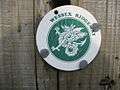
Wessex Ridgeway logo on a gatepost in Fyfield Down 
Standing stone and gallop, Overton Down 
Sarsen stones, beside Delling Copse
External links
![]() Media related to West Overton at Wikimedia Commons
Media related to West Overton at Wikimedia Commons