West Gojjam Zone
Mirab Gojjam (or "West Gojjam") is a Zone in the Amhara Region of Ethiopia. Mirab Gojjam is named after the former province of Gojjam.
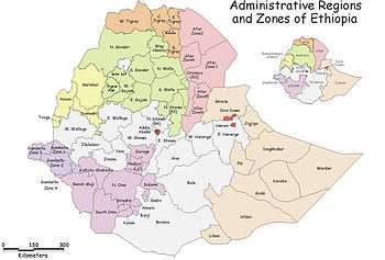
Mirab Gojjam is bordered on the south by the Abay River which separates it from the Oromia Region and Benishangul-Gumuz Region, on the west by Agew Awi, on the northwest by Semien Gondar, on the north by Lake Tana, and the Abay River which separates it from the Debub Gondar, and on the east by Misraq Gojjam. Its highest point is Mount Amedamit. Towns in Mirab Gojjam include Bahir Dar, Adet, Finote Selam, Bure, Quarite, Dega Damot, Sekela, Merawi, Yismala and Dembecha. Finote selam is the capital of the zone.
Demographics
Based on the 2007 Census conducted by the Central Statistical Agency of Ethiopia (CSA), this Zone has a total population of 2,106,596, of whom 1,058,272 are men and 1,048,324 women; with an area of 13,311.94 square kilometers, Mirab Gojjam has a population density of 158.25. While 184,703 or 8.77% are urban inhabitants, one person was reported to be a pastoralist. A total of 480,255 households were counted in this Zone, which results in an average of 4.39 persons to a household, and 466,491 housing units. The largest ethnic group reported in Semien Shewa was the Amhara (99.42%); all other ethnic groups made up 0.52% of the population. Amharic is spoken as a first language by 99.43%; the remaining 0.57% spoke all other primary languages reported. 98.68% of the population said they practiced Ethiopian Orthodox Christianity, and 1.19% were Muslim.[1]
The 1994 national census reported a total population for this Zone of 1,779,723 in 374,115 households, of whom 897,215 were men and 882,508 women; 107,238 or 6.03% of its population were urban dwellers at the time. The largest ethnic group reported in Mirab Gojjam was the Amhara (99.43%); all other ethnic groups made up 0.57% of the population. Amharic was spoken as a first language by 99.46%; the remaining 0.54% spoke all other primary languages reported. 98.28% practiced Ethiopian Orthodox Christianity, and 1.59% of the population said they were Muslim.[2]
According to a May 24, 2004 World Bank memorandum, 6% of the inhabitants of Mirab Gojjam have access to electricity, this zone has a road density of 56.7 kilometers per 1000 square kilometers (compared to the national average of 30 kilometers),[3] the average rural household has 1.1 hectare of land (compared to the national average of 1.01 hectare of land and an average of 0.75 for the Amhara Region)[4] and the equivalent of 0.7 heads of livestock. 19.5% of the population is in non-farm related jobs, compared to the national average of 25% and a Regional average of 21%. 61% of all eligible children are enrolled in primary school, and 11% in secondary schools. 40% of the zone is exposed to malaria, and 38% to Tsetse fly. The memorandum gave this zone a drought risk rating of 454.[5]
The Zonal Water Resource Development Office announced 29 July 2009 that it had completed construction of 943 wells and 89 springs in Mirab Gojjam, which will benefit 331,000 people. Using funds from the government, local NGOs and the public, this program improved the rate of access to clean water for inhabitants in the Zone from 39% to 50.6%.[6]
Notes
- ↑ Census 2007 Tables: Amhara Region, Tables 2.1, 2.4, 2.5, 3.1, 3.2 and 3.4.
- ↑ 1994 Population and Housing Census of Ethiopia: Results for Amhara Region, Vol. 1, part 1, Tables 2.1, 2.11, 2.14, 2.17 (accessed 6 April 2009)
- ↑ "Ethiopia - Second Road Sector Development Program Project", p.3 (World Bank Project Appraisal Document, published 19 May 2003)
- ↑ Comparative national and regional figures comes from the World Bank publication, Klaus Deininger et al. "Tenure Security and Land Related Investment", WP-2991 (accessed 23 March 2006).
- ↑ World Bank, Four Ethiopias: A Regional Characterization (accessed 23 March 2006).
- ↑ "Potable water facilities begin service", Ethiopian News Agency, 29 July 2009 (accessed 1 November 2009
Coordinates: 11°10′N 37°15′E / 11.167°N 37.250°E
Zones of the Amhara Region | ||
|---|---|---|
| Current zones | ||
| Special woredas | ||
Woredas of the Mirab Gojjam Zone | ||
|---|---|---|
| Former woredas | ||
| Current woredas | ||