Ashford, Connecticut
| Ashford, Connecticut | ||
|---|---|---|
| Town | ||
|
Center of town in 1838 | ||
| ||
 Location in Windham County and the state of Connecticut. | ||
| Coordinates: 41°53′N 72°10′W / 41.883°N 72.167°WCoordinates: 41°53′N 72°10′W / 41.883°N 72.167°W | ||
| Country | United States | |
| State | Connecticut | |
| NECTA | Hartford | |
| Region | Windham Region | |
| Incorporated | 1714 | |
| Government | ||
| • Type | Selectman-Town meeting | |
| • First Selectman | Michael J. Zambo (D) | |
| • Selectman | Ralph H. Fletcher (D) | |
| • Selectman | William A. Falletti (R) | |
| Area | ||
| • Total | 39.5 sq mi (102.3 km2) | |
| • Land | 38.8 sq mi (100.5 km2) | |
| • Water | 0.7 sq mi (1.8 km2) | |
| Elevation | 531 ft (162 m) | |
| Population (2005)[1] | ||
| • Total | 4,416 | |
| • Density | 114/sq mi (44/km2) | |
| Time zone | Eastern (UTC-5) | |
| • Summer (DST) | Eastern (UTC-4) | |
| ZIP code | 06278 | |
| Area code(s) | 860 | |
| FIPS code | 09-01430 | |
| GNIS feature ID | 0213384 | |
| Website |
www | |


Ashford is a town in Windham County, Connecticut, United States. It is part of the Connecticut Quiet Corner. The population was 4,317 at the 2010 census. It was founded in 1714. Eastford was a part of Ashford until 1847, when the former split off to organize its own town.[2] For this reason North Ashford is located in northeast Eastford.
Ashford is home to the largest boy scout camp in Connecticut, the June Norcross Webster Scout Reservation; to Paul Newman's Hole in the Wall Gang Camp for children with cancer and other serious illness; to the Salvation Army CONNRI Lodge and Conference Center;[3] and to the Evangelical Christian Center, a retreat, camp and conference center.[4]
History
President George Washington, returning from his tour of the country in the fall of 1789, was chagrined to be involuntarily abandoned in the village on a Sunday. It was contrary to law to hire a conveyance on that day, which was observed by villagers, to Washington's great annoyance.[5]
New Ashford in Massachusetts is named after Ashford, as it was settled in 1762 by people from Ashford.
Geography
According to the United States Census Bureau, the town has a total area of 39.5 square miles (102 km2), of which, 38.8 square miles (100 km2) of it is land and 0.7 square miles (1.8 km2) of it (1.80%) is water. The Mount Hope River flows through the middle of the town, from north to south, while Bigelow Brook flows along the town's eastern border with Eastford. Ashford has several lakes and ponds, notably Ashford Lake, Lake Chaffee, Knowlton Pond, Rychlings Pond, Halls Pond, Poole Pond, and Morey Pond.
Boston Hollow, a deep ravine, is located in Ashford, in the Yale-Myers Forest. Parts of Natchaug State Forest and Nipmuck State Forest are also located in Ashford, and both the Natchaug Trail and the Nipmuck Trail runs through the town. Joshua's Tract Conservation and Historic Trust has several nature preserved in town. Snow Hill located in the northwest corner of the town, is the highest point in Windham County at 1,210 feet.
Flora and fauna

Ashford is located in the northeastern coastal forests, which is a temperate broadleaf and mixed forest ecoregion. Ashford is home to the Yale-Myers Forest, which is used by the Yale School of Forestry & Environmental Studies for scientific research and education. The most famous tree in town is the Ashford Oak, a very large and old Northern Red Oak with a trunk that is 8 meters in circumference.
The last recorded sighting of periodic cicadas belonging to Brood XI of the 17-year variety occurred in Ashford in 1954 along the Fenton River.
On the National Register of Historic Places
- Ashford Academy — Fitts Road (added 1988)
- Church Farm — 396 Mansfield Road (added December 17, 1988)
- Knowlton Memorial Hall — 25 Pompey Hollow Road (added April 17, 1994)
- Mixer Tavern — 14 Westford Road (added April 17, 1994)
Demographics
As of 2010 Ashford had a population of 4,317. The racial and ethnic composition of the population was 94.1% white, 1.0% black or African American, 0.4% Native American, 1.3% Asian, 1.1% from some other race, 2.1% from two or more races and 3.5% Hispanic or Latino of any race.[6]
As of the census[7] of 2000, there were 4,098 people, 1,578 households, and 1,084 families residing in the town. The population density was 105.6 people per square mile (40.8/km²). There were 1,699 housing units at an average density of 43.8 per square mile (16.9/km²). The racial makeup of the town was 95.71% White, 1.00% African American, 0.27% Native American, 1.02% Asian, 0.44% from other races, and 1.56% from two or more races. Hispanic or Latino of any race were 2.00% of the population.
There were 1,578 households out of which 34.5% had children under the age of 18 living with them, 56.5% were married couples living together, 8.5% had a female householder with no husband present, and 31.3% were non-families. 20.6% of all households were made up of individuals and 6.0% had someone living alone who was 65 years of age or older. The average household size was 2.59 and the average family size was 3.05.
In the town the population was spread out with 25.6% under the age of 18, 8.5% from 18 to 24, 32.0% from 25 to 44, 25.6% from 45 to 64, and 8.3% who were 65 years of age or older. The median age was 36 years. For every 100 females there were 99.6 males. For every 100 females age 18 and over, there were 98.1 males.
The median income for a household in the town was $55,000, and the median income for a family was $61,693. Males had a median income of $42,117 versus $31,942 for females. The per capita income for the town was $26,104. About 3.4% of families and 5.9% of the population were below the poverty line, including 6.1% of those under age 18 and 8.7% of those age 65 or over.
| Voter Registration and Party Enrollment as of October 25, 2005[8] | |||||
|---|---|---|---|---|---|
| Party | Active voters | Inactive voters | Total voters | Percentage | |
| Democratic | 867 | 8 | 875 | 31.34% | |
| Republican | 518 | 2 | 520 | 18.62% | |
| Unaffiliated | 1,379 | 11 | 1,390 | 49.79% | |
| Minor Parties | 7 | 0 | 7 | 0.25% | |
| Total | 2,771 | 21 | 2,792 | 100% | |
Notable people


In chronological order:
- Thomas Knowlton (1740–1776), military officer in the American Revolution, who led the Knowlton's Rangers, America's first Army intelligence unit.
- John Keyes (1744-1824), first adjutant general of the State of Connecticut.
- Elias Keyes, (1758–1844), United States Congressman from Vermont.[9]
- Solomon Spalding (1761–1816), writer.
- Eliphalet Nott (1773–1866), president of Union College, and from 1829 to 1845 simultaneously was president of Rensselaer Polytechnic Institute. Inventor of the first stove for anthracite coal.[9]
- Francis Bugbee (1794-1877), lawyer, judge and politician.
- John Frink (1797-), businessman, ran one of Americas largest stage coach companies.[10]
- James Hamilton Shegogue (1806-1872), painter.
- Nathaniel Lyon (1818–1861), the first Union general to be killed in the American Civil War.[9]
- Galusha A. Grow (1822–1907), speaker of the U.S. House of Representatives from 1861 to 1863.
- Emeline Horton Cleveland (1829-1878), physician and college professor, the first woman on record to perform major surgery.[11][12]
- Walter Eli Clark (1869–1950), journalist, last governor of the District of Alaska and the first governor of the Alaska Territory.
- John H. Trumbull (1873-1961), the 70th governor of Connecticut.
- Michael Sveda (1912-1999), chemist, invented the artificial sweetener sodium cyclamate.[13]
- Paul Newman (1925–2008), award winning actor, film director and philanthropist. A seasonal resident of Ashford from the opening of the Hole in the Wall Gang Camp in 1988.
- Valerie Wilson Wesley (1947-), mystery writer.[14]
- Timothy Rourke (1967-), engineer, coordinator for the Green Buildings Open House Program.[15]
- Clay Dreslough (1970-) game designer and creator of the Baseball Mogul series of products.
- Becky Stern (1985-), artist whose work combines electronics, textile crafts, and fashion.
- Desireé Bassett (1992-), rock music guitarist and recording artist.
Education
Elementary and middle school-aged residents attend Ashford School, the town's only school, built in 1951 to replace the old Ashford Academy schoolhouse. This school educates students from pre-k through grade eight. In February 1979, the town's board of education considered closing the school in response to a budget crisis.[16] [17]
High school-aged residents may attend E. O. Smith High School in Mansfield, CT, part of Regional School District 19 . They also can go to Windham Technical High School, ACT. and Ellis Technical High School.
Religion

Several churches exist in Ashford. They include the St Philip-Apostle Church (Catholic), United Baptist Church of Ashford, The Church of Jesus Christ of Latter-day Saints, and Westford Congregational Church.
References
- ↑ U.S. Census Bureau Population Estimates
- ↑ Ashford 1714-1989, Moments from History, p69-70
- ↑ "Salvation Army CONNRI Lodge and Conference Center". Retrieved 2015-10-25.
- ↑ "Evangelical Christian Center Web Site". Retrieved 2015-10-25.
- ↑ Flexner, James Thomas (1984). Washington, The Indispensable Man. New York City: Signet Books. p. 229. ISBN 0-451-12890-7.
- ↑ 2010 race and Hispanic or Latino by place chart for Connecticut from the US Census
- ↑ "American FactFinder". United States Census Bureau. Archived from the original on 2013-09-11. Retrieved 2008-01-31.
- ↑ "Registration and Party Enrollment Statistics as of October 25, 2005" (PDF). Connecticut Secretary of State. Archived from the original (PDF) on 2006-09-23. Retrieved 2006-10-02.
- 1 2 3 Who Was Who in America, Historical Volume, 1607-1896. Chicago: Marquis Who's Who. 1963.
- ↑ Roger Matile (2002). "John Frink and Martin Walker: Stagecoach Kings of the Old Northwest". Journal of the Illinois State Historical Society. 95: 119. JSTOR 40193518.
- ↑ "Emeline Horton Cleveland". Encyclopedia Britannica.
- ↑ "Cleveland, Emeline Horton (1829–1878)". Encyclopedia,com.
- ↑ "Michael Sveda, the Inventor Of Cyclamates, Dies at 87". New York Times. 1999-08-21.
- ↑ Staff. "Mystery Plot: Whodunit in Newark?", The New York Times, August 26, 1994. Accessed February 6, 2012. "Ms. Wilson Wesley grew up in Ashford, Conn., and now lives in Montclair, N.J., with her husband and two daughters. But she lived in nearby East Orange in the early 1970s, and Tamara's yellow-and-green Cape Cod is modeled on her old house."
- ↑ Jim Motavalli (July–August 2005). "Abundant Energy: New England's NESEA Promotes Solar Power and Green Buildings". E Magazine.
- ↑ The Hartford Courant, Hartford, Conn. Feb 8, 1979, page 46. by Mark McGrath. "Board May Close Ashford
- ↑ The New York Times, Saturday, February 10, 1979, Page 24. "Connecticut Town to Close School in Budget Indecision; Children Seem Unconcerned" by Matthew L. Wald
External links
- Town of Ashford
- Ashford School
- Babcock Library
- Fire Department
- June Norcross Webster Scout Reservation
- Knowltons Rangers & Nathan Hale Ancient Fifes & Drums
- Mystic Country: The Eastern Regional Tourism District

Municipalities and communities of Windham County, Connecticut, United States | ||
|---|---|---|
| Towns | 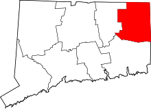 | |
| Borough | ||
| Other communities | ||