Werra
 | |
| Course of the Werra | |
| Location | States of Thuringia, Hesse, Lower Saxony) |
|---|---|
| Length | 299.6 km (186.2 mi) [1] |
| Source | on the Eselsberg and Bleßberg 50°29′59″N 10°57′53″E / 50.4997°N 10.96478°ECoordinates: 50°29′59″N 10°57′53″E / 50.4997°N 10.96478°E |
| Source height | 797 m above sea level (NN) |
| Mouth | confluence with the Fulda in Hann. Münden to form the Weser 51°25′16″N 9°38′57″E / 51.42097496°N 9.6491679°E |
| Mouth height | 116.5 m above sea level (NN) |
| Descent | 680.5 m |
| Basin | Weser |
| Progression | Weser → North Sea |
| Catchment | 5,496 km2 (2,122 sq mi) |
| Discharge[2] | Average mid: 14.0 m3/s (490 cu ft/s) am Pegel Meiningen 23.6 m3/s (830 cu ft/s) Vacha 30.9 m3/s (1,090 cu ft/s) Gerstungen 40.6 m3/s (1,430 cu ft/s) Frankenroda 46.5 m3/s (1,640 cu ft/s) Allendorf 51.2 m3/s (1,810 cu ft/s) Letzter Heller, bei Hann. Münden |
| Right tributaries | Schleuse, Hasel, Hörsel |
| Left tributaries | Ulster, Felda, Wehre |
| Large towns | Meiningen, Eisenach, Eschwege, Hann. Münden |
| Small towns | Bad Salzungen, Vacha, Creuzburg, Treffurt |
| Notable bridges | Werrabrücke Vacha, Werrabrücke Creuzburg, Werratalbrücke Hörschel |
| Navigable | 89 km (55 mi); motor boats in places, but not throughout |
The Werra (German pronunciation: [ˈvɛʁa]), a river in central Germany, forms the right-source of the Weser. The Werra has its source near Eisfeld in southern Thuringia. After 293 kilometres (182 mi) the Werra joins the river Fulda in the town of Hann. Münden, forming the Weser.
The Werra Valley ("Werratal") forms a natural border between the Rhön Mountains and the Thuringian Forest. Highlights here include Eiben Forest near Dermbach, the fairytale sandstone cave at Walldorf, the deepest lake in Germany formed by land subsidence (near Bernshausen), and the "Krayenburg", the ruins of a castle (dating back to the year 786), restaurant and a tower with a wide outlook into the Werra valley near Tiefenort.
The following towns or townships lie along the Werra: Hildburghausen, Meiningen, Bad Salzungen, Tiefenort, Merkers-Kieselbach, Heringen, Philippsthal, Gerstungen, Wanfried, Eschwege, Bad Sooden-Allendorf, Witzenhausen and Hann. Münden.
Gallery
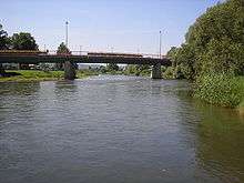 The Werra near Treffurt |
 The Werra near Creuzburg |
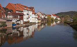 The Werra in Eschwege |
See also
References
- ↑ Messung über Geopfad (kmz, 66 kB). Die Werte von 292,1 km (ohne Quellbäche) bzw. 298,7 km (über Quelle am Eselsberg) wurden um 0,9 km nach oben korrigiert, da laut hessischer Stationierung die Ulstermündung an km 161,6 liegt, im Geopfad jedoch an 160,7.
- ↑ Gewässerkundliches Jahrbuch Weser-Ems 2005 - PDF, 6,7 MB
External links
- Krayenburg (German)