Welton, Iowa
| Welton, Iowa | |
|---|---|
| City | |
 | |
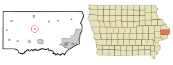 Location of Welton, Iowa | |
| Coordinates: 41°54′44″N 90°36′4″W / 41.91222°N 90.60111°WCoordinates: 41°54′44″N 90°36′4″W / 41.91222°N 90.60111°W | |
| Country |
|
| State |
|
| County | Clinton |
| Area[1] | |
| • Total | 0.27 sq mi (0.70 km2) |
| • Land | 0.27 sq mi (0.70 km2) |
| • Water | 0 sq mi (0 km2) |
| Elevation | 696 ft (212 m) |
| Population (2010)[2] | |
| • Total | 165 |
| • Estimate (2012[3]) | 163 |
| • Density | 611.1/sq mi (235.9/km2) |
| Time zone | Central (CST) (UTC-6) |
| • Summer (DST) | CDT (UTC-5) |
| ZIP code | 52774 |
| Area code(s) | 563 |
| FIPS code | 19-83370 |
| GNIS feature ID | 0462796 |
Welton is a city in Clinton County, Iowa, United States. The population was 165 at the 2010 census.
The community is located adjacent to U.S. Route 61, which passes around Welton just to the east of the city. Prior to the expansion of Highway 61 to a four-lane highway, it passed directly through the city. Following reconstruction of U.S. 61, a new truck stop was built adjacent to U.S. 61 near the southern edge of the city.
History
Welton had its start in the year 1871 by the building of the Davenport and St. Paul Railroad through that territory.[4]
Education
Welton is one of the communities in the Central Community School District of DeWitt, which spans a large portion of central Clinton County. For more than 40 years, the district operated Welton Elementary School to serve students in the north-central part of the district, with junior high and high school students being bused to DeWitt. According to the Dubuque Telegraph Herald, "the school was closed in 2005 because of budget problems and declining enrollment," and on April 5, 2006 the 85-year-old Welton School building was demolished.
Until 1961, the school building also housed junior high and high school students as part of the Welton Independent School District; sports teams were known as the Wolverines. The junior-senior high school was closed in 1961, when Welton, along with the former Grand Mound and DeWitt school districts, consolidated to form the Central Community School District.
Geography
Welton is located at 41°54′44″N 90°36′4″W / 41.91222°N 90.60111°W (41.912283, -90.601152).[5]
According to the United States Census Bureau, the city has a total area of 0.27 square miles (0.70 km2), all of it land.[1]
Demographics
| Historical populations | ||
|---|---|---|
| Year | Pop. | ±% |
| 1910 | 69 | — |
| 1920 | 69 | +0.0% |
| 1930 | 80 | +15.9% |
| 1940 | 100 | +25.0% |
| 1950 | 93 | −7.0% |
| 1960 | 88 | −5.4% |
| 1970 | 104 | +18.2% |
| 1980 | 119 | +14.4% |
| 1990 | 184 | +54.6% |
| 2000 | 159 | −13.6% |
| 2010 | 165 | +3.8% |
| 1880 | 79 | −52.1% |
| 2014 | 161 | +103.8% |
| 2015 | 160 | −0.6% |
| Source:"American FactFinder". United States Census Bureau. and Iowa Data Center Source: | ||
2010 census
As of the census[2] of 2010, there were 165 people, 61 households, and 49 families residing in the city. The population density was 611.1 inhabitants per square mile (235.9/km2). There were 62 housing units at an average density of 229.6 per square mile (88.6/km2). The racial makeup of the city was 96.4% White and 3.6% from two or more races. Hispanic or Latino of any race were 0.6% of the population.
There were 61 households of which 41.0% had children under the age of 18 living with them, 57.4% were married couples living together, 13.1% had a female householder with no husband present, 9.8% had a male householder with no wife present, and 19.7% were non-families. 16.4% of all households were made up of individuals and 6.6% had someone living alone who was 65 years of age or older. The average household size was 2.70 and the average family size was 2.94.
The median age in the city was 38.5 years. 27.9% of residents were under the age of 18; 4.9% were between the ages of 18 and 24; 29.7% were from 25 to 44; 25.4% were from 45 to 64; and 12.1% were 65 years of age or older. The gender makeup of the city was 47.3% male and 52.7% female.
2000 census
As of the census[7] of 2000, there were 159 people, 57 households, and 47 families residing in the city. The population density was 1,388.9 people per square mile (558.1/km²). There were 60 housing units at an average density of 524.1 per square mile (210.6/km²). The racial makeup of the city was 97.48% White, 0.63% African American, and 1.89% from two or more races. Hispanic or Latino of any race were 0.63% of the population.
There were 57 households out of which 38.6% had children under the age of 18 living with them, 64.9% were married couples living together, 10.5% had a female householder with no husband present, and 15.8% were non-families. 12.3% of all households were made up of individuals and 1.8% had someone living alone who was 65 years of age or older. The average household size was 2.79 and the average family size was 3.02.
In the city the population was spread out with 27.0% under the age of 18, 8.8% from 18 to 24, 28.9% from 25 to 44, 27.0% from 45 to 64, and 8.2% who were 65 years of age or older. The median age was 32 years. For every 100 females there were 89.3 males. For every 100 females age 18 and over, there were 96.6 males.
The median income for a household in the city was $48,750, and the median income for a family was $42,500. Males had a median income of $39,688 versus $22,083 for females. The per capita income for the city was $17,680. None of the population or families were below the poverty line.
References
- 1 2 "US Gazetteer files 2010". United States Census Bureau. Retrieved 2012-05-11.
- 1 2 "American FactFinder". United States Census Bureau. Retrieved 2012-05-11.
- ↑ "Population Estimates". United States Census Bureau. Retrieved 2013-05-23.
- ↑ Wolfe, Patrick B. (1911). Wolfe's History of Clinton County, Iowa, Volume 1. B. F. Bowen. p. 283.
- ↑ "US Gazetteer files: 2010, 2000, and 1990". United States Census Bureau. 2011-02-12. Retrieved 2011-04-23.
- ↑ "Census of Population and Housing". Census.gov. Retrieved June 4, 2015.
- ↑ "American FactFinder". United States Census Bureau. Retrieved 2008-01-31.
Municipalities and communities of Clinton County, Iowa, United States | ||
|---|---|---|
| Cities | ||
| Townships | ||
| Unincorporated communities | ||
| Footnotes | ‡This populated place also has portions in an adjacent county or counties | |