Waynesburg, Pennsylvania
| Waynesburg | |
|---|---|
| Borough | |
|
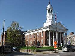
Greene County Courthouse in downtown Waynesburg | |
| Etymology: Anthony Wayne | |
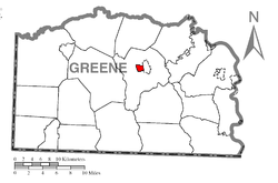 Location of Waynesburg in Greene County | |
| Coordinates: 39°53′51″N 80°11′8″W / 39.89750°N 80.18556°WCoordinates: 39°53′51″N 80°11′8″W / 39.89750°N 80.18556°W | |
| Country | United States |
| State | Pennsylvania |
| County | Greene |
| Established | 1796 |
| Government | |
| • Mayor | Blair Zimmerman |
| Area | |
| • Total | 0.8 sq mi (2 km2) |
| Population (2000) | |
| • Total | 4,184 |
| • Density | 5,200/sq mi (2,000/km2) |
| Time zone | EST (UTC-4) |
| • Summer (DST) | EDT (UTC-5) |
| Area code(s) | 724 |
Waynesburg is a borough in and the county seat of Greene County, Pennsylvania, United States,[1] located about 60 miles (97 km) southwest of Pittsburgh. Its population was 4,184 at the 2000 census.
The region around Waynesburg is underlaid with several layers of coking coal, including the Pittsburgh No. 8 seam, the Waynesburg seam, and the Sewickley (Mapletown) seam. This area is also rich with coalbed methane, which is being developed from the underlying Marcellus Shale, the largest domestic natural gas reserve. Early in the 20th Century, four large gas compressing stations and a steam shovel factory were located in Waynesburg.
Waynesburg is named for General "Mad" Anthony Wayne, one of the top lieutenants of George Washington during the Revolutionary War (1776–81). Waynesburg also the location of the Waynesburg University and the Greene County Airport.
History
In August 1875 construction began of the 3 ft (914 mm) narrow gauge Waynesburg and Washington Railroad, conceived by John Day in 1874 and chartered in 1875.[2] Its passenger service ended in 1929, and conversion to 4 ft 8 1⁄2 in (1,435 mm) standard gauge followed in 1944 as a wartime measure. Then the railroad was renamed the Waynesburg Secondary Railroad. Regular freight service ended on this line in 1976, though part of it still serves (irregularly) for railroad access to a coal mine.
The Waynesburg Historic District, Hanna Hall at the university, and Miller Hall are listed on the National Register of Historic Places.[3]
Geography
Waynesburg is located at 39°53′51″N 80°11′8″W / 39.89750°N 80.18556°W (39.897403, -80.185597).[4]
According to the United States Census Bureau, the borough has a total area of about 0.8 square miles (2.1 km2), all of which is dry land.
Demographics
| Historical population | |||
|---|---|---|---|
| Census | Pop. | %± | |
| 1820 | 298 | — | |
| 1870 | 1,272 | — | |
| 1880 | 1,208 | −5.0% | |
| 1890 | 2,101 | 73.9% | |
| 1900 | 2,544 | 21.1% | |
| 1910 | 3,545 | 39.3% | |
| 1920 | 3,332 | −6.0% | |
| 1930 | 4,915 | 47.5% | |
| 1940 | 4,891 | −0.5% | |
| 1950 | 5,514 | 12.7% | |
| 1960 | 5,188 | −5.9% | |
| 1970 | 5,152 | −0.7% | |
| 1980 | 4,482 | −13.0% | |
| 1990 | 4,270 | −4.7% | |
| 2000 | 4,184 | −2.0% | |
| 2010 | 4,176 | −0.2% | |
| Est. 2015 | 4,045 | [5] | −3.1% |
| Sources:[6][7][8] | |||
As of the census[7] of 2000, there were 4,184 people, 1,619 households, and 869 families residing in the borough. The population density was 5,038.6 people per square mile (1,946.3/km²). There were 1,811 housing units at an average density of 2,180.9 per square mile (842.4/km²). The racial makeup of the borough was 96.94% White, 1.63% African American, 0.10% Native American, 0.57% Asian, 0.05% Pacific Islander, 0.17% from other races, and 0.55% from two or more races. Hispanic or Latino of any race were 0.65% of the population.
There were 1,619 households, out of which 24.1% had children under the age of 18 living with them, 38.4% were married couples living together, 11.6% had a female householder with no husband present, and 46.3% were non-families. 38.2% of all households were made up of individuals, and 16.7% had someone living alone who was 65 years of age or older. The average household size was 2.24 and the average family size was 2.99.
In the borough the population was spread out, with 18.6% under the age of 18, 24.2% from 18 to 24, 24.8% from 25 to 44, 17.8% from 45 to 64, and 14.5% who were 65 years of age or older. The median age was 30 years. For every 100 females there were 97.5 males. For every 100 females age 18 and over, there were 97.4 males.
The median income for a household in the borough was $30,990, and the median income for a family was $42,933. Males had a median income of $31,577 versus $22,458 for females. The per capita income for the borough was $15,333. About 8.0% of families and 13.0% of the population were below the poverty line, including 10.5% of those under age 18 and 11.7% of those age 65 or over.
Notable people
- Arthur I. Boreman, first Governor of West Virginia who left the town at the age of four
- Todd Tamanend Clark, poet and composer, lived in Waynesburg from 1965 to 1970
- Bill George, a linebacker for the Chicago Bears and the Los Angeles Rams
- Greg Hopkins, Arena Football League player who played High School football in Waynesburg
- Josh Koscheck, mixed martial artist
- Edward Martin, Republican Governor and Senator for Pennsylvania
- Elissa McCracken 2012 Miss Ohio[9]
- Dave Palone, harness racing driver
- Coleman Scott, 2012 London Olympic Bronze Medalist
- Rittz, Rapper on Tech N9ne's record label Strange Music.
References
- ↑ "Find a County". National Association of Counties. Retrieved 2011-06-07.
- ↑ "The Waynesburg and Washington RR". 2003. Retrieved December 30, 2011.
- ↑ National Park Service (2010-07-09). "National Register Information System". National Register of Historic Places. National Park Service.
- ↑ "US Gazetteer files: 2010, 2000, and 1990". United States Census Bureau. 2011-02-12. Retrieved 2011-04-23.
- ↑ "Annual Estimates of the Resident Population for Incorporated Places: April 1, 2010 to July 1, 2015". Retrieved July 2, 2016.
- ↑ "Census of Population and Housing". U.S. Census Bureau. Retrieved 11 December 2013.
- 1 2 "American FactFinder". United States Census Bureau. Retrieved 2008-01-31.
- ↑ "Incorporated Places and Minor Civil Divisions Datasets: Subcounty Resident Population Estimates: April 1, 2010 to July 1, 2012". Population Estimates. U.S. Census Bureau. Retrieved 11 December 2013.
- ↑ Former queen achieves another reign
Municipalities and communities of Greene County, Pennsylvania, United States | ||
|---|---|---|
| Boroughs | 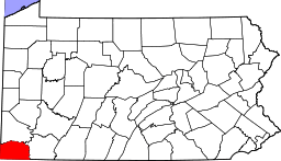 | |
| Townships | ||
| CDPs | ||
| Unincorporated communities | ||