Wayne County, Kentucky
| Wayne County, Kentucky | |
|---|---|
 Wayne County courthouse in Monticello | |
 Location in the U.S. state of Kentucky | |
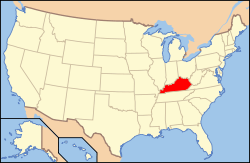 Kentucky's location in the U.S. | |
| Founded | 1800 |
| Named for | Anthony Wayne |
| Seat | Monticello |
| Largest city | Monticello |
| Area | |
| • Total | 484 sq mi (1,254 km2) |
| • Land | 458 sq mi (1,186 km2) |
| • Water | 26 sq mi (67 km2), 5.4% |
| Population | |
| • (2010) | 20,813 |
| • Density | 43/sq mi (17/km²) |
| Congressional district | 5th |
| Time zone | Eastern: UTC-5/-4 |
| Website |
waynecounty |
Wayne County is a county located in the U.S. state of Kentucky. As of the 2010 census, the population was 20,813.[1] Its county seat is Monticello.[2] The county was named for Gen. Anthony Wayne. It is a prohibition or dry county.
History
Wayne County was formed December 13, 1800 from Pulaski and Cumberland Counties. It was the 43rd county and is named for General "Mad Anthony" Wayne, a hero of the American Revolution and the Northwest Indian War.[3] Wayne's victory at the Battle of Fallen Timbers virtually ended the Indian threat against Kentucky settlers.[4]
During the winter of 1861, an act was passed by the Confederate government of Kentucky to rename Wayne County to Zollicoffer County in honor of Felix Zollicoffer, who died at the Battle of Mill Springs.
Geography

According to the U.S. Census Bureau, the county has a total area of 484 square miles (1,250 km2), of which 458 square miles (1,190 km2) is land and 26 square miles (67 km2) (5.4%) is water.[5]
The county's elevation ranges from 723 feet (220 m) to 1,788 feet (545 m), at the Monticello/Wayne County Airport the elevation is 963 feet (294 m). Wayne County is located in the Pennyrile Plateau (image) and Eastern Coal Field (image) regions of Kentucky.
Adjacent counties
- Russell County (northwest/CST Border)
- Pulaski County (northeast)
- McCreary County (east)
- Scott County, Tennessee (southeast)
- Pickett County, Tennessee (south/CST Border)
- Clinton County (west/CST Border)
National protected area
- Daniel Boone National Forest (part)
Time zone boundary

Wayne County is on Eastern Time; however, its western border, shared with Clinton and Russell Counties, is part of the Eastern/Central time zone boundary, as is its southern border with Pickett County, TN. Wayne County was on Central time until October 2000; an account of this change is documented in an article by Dr. Stanley Brunn of the University of Kentucky.[6]
It has the tz database zone identifier America/Kentucky/Monticello.
Demographics
| Historical population | |||
|---|---|---|---|
| Census | Pop. | %± | |
| 1810 | 5,430 | — | |
| 1820 | 7,951 | 46.4% | |
| 1830 | 8,685 | 9.2% | |
| 1840 | 7,399 | −14.8% | |
| 1850 | 8,692 | 17.5% | |
| 1860 | 10,259 | 18.0% | |
| 1870 | 10,602 | 3.3% | |
| 1880 | 12,512 | 18.0% | |
| 1890 | 12,852 | 2.7% | |
| 1900 | 14,892 | 15.9% | |
| 1910 | 17,518 | 17.6% | |
| 1920 | 16,208 | −7.5% | |
| 1930 | 15,848 | −2.2% | |
| 1940 | 17,204 | 8.6% | |
| 1950 | 16,475 | −4.2% | |
| 1960 | 14,700 | −10.8% | |
| 1970 | 14,268 | −2.9% | |
| 1980 | 17,022 | 19.3% | |
| 1990 | 17,468 | 2.6% | |
| 2000 | 19,923 | 14.1% | |
| 2010 | 20,813 | 4.5% | |
| Est. 2015 | 20,464 | [7] | −1.7% |
| U.S. Decennial Census[8] 1790-1960[9] 1900-1990[10] 1990-2000[11] 2010-2013[1] | |||
As of the census[12] of 2000, there were 19,923 people, 7,913 households, and 5,808 families residing in the county. The population density was 43 per square mile (17/km2). There were 9,789 housing units at an average density of 21 per square mile (8.1/km2). The racial makeup of the county was 96.98% White, 1.49% Black or African American, 0.18% Native American, 0.11% Asian, 0.47% from other races, and 0.78% from two or more races. 1.46% of the population were Hispanic or Latino of any race.
There were 7,913 households out of which 33.40% had children under the age of 18 living with them, 58.90% were married couples living together, 10.60% had a female householder with no husband present, and 26.60% were non-families. 23.90% of all households were made up of individuals and 10.40% had someone living alone who was 65 years of age or older. The average household size was 2.49 and the average family size was 2.94.
In the county the population was spread out with 25.30% under the age of 18, 8.90% from 18 to 24, 28.10% from 25 to 44, 24.00% from 45 to 64, and 13.60% who were 65 years of age or older. The median age was 37 years. For every 100 females there were 97.80 males. For every 100 females age 18 and over, there were 94.90 males.
The median income for a household in the county was $20,863, and the median income for a family was $24,869. Males had a median income of $24,021 versus $18,102 for females. The per capita income for the county was $12,601. About 24.60% of families and 29.40% of the population were below the poverty line, including 34.90% of those under age 18 and 31.50% of those age 65 or over.
Politics
| Year | Republican | Democrat |
|---|---|---|
| 2016 | 79.72% 6,371 | 17.91% 1,431 |
| 2012 | 73.36% 5,289 | 25.73% 1,855 |
| 2008 | 67.65% 4,868 | 30.59% 2,201 |
| 2004 | 65.41% 5,027 | 34.04% 2,616 |
| 2000 | 62.85% 4,069 | 35.71% 2,312 |
Communities
- Alpha
- Barrier
- Big Sinking
- Cooper
- Duncan Valley
- Frazier
- Monticello (county seat)
- Parmleysville
- Powersburg
- Rocky Branch
- Roger's Grove
- Sunnybrook
- Windy
See also
- National Register of Historic Places listings in Wayne County, Kentucky
- Ken Upchurch - member of the Kentucky House of Representatives from Wayne County
References
- 1 2 "State & County QuickFacts". United States Census Bureau. Retrieved March 6, 2014.
- ↑ "Find a County". National Association of Counties. Retrieved 2011-06-07.
- ↑ The Register of the Kentucky State Historical Society, Volume 1. Kentucky State Historical Society. 1903. p. 37.
- ↑ ^ Geographic Names Information System. United States Geological Survey. Retrieved on 2008-01-31.
- ↑ "2010 Census Gazetteer Files". United States Census Bureau. August 22, 2012. Retrieved August 20, 2014.
- ↑ Brunn, Stanley D. 2001. "Citizen reaction to a proposed time zone change in Kentucky: Juxtaposing boundaries on the land / in the mind." Southeastern Geographer 41 (2): 246-258.
- ↑ "County Totals Dataset: Population, Population Change and Estimated Components of Population Change: April 1, 2010 to July 1, 2015". Retrieved July 2, 2016.
- ↑ "U.S. Decennial Census". United States Census Bureau. Retrieved August 20, 2014.
- ↑ "Historical Census Browser". University of Virginia Library. Retrieved August 20, 2014.
- ↑ "Population of Counties by Decennial Census: 1900 to 1990". United States Census Bureau. Retrieved August 20, 2014.
- ↑ "Census 2000 PHC-T-4. Ranking Tables for Counties: 1990 and 2000" (PDF). United States Census Bureau. Retrieved August 20, 2014.
- ↑ American Fact Finder, U.S. Bureau of the Census.
- ↑ "Dave Leip's Atlas of U.S. Presidential Elections". Retrieved 2016-05-17.
External links
- Wayne County History
- [ County History]
- Wayne County Historical Museum
- Battle of Mill Springs
- Wayne County KYGenWeb Site
- General
- School Systems
Municipalities and communities of Wayne County, Kentucky, United States | ||
|---|---|---|
| City | | |
| Unincorporated communities | ||
| Ghost town | ||
Coordinates: 36°49′N 84°50′W / 36.81°N 84.83°W