Waylla Tira
| Waylla Tira | |
|---|---|
 Waylla Tira Location in Bolivia | |
| Highest point | |
| Elevation | 4,324 m (14,186 ft) [1] |
| Coordinates | 19°19′16″S 65°37′10″W / 19.32111°S 65.61944°WCoordinates: 19°19′16″S 65°37′10″W / 19.32111°S 65.61944°W |
| Geography | |
| Location |
Bolivia Potosí Department, Tomás Frías Province |
| Parent range | Andes |
Waylla Tira (Aymara waylla Stipa obtusa, a kind of feather grass, tira cradle,[2][3] "feather grass cradle", hispanicized spelling Huayllatira) is a 4,324-metre (14,186 ft) high mountain in the Andes of Bolivia. It is located in the Potosí Department, Tomás Frías Province, Potosí Municipality. Waylla Tira lies east of the Challwiri River,[1][4] an affluent of the Pillku Mayu.
References
- 1 2 BIGM map 1.50,000 6436-II Colavi
- ↑ Radio San Gabriel, "Instituto Radiofonico de Promoción Aymara" (IRPA) 1993, Republicado por Instituto de las Lenguas y Literaturas Andinas-Amazónicas (ILLLA-A) 2011, Transcripción del Vocabulario de la Lengua Aymara, P. Ludovico Bertonio 1612 (Spanish-Aymara-Aymara-Spanish dictionary)
- ↑ Plan de desarollo municipal Municipio de Turco
- ↑ "Potosí". INE, Bolivia. Retrieved October 12, 2014. (unnamed)
Capital: Potosí | ||
| Provinces | 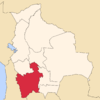 | |
| Municipalities (and seats) |
| |
This article is issued from Wikipedia - version of the 5/7/2016. The text is available under the Creative Commons Attribution/Share Alike but additional terms may apply for the media files.