Wathena, Kansas
| Wathena, Kansas | |
|---|---|
| City | |
 Location within Doniphan County and Kansas | |
 KDOT map of Doniphan County (legend) | |
| Coordinates: 39°45′44″N 94°56′53″W / 39.76222°N 94.94806°WCoordinates: 39°45′44″N 94°56′53″W / 39.76222°N 94.94806°W | |
| Country | United States |
| State | Kansas |
| County | Doniphan |
| Founded | 1861 |
| Incorporated | 1873 |
| Area[1] | |
| • Total | 2.31 sq mi (5.98 km2) |
| • Land | 2.28 sq mi (5.91 km2) |
| • Water | 0.03 sq mi (0.08 km2) |
| Elevation | 827 ft (252 m) |
| Population (2010)[2] | |
| • Total | 1,364 |
| • Estimate (2012[3]) | 1,353 |
| • Density | 598.2/sq mi (231.0/km2) |
| Time zone | Central (CST) (UTC-6) |
| • Summer (DST) | CDT (UTC-5) |
| ZIP code | 66090 |
| Area code(s) | 785 |
| FIPS code | 20-76000 [4] |
| GNIS feature ID | 0473057 [5] |
| Website | City Website |
Wathena is a city in Doniphan County, Kansas, United States. As of the 2010 census, the city population was 1,364.[6]
History
Wathena was founded in 1856.[7] The city is named in honor of Chief Wathena, a Native American chief of the Kickapoo tribe who previously lived in the area.[8]
The first post office in Wathena was established in 1855, but before August, 1859, the post office was called Bryan.[9]
The St. Joseph & Denver Railroad was extended to Wathena in 1860.[10]
Wathena was incorporated as a city in 1873.[11]
Geography
Wathena is located at 39°45′44″N 94°56′53″W / 39.76222°N 94.94806°W (39.762161, -94.948117).[12] According to the United States Census Bureau, the city has a total area of 2.31 square miles (5.98 km2), of which 2.28 square miles (5.91 km2) is land and 0.03 square miles (0.08 km2) is water.[1]
Demographics
| Historical population | |||
|---|---|---|---|
| Census | Pop. | %± | |
| 1880 | 710 | — | |
| 1890 | 694 | −2.3% | |
| 1900 | 798 | 15.0% | |
| 1910 | 777 | −2.6% | |
| 1920 | 645 | −17.0% | |
| 1930 | 854 | 32.4% | |
| 1940 | 860 | 0.7% | |
| 1950 | 797 | −7.3% | |
| 1960 | 837 | 5.0% | |
| 1970 | 1,150 | 37.4% | |
| 1980 | 1,418 | 23.3% | |
| 1990 | 1,160 | −18.2% | |
| 2000 | 1,348 | 16.2% | |
| 2010 | 1,364 | 1.2% | |
| Est. 2015 | 1,336 | [13] | −2.1% |
| U.S. Decennial Census | |||
Wathena is part of the St. Joseph, MO–KS Metropolitan Statistical Area.
2010 census
As of the census[2] of 2010, there were 1,364 people, 550 households, and 365 families residing in the city. The population density was 598.2 inhabitants per square mile (231.0/km2). There were 587 housing units at an average density of 257.5 per square mile (99.4/km2). The racial makeup of the city was 96.6% White, 1.3% African American, 0.3% Native American, 0.3% Asian, and 1.5% from two or more races. Hispanic or Latino of any race were 1.1% of the population.
There were 550 households of which 32.4% had children under the age of 18 living with them, 50.0% were married couples living together, 12.7% had a female householder with no husband present, 3.6% had a male householder with no wife present, and 33.6% were non-families. 29.5% of all households were made up of individuals and 13.2% had someone living alone who was 65 years of age or older. The average household size was 2.40 and the average family size was 2.92.
The median age in the city was 40.9 years. 24.7% of residents were under the age of 18; 6.5% were between the ages of 18 and 24; 24.9% were from 25 to 44; 25.9% were from 45 to 64; and 17.8% were 65 years of age or older. The gender makeup of the city was 47.2% male and 52.8% female.
2000 census
As of the census[4] of 2000, there were 1,348 people, 524 households, and 345 families residing in the city. The population density was 690.6 people per square mile (266.9/km²). There were 566 housing units at an average density of 290.0 per square mile (112.1/km²). The racial makeup of the city was 97.48% White, 0.67% African American, 0.59% Native American, 0.30% from other races, and 0.96% from two or more races. Hispanic or Latino of any race were 0.96% of the population.
There were 524 households out of which 34.4% had children under the age of 18 living with them, 53.4% were married couples living together, 10.3% had a female householder with no husband present, and 34.0% were non-families. 30.2% of all households were made up of individuals and 14.7% had someone living alone who was 65 years of age or older. The average household size was 2.48 and the average family size was 3.14.
In the city the population was spread out with 27.3% under the age of 18, 8.7% from 18 to 24, 25.8% from 25 to 44, 23.0% from 45 to 64, and 15.2% who were 65 years of age or older. The median age was 36 years. For every 100 females there were 85.7 males. For every 100 females age 18 and over, there were 81.1 males.
The median income for a household in the city was $34,046, and the median income for a family was $40,216. Males had a median income of $31,618 versus $20,800 for females. The per capita income for the city was $15,440. About 5.5% of families and 9.8% of the population were below the poverty line, including 11.6% of those under age 18 and 17.2% of those age 65 or over.
Notable people
- Louis W. Staudenmaier, Wisconsin state legislator and lawyer, was born in Wathena.[14]
References
- 1 2 "US Gazetteer files 2010". United States Census Bureau. Retrieved 2012-07-06.
- 1 2 "American FactFinder". United States Census Bureau. Retrieved 2012-07-06.
- ↑ "Population Estimates". United States Census Bureau. Retrieved 2013-05-29.
- 1 2 "American FactFinder". United States Census Bureau. Retrieved 2008-01-31.
- ↑ "US Board on Geographic Names". United States Geological Survey. 2007-10-25. Retrieved 2008-01-31.
- ↑ "2010 City Population and Housing Occupancy Status". U.S. Census Bureau. Retrieved August 11, 2011.
- ↑ Kansas State Historical Society (1916). Biennial Report of the Board of Directors of the Kansas State Historical Society. Kansas State Printing Plant. p. 178.
- ↑ Kansas Place-Names, John Rydjord, University of Oklahoma Press, 1972, p. 434 ISBN 0-8061-0994-7
- ↑ "Kansas Post Offices, 1828-1961 (archived)". Kansas Historical Society. Archived from the original on October 9, 2013. Retrieved 8 June 2014.
- ↑ Gray, Patrick Leopoldo (1905). Gray's Doniphan County History: A Record of the Happenings of Half a Hundred Years. Roycroft Press. p. 26.
- ↑ History of the State of Kansas: Containing a Full Account of Its Growth from an Uninhabited Territory to a Wealthy and Important State. A. T. Andreas. 1883. p. 494.
- ↑ "US Gazetteer files: 2010, 2000, and 1990". United States Census Bureau. 2011-02-12. Retrieved 2011-04-23.
- ↑ "Annual Estimates of the Resident Population for Incorporated Places: April 1, 2010 to July 1, 2015". Retrieved July 2, 2016.
- ↑ 'Wisconsin Blue Book 1935,' Biographical Sketch of Louis W. Staudenmaier, pg. 218
External links
| Wikimedia Commons has media related to Wathena, Kansas. |
- City
- Schools
- USD 114, local school district
- Maps
- Wathena City Map, KDOT
Municipalities and communities of Doniphan County, Kansas, United States | ||
|---|---|---|
| Cities | 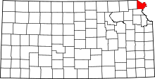 | |
| CDP | ||
| Unincorporated communities | ||
| Ghost town | ||
| Indian reservation | ||
| Townships | ||
| Footnotes | ‡This populated place also has portions in an adjacent county or counties | |