Waterville Valley, New Hampshire
| Waterville Valley, New Hampshire | |
|---|---|
| Town | |
| Motto: "The Town at the End of the Road" | |
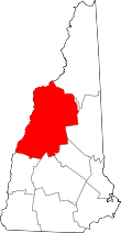
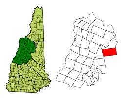 Location in Grafton County, New Hampshire | |
| Coordinates: 43°57′23″N 71°30′31″W / 43.95639°N 71.50861°WCoordinates: 43°57′23″N 71°30′31″W / 43.95639°N 71.50861°W | |
| Country | United States |
| State | New Hampshire |
| County | Grafton |
| Incorporated | 1829 |
| Government | |
| • Board of Selectmen |
William "Mike" Aronson, Chair Margaret C. Turner William Larsen |
| • Town Manager | Mark Decoteau |
| Area | |
| • Total | 64.9 sq mi (168.1 km2) |
| • Land | 64.9 sq mi (168.1 km2) |
| • Water | 0.04 sq mi (0.1 km2) 0.05% |
| Elevation | 1,506 ft (459 m) |
| Population (2010) | |
| • Total | 247 |
| • Density | 3.8/sq mi (1.5/km2) |
| Time zone | Eastern (UTC-5) |
| • Summer (DST) | Eastern (UTC-4) |
| ZIP code | 03215 |
| Area code(s) | 603 |
| FIPS code | 33-79380 |
| GNIS feature ID | 0873748 |
| Website |
www |
Waterville Valley is a town in Grafton County, New Hampshire, United States. The population was 247 at the 2010 census.[1]
Waterville Valley attracts many visitors in the winter months with alpine skiing at Waterville Valley Resort and many miles of trails for cross-country skiing. During the summer, attractions include a golf course, tennis courts, and lots of hiking. The Mad River flows through the town, providing great views all year round.
History
The area was first settled in the 1760s, and incorporated as Waterville in 1829. The name Waterville Valley was adopted in 1967.
Geography
According to the United States Census Bureau, the town has a total area of 64.9 square miles (168 km2), of which 0.04 sq mi (0.10 km2) is water, comprising 0.05% of the town. The highest point in Waterville Valley is the North Peak of Mount Tripyramid, at 4,180 feet (1,270 m) above sea level.
Demographics
| Historical population | |||
|---|---|---|---|
| Census | Pop. | %± | |
| 1830 | 96 | — | |
| 1840 | 63 | −34.4% | |
| 1850 | 42 | −33.3% | |
| 1860 | 48 | 14.3% | |
| 1870 | 33 | −31.2% | |
| 1880 | 54 | 63.6% | |
| 1890 | 39 | −27.8% | |
| 1900 | 50 | 28.2% | |
| 1910 | 16 | −68.0% | |
| 1920 | 95 | 493.8% | |
| 1930 | 23 | −75.8% | |
| 1940 | 26 | 13.0% | |
| 1950 | 11 | −57.7% | |
| 1960 | 14 | 27.3% | |
| 1970 | 109 | 678.6% | |
| 1980 | 180 | 65.1% | |
| 1990 | 151 | −16.1% | |
| 2000 | 257 | 70.2% | |
| 2010 | 247 | −3.9% | |
| Est. 2015 | 246 | [2] | −0.4% |
As of the census[4] of 2000, there were 257 people, 121 households, and 75 families residing in the town. The population density was 4.0 people per square mile (1.5/km²). There were 1,097 housing units at an average density of 16.9 per square mile (6.5/km²). The racial makeup of the town was 97.28% White, 1.95% Asian, 0.78% from other races. Hispanic or Latino of any race were 1.56% of the population.
There were 121 households out of which 27.3% had children under the age of 18 living with them, 45.5% were married couples living together, 9.1% had a female householder with no husband present, and 38.0% were non-families. 34.7% of all households were made up of individuals and 6.6% had someone living alone who was 65 years of age or older. The average household size was 2.12 and the average family size was 2.72.
In the town the population was spread out with 22.2% under the age of 18, 6.6% from 18 to 24, 20.6% from 25 to 44, 37.0% from 45 to 64, and 13.6% who were 65 years of age or older. The median age was 45 years. For every 100 females there were 104.0 males. For every 100 females age 18 and over, there were 108.3 males.
The median income for a household in the town was $40,417, and the median income for a family was $55,625. Males had a median income of $34,167 versus $34,063 for females. The per capita income for the town was $26,400. About 6.8% of families and 6.2% of the population were below the poverty line, including 6.7% of those under the age of eighteen and none of those sixty five or over.
Education
The Waterville Valley Elementary School is also known as the "Little Red School" and has forty-one students enrolled for kindergarten through 8th grade (2011-2012 school year). The children at the school are able to bike, swim, ski, skate, and play tennis in Waterville Valley. There is a recreation department attached to the "Little Red School".
Notable people
- Tom Corcoran, resort founder and Olympic skier
- H. A. Rey and Margret Rey, co-authors of Curious George
- John E. Sununu, US congressman and senator
References
- ↑ United States Census Bureau, American FactFinder, 2010 Census figures. Retrieved March 23, 2011.
- ↑ "Annual Estimates of the Resident Population for Incorporated Places: April 1, 2010 to July 1, 2015". Retrieved July 2, 2016.
- ↑ "Census of Population and Housing". Census.gov. Retrieved June 4, 2016.
- ↑ "American FactFinder". United States Census Bureau. Retrieved 2008-01-31.
External links
| Wikivoyage has a travel guide for Waterville Valley. |
- Town of Waterville Valley official website
- New Hampshire Economic and Labor Market Information Bureau Profile
- Waterville Valley resort