Waterloo Township, Fayette County, Indiana
| Waterloo Township | |
|---|---|
| Township | |
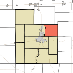 Location of Waterloo Township in Fayette County | |
| Coordinates: 39°41′42″N 85°04′43″W / 39.69500°N 85.07861°WCoordinates: 39°41′42″N 85°04′43″W / 39.69500°N 85.07861°W | |
| Country | United States |
| State | Indiana |
| County | Fayette |
| Government | |
| • Type | Indiana township |
| Area | |
| • Total | 17.15 sq mi (44.4 km2) |
| • Land | 17.15 sq mi (44.4 km2) |
| • Water | 0 sq mi (0 km2) |
| Elevation[1] | 1,007 ft (307 m) |
| Population (2010) | |
| • Total | 607 |
| • Density | 35.4/sq mi (13.7/km2) |
| FIPS code | 18-81314[2] |
| GNIS feature ID | 454026 |
Waterloo Township is one of nine townships in Fayette County, Indiana. As of the 2010 census, its population was 607 and it contained 240 housing units.[3]
History
Waterloo Township was organized in 1821.[4]
The Thomas Ranck Round Barn was added to the National Register of Historic Places in 1983.[5]
Geography
According to the 2010 census, the township has a total area of 17.15 square miles (44.4 km2), all land.[3]
Unincorporated towns
Adjacent townships
- Abington Township, Wayne County (northeast)
- Brownsville Township, Union County (east)
- Liberty Township, Union County (southeast)
- Jennings Township (south)
- Connersville Township (southwest)
- Harrison Township (west)
- Washington Township, Wayne County (northwest)
References
- ↑ "US Board on Geographic Names". United States Geological Survey. 2007-10-25. Retrieved 2008-01-31.
- ↑ "American FactFinder". United States Census Bureau. Retrieved 2008-01-31.
- 1 2 "Population, Housing Units, Area, and Density: 2010 - County -- County Subdivision and Place -- 2010 Census Summary File 1". United States Census. Retrieved 2013-05-10.
- ↑ History of Fayette County, Indiana. Warner, Beers and Company. 1885. p. 210.
- ↑ National Park Service (2010-07-09). "National Register Information System". National Register of Historic Places. National Park Service.
External links
Municipalities and communities of Fayette County, Indiana, United States | ||
|---|---|---|
| City | ||
| Town | ||
| Townships | ||
| Unincorporated communities | ||
| Footnotes | ‡This populated place also has portions in an adjacent county or counties | |
This article is issued from Wikipedia - version of the 10/13/2016. The text is available under the Creative Commons Attribution/Share Alike but additional terms may apply for the media files.