Wassertalkogel
| Wassertalkogel | |
|---|---|
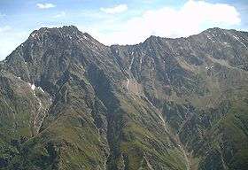 Puitkogel (left) and Wassertalkogel from the west across Pitz valley | |
| Highest point | |
| Elevation | 3,247 m (10,653 ft) |
| Prominence | 175 m (574 ft) |
| Parent peak | Puitkogel |
| Coordinates | 46°58′01″N 10°54′19″E / 46.96694°N 10.90528°ECoordinates: 46°58′01″N 10°54′19″E / 46.96694°N 10.90528°E |
| Geography | |
| Parent range | Ötztal Alps |
| Climbing | |
| First ascent | 29 Aug 1895 by Rudolf L. Kusdas (much earlier by locals) |
| Easiest route | South ridge from the Rüsselsheimer Hütte (UIAA-I) |

The Wassertalkogel is a mountain in the Geigenkamm group of the Ötztal Alps.
This article is issued from Wikipedia - version of the 5/19/2013. The text is available under the Creative Commons Attribution/Share Alike but additional terms may apply for the media files.