Wasigny
| Wasigny | ||
|---|---|---|
|
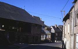
Old market hall | ||
| ||
 Wasigny | ||
|
Location within Grand Est region  Wasigny | ||
| Coordinates: 49°38′01″N 4°21′27″E / 49.6336°N 4.3575°ECoordinates: 49°38′01″N 4°21′27″E / 49.6336°N 4.3575°E | ||
| Country | France | |
| Region | Grand Est | |
| Department | Ardennes | |
| Arrondissement | Rethel | |
| Canton | Novion-Porcien | |
| Intercommunality | Crêtes Préardennaises | |
| Government | ||
| • Mayor (2008–2014) | Hubert Samyn | |
| Area1 | 9.98 km2 (3.85 sq mi) | |
| Population (2008)2 | 348 | |
| • Density | 35/km2 (90/sq mi) | |
| Time zone | CET (UTC+1) | |
| • Summer (DST) | CEST (UTC+2) | |
| INSEE/Postal code | 08499 / 08270 | |
| Elevation |
85–177 m (279–581 ft) (avg. 102 m or 335 ft) | |
|
1 French Land Register data, which excludes lakes, ponds, glaciers > 1 km² (0.386 sq mi or 247 acres) and river estuaries. 2 Population without double counting: residents of multiple communes (e.g., students and military personnel) only counted once. | ||

Wasigny is a commune in the Ardennes département in northern France.
Population
| Historical population | ||
|---|---|---|
| Year | Pop. | ±% |
| 1962 | 453 | — |
| 1968 | 494 | +9.1% |
| 1975 | 406 | −17.8% |
| 1982 | 345 | −15.0% |
| 1990 | 331 | −4.1% |
| 1999 | 319 | −3.6% |
| 2008 | 348 | +9.1% |
Sights
The 15th century market hall dominates the village square.
See also
References
| Wikimedia Commons has media related to Wasigny. |
This article is issued from Wikipedia - version of the 2/12/2016. The text is available under the Creative Commons Attribution/Share Alike but additional terms may apply for the media files.