Washingtonville, Pennsylvania
| Washingtonville, Pennsylvania | |
|---|---|
| Borough | |
|
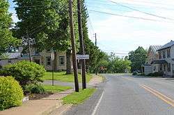
Entering Washingtonville from Strawberry Ridge Road | |
 Washingtonville, Pennsylvania Location within the state of Pennsylvania | |
| Coordinates: 41°03′09″N 76°40′30″W / 41.05250°N 76.67500°WCoordinates: 41°03′09″N 76°40′30″W / 41.05250°N 76.67500°W | |
| Country | United States |
| State | Pennsylvania |
| County | Montour |
| Settled | 1775 |
| Incorporated (borough) | April 28, 1870 |
| Government | |
| • Mayor | Tyler Dombroski |
| Area | |
| • Total | 0.1 sq mi (0.2 km2) |
| Population (2010) | |
| • Total | 273 |
| • Density | 3,498.0/sq mi (1,293.4/km2) |
| Time zone | Eastern (EST) |
| • Summer (DST) | EDT (UTC) |
| Zip code | 17884 |
| Area code(s) | 570 |
Washingtonville is a borough in Montour County, Pennsylvania, United States. The population was 273 at the 2010 census.[1] It is part of the Bloomsburg–Berwick Micropolitan Statistical Area.
History
The small borough is named after the first American president, George Washington. Before the time of the town's founding during the Revolutionary War, Fort Bosley stood along the eastern backs of Chillisquaque Creek near its confluence with Mud Creek. During, the early 20th century, millionaire Frank DeLong would often visit the borough to get away from the city. He ended up donating a school, which at the time was considered one of the best facilities in the country, to the town. He also turned the old Presbyterian Church into a memorial for his mother. Today, the old school building is now a nursing home, and the memorial still stands today, containing many historical artifacts.
Geography

According to the United States Census Bureau, the borough has a total area of 0.1 square miles (0.26 km2), all of it land. Washingtonville sits at the intersection of Pennsylvania Route 54 and Pennsylvania Route 254. Washingtonville is bordered on the west by Chillisquaque Creek. The eastern part of the borough is atop a low hill. The town's land is almost entirely residential.[2]
Demographics
| Historical population | |||
|---|---|---|---|
| Census | Pop. | %± | |
| 1870 | 172 | — | |
| 1880 | 203 | 18.0% | |
| 1890 | 171 | −15.8% | |
| 1900 | 212 | 24.0% | |
| 1910 | 183 | −13.7% | |
| 1920 | 177 | −3.3% | |
| 1930 | 182 | 2.8% | |
| 1940 | 175 | −3.8% | |
| 1950 | 194 | 10.9% | |
| 1960 | 198 | 2.1% | |
| 1970 | 174 | −12.1% | |
| 1980 | 218 | 25.3% | |
| 1990 | 228 | 4.6% | |
| 2000 | 201 | −11.8% | |
| 2010 | 273 | 35.8% | |
| Est. 2015 | 278 | [3] | 1.8% |
| Sources:[4][5][6] | |||
As of the census[5] of 2000, there were 201 people, 82 households, and 51 families residing in the borough. The population density was 3,498.0 people per square mile (1,293.4/km2). There were 93 housing units at an average density of 1,618.5 per square mile (598.5/km2). The racial makeup of the borough was 97.01% White, 1.49% African American, 0.50% Asian, and 1.00% from two or more races.
There were 82 households, out of which 29.3% had children under the age of 18 living with them, 50.0% were married couples living together, 11.0% had a female householder with no husband present, and 37.8% were non-families. 32.9% of all households were made up of individuals, and 6.1% had someone living alone who was 65 years of age or older. The average household size was 2.45 and the average family size was 3.18.
In the borough the population was spread out, with 24.4% under the age of 18, 10.0% from 18 to 24, 32.3% from 25 to 44, 23.9% from 45 to 64, and 9.5% who were 65 years of age or older. The median age was 35 years. For every 100 females there were 105.1 males. For every 100 females age 18 and over, there were 100.0 males.
The median income for a household in the borough was $35,278, and the median income for a family was $38,393. Males had a median income of $37,292 versus $17,500 for females. The per capita income for the borough was $21,206. About 15.1% of families and 19.6% of the population were below the poverty line, including 28.1% of those under the age of eighteen and 12.5% of those sixty five or over.
References
- ↑ "Washingtonville, Pennsylvania (PA 17884) profile: population, maps, real estate, averages, homes, statistics, relocation, travel, jobs, hospitals, schools, crime, moving, houses, news". City-data.com. Retrieved 2013-04-29.
- ↑ Terrain and Satellite imagery.
- ↑ "Annual Estimates of the Resident Population for Incorporated Places: April 1, 2010 to July 1, 2015". Retrieved July 2, 2016.
- ↑ "Census of Population and Housing". U.S. Census Bureau. Retrieved 11 December 2013.
- 1 2 "American FactFinder". United States Census Bureau. Retrieved 2008-01-31.
- ↑ "Incorporated Places and Minor Civil Divisions Datasets: Subcounty Resident Population Estimates: April 1, 2010 to July 1, 2012". Population Estimates. U.S. Census Bureau. Retrieved 11 December 2013.
Municipalities and communities of Montour County, Pennsylvania, United States | ||
|---|---|---|
| Boroughs |  | |
| Townships | ||
| Unincorporated communities | ||