Washington State Route 278
| ||||
|---|---|---|---|---|
|
SR 278 is highlighted in red. | ||||
| Route information | ||||
| Auxiliary route of SR 27 | ||||
| Defined by RCW 47.17.503 | ||||
| Maintained by WSDOT | ||||
| Length: | 5.50 mi[1] (8.85 km) | |||
| Existed: | 1991[2] – present | |||
| Major junctions | ||||
| West end: |
| |||
| East end: |
| |||
| Location | ||||
| Counties: | Spokane | |||
| Highway system | ||||
| ||||

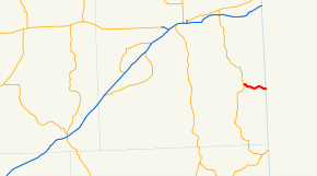
State Route 278 (SR 278) is a 5.50-mile (8.85 km) long state highway serving rural Spokane County in the U.S. state of Washington. The highway begins at SR 28 in Rockford and travels east to the Idaho state line, where it becomes Idaho State Highway 58. SR 278 was established in 1991 to serve the Coeur d'Alene Reservation in Idaho and used the route of an old gravel road that dates back to the 1930s.
Route description
SR 278 begins as Emma Street in Rockford at an intersection with Railroad Street, signed as SR 28.[3] The highway enters the town parallel to a Union Pacific rail line and crosses over Rock Creek to an intersection with 1st Street.[4][5] SR 278 turns south onto 1st Street and leaves Rockford, crossing over Rock Creek and beginning to parallel it east as Hoxie Road to the Idaho state line, where the roadway becomes Idaho State Highway 58, continuing 2.943 miles (4.736 km) to U.S. Route 95 (US-95).[6][7]
Every year the Washington State Department of Transportation (WSDOT) conducts a series of surveys on its highways in the state to measure traffic volume. This is expressed in terms of average annual daily traffic (AADT), which is a measure of traffic volume for any average day of the year. In 2011, WSDOT calculated that between 3,100 and 4,100 vehicles per day used the highway, mostly in Rockford.[8]
History
The route of SR 278 was previously Hoxie Road, which was graveled in 1938 and later paved by the 1950s.[9][10] Hoxie Road was signed as SR 278 in 1991,[2] and no further major revisions have occurred.[11]
Major intersections
The entire highway is in Spokane County.
| Location | mi[1] | km | Destinations | Notes | |
|---|---|---|---|---|---|
| Rockford | 0.00 | 0.00 | Western terminus | ||
| | 5.50 | 8.85 | Eastern terminus; Idaho state border | ||
| 1.000 mi = 1.609 km; 1.000 km = 0.621 mi | |||||
References
- 1 2 Staff (2012), State Highway Log: Planning Report 2011, SR 2 to SR 971 (PDF), Washington State Department of Transportation, pp. 1312–1313, retrieved January 19, 2013
- 1 2 "47.17.503: State route No. 278", Revised Code of Washington, Washington State Legislature, 1991, retrieved January 19, 2013
- ↑ "Feature Detail Report for: Rockford", Geographic Names Information System, United States Geological Survey, September 10, 1979, retrieved January 19, 2013
- ↑ 2011 Washington State Rail System (PDF) (Map). Washington State Department of Transportation. January 2012. Retrieved January 19, 2013.
- ↑ "Feature Detail Report for: Rock Creek", Geographic Names Information System, United States Geological Survey, September 10, 1979, retrieved January 19, 2013
- ↑ Google (January 19, 2013). "State Route 278" (Map). Google Maps. Google. Retrieved January 19, 2013.
- ↑ State Highway 58 Milepost Log, Idaho Transportation Department, August 30, 2011, retrieved January 19, 2013
- ↑ Staff (2011), 2011 Annual Traffic Report (PDF), Washington State Department of Transportation, pp. 165–166, retrieved January 19, 2013
- ↑ "Old Hoxie Road Will Be Graveled", Spokane Daily Chronicle, Spokane, Washington, p. 27, August 1, 1938, retrieved January 19, 2013
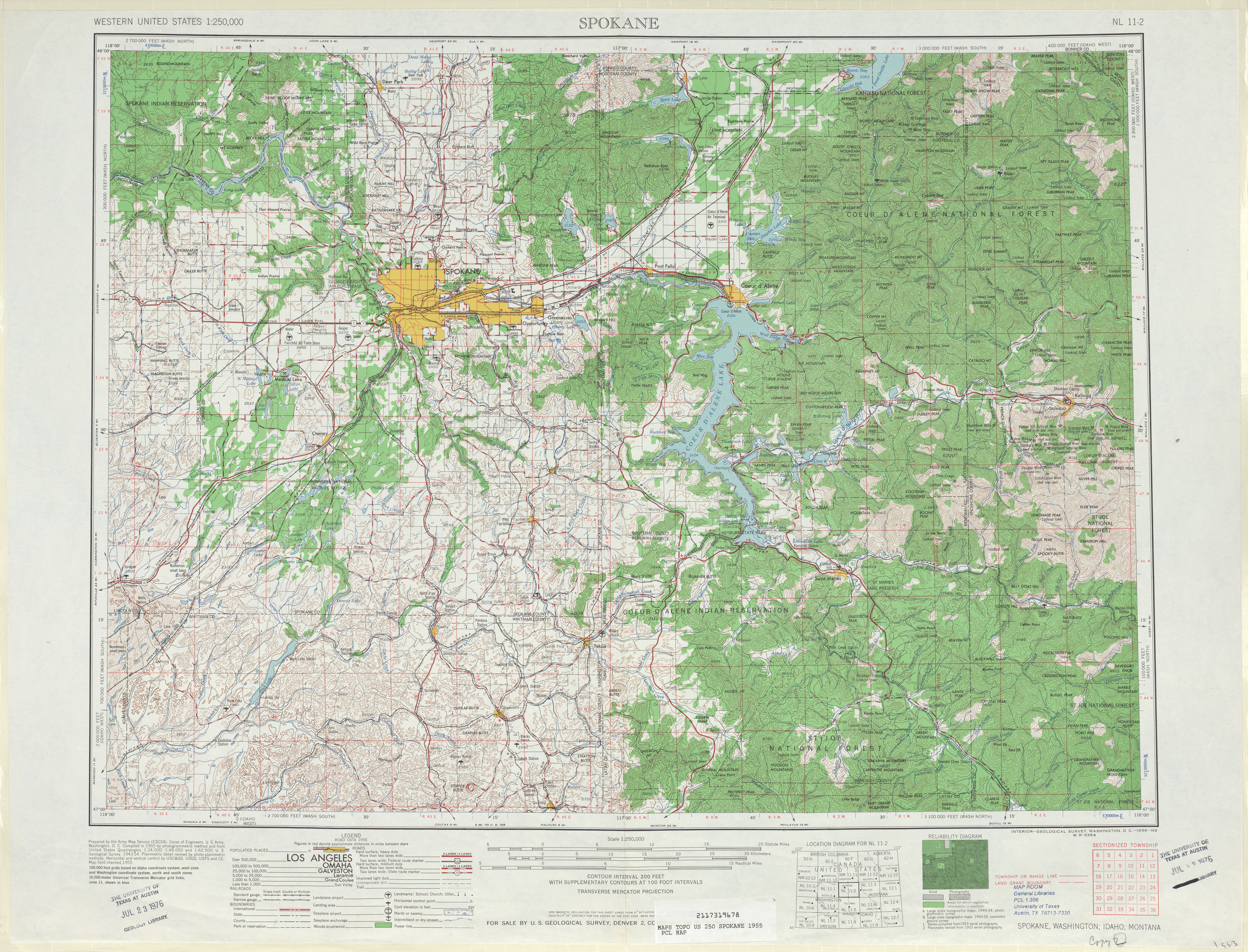
- ↑ Spokane, 1955 (JPG) (Map). 1:250,000. United States Geological Survey. 1955. Retrieved January 19, 2013.
- ↑ Washington State Highways, 2011–2012 (PDF) (Map). 1:842,000. Washington State Department of Transportation. 2011. Retrieved January 19, 2013.