Washington State Route 10
| ||||
|---|---|---|---|---|
|
SR 10 is highlighted in red. | ||||
| Route information | ||||
| Defined by RCW 47.17.045 | ||||
| Maintained by WSDOT | ||||
| Length: | 16.16 mi[1] (26.01 km) | |||
| Existed: | 1970[2] – present | |||
| Major junctions | ||||
| West end: |
| |||
| East end: |
| |||
| Location | ||||
| Counties: | Kittitas | |||
| Highway system | ||||
| ||||


State Route 10 (SR 10) is a 16.16-mile-long (26.01 km) state highway in the U.S. state of Washington. The highway is a remnant of U.S. Route 10 (US 10) in Kittitas County, traveling southeast along the Yakima River from SR 970 in Teanaway to US 97 northwest of Ellensburg. SR 10 was established in 1970 as the successor to US 10 after the completion of I-90 across the Snoqualmie Pass in 1968. The highway was previously part of State Road 3 from 1923 to 1937 and Primary State Highway 3 (PSH 3) until the 1964 highway renumbering.
Route description
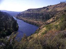
SR 10 begins at an intersection with SR 970 south of DeVere Field in the unincorporated community of Teanaway in Kittitas County, southeast of Cle Elum.[3][4] The highway travels southeast, parallel to a portion of the Stampede Subdivision of the BNSF Railway through the Yakima River valley and crosses over the Teanaway River before its confluence with the Yakima River.[5][6][7] SR 10 continues southeast through Bristol and Thorp before it ends at an intersection with US 97 northwest of Ellensburg.[8][9][10]
Every year, the Washington State Department of Transportation (WSDOT) conducts a series of surveys on its highways in the state to measure traffic volume. This is expressed in terms of average annual daily traffic (AADT), which is a measure of traffic volume for any average day of the year. In 2011, WSDOT calculated that 1,400 vehicles per day used the highway.[11]
History
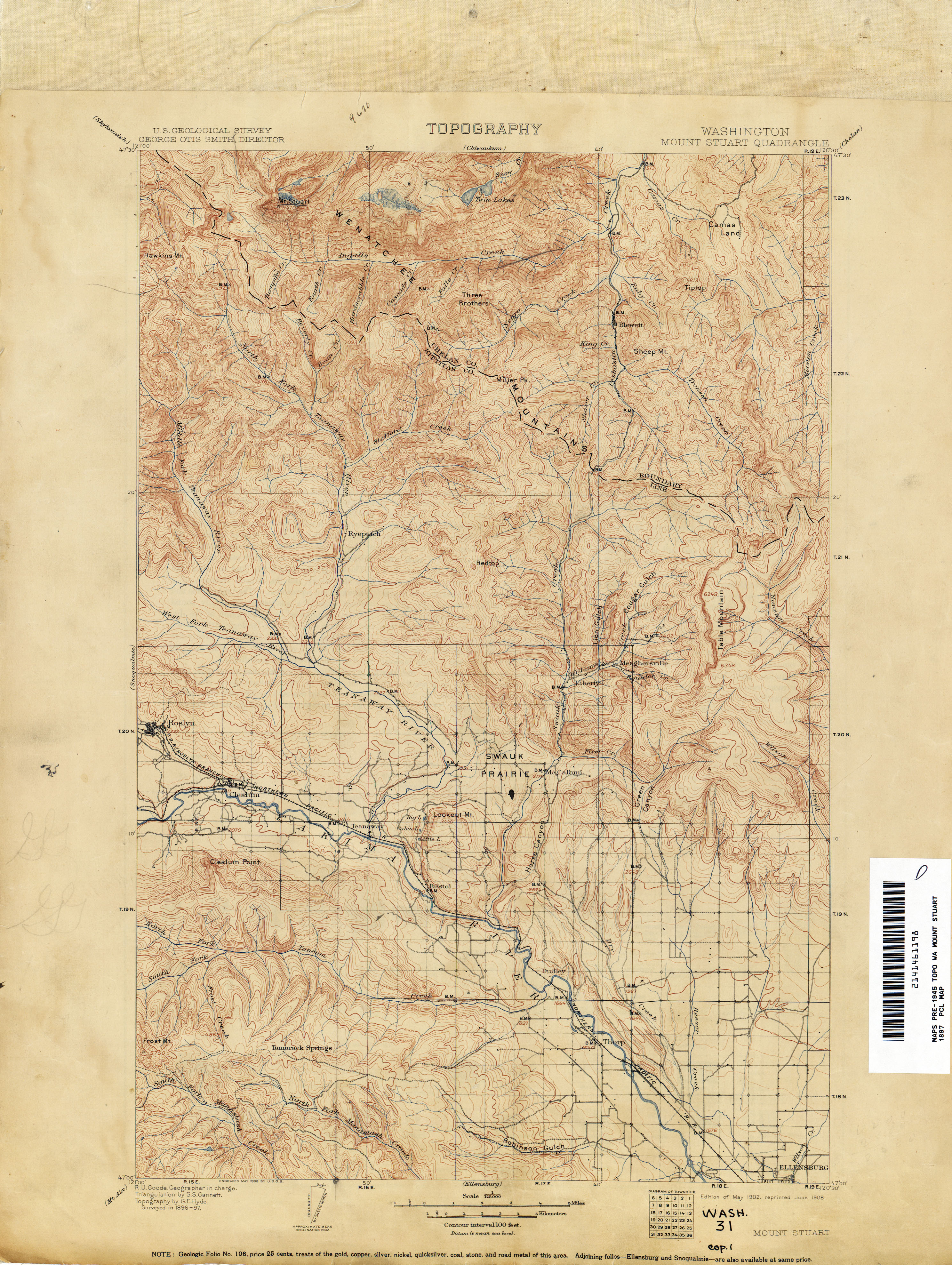
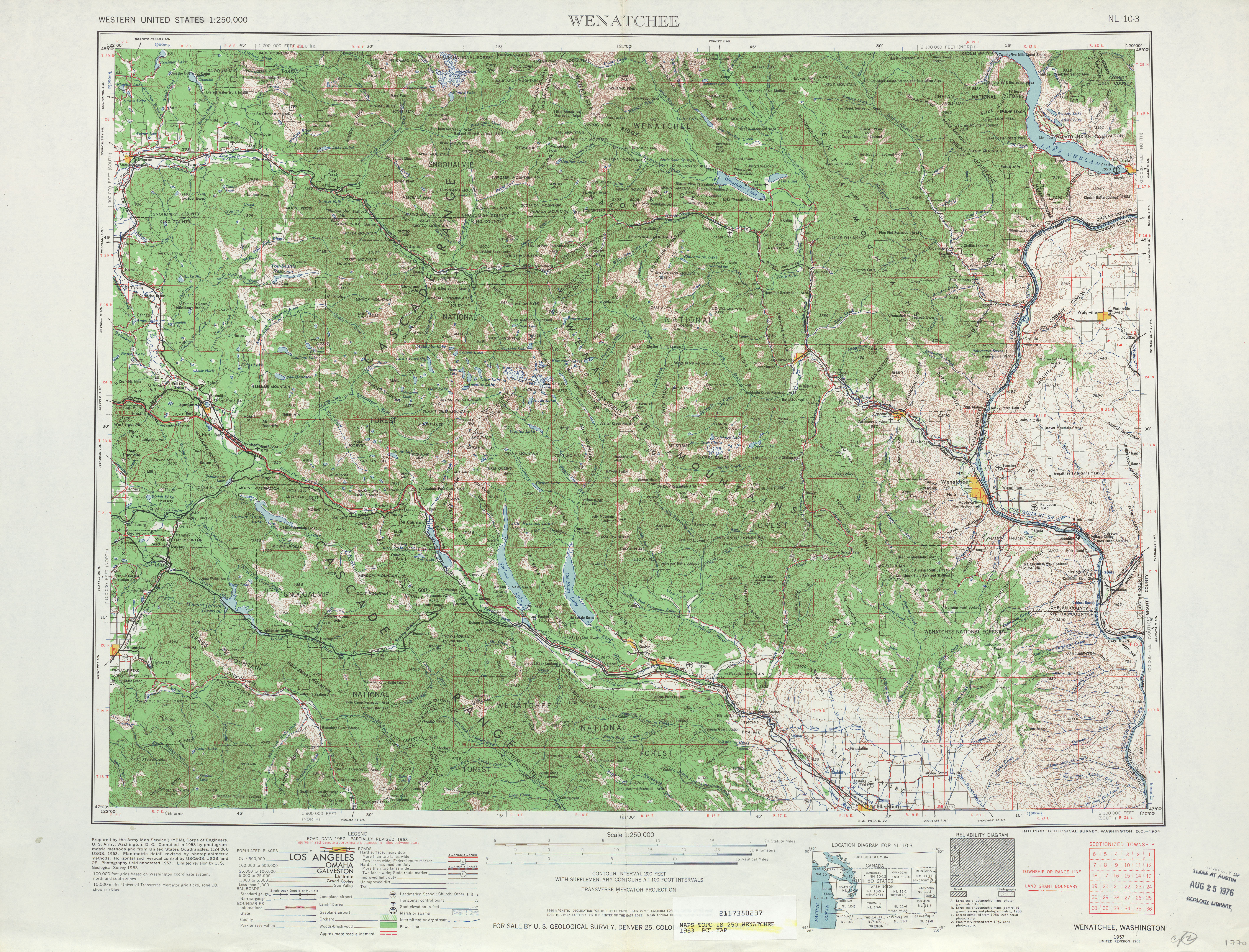
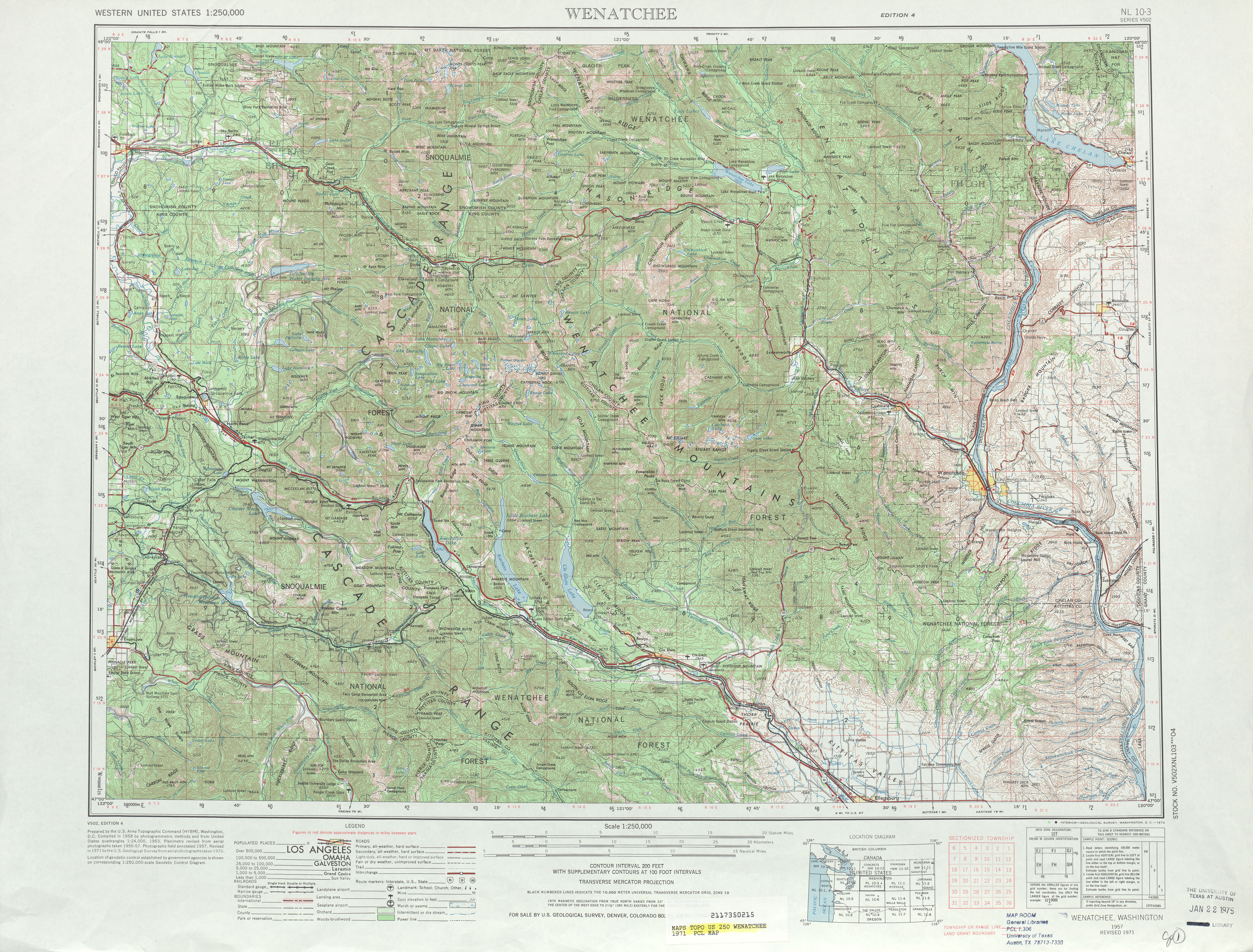
SR 10 follows the route of the Roslyn branch of the Northern Pacific Railway, built in the Yakima River valley by the late 1890s.[12] A roadway was built in the valley and incorporated into the Inland Empire Highway in 1913 and the Southern Division of the Sunset Highway in 1919.[13][14][15] The highway became part of State Road 3 in 1923, which was co-signed with US 10 and US 97 during the creation of the United States Numbered Highways in 1926.[16][17] State Road 3 became PSH 3 during the creation of the primary and secondary state highways in 1937, still co-signed with US 10 and US 97 through the Yakima River valley.[18] US 10 was temporarily re-aligned over Blewett Pass in the late 1930s, leaving US 97 alone in the Yakima River valley,[19] until US 10 was moved back to its original route in 1946 after US 2 was extended west from Idaho.[20][21] During the 1964 highway renumbering, US 10 completely replaced PSH 3 as I-90 was being planned along its route.[22][23] I-90 opened between Vantage and Snoqualmie Pass in November 1968 and SR 10 replaced US 10 when the state highways were codified in 1970.[2][24][25] US 97 was moved onto former SR 131 between Thorp and Virden in 1975,[26] leaving SR 10 without a concurrency and creating SR 970.[27]
Major intersections
The entire highway is in Kittitas County.
| Location | mi[1] | km | Destinations | Notes | |
|---|---|---|---|---|---|
| Teanaway | 0.00 | 0.00 | Western terminus | ||
| | 16.16 | 26.01 | Eastern terminus | ||
| 1.000 mi = 1.609 km; 1.000 km = 0.621 mi | |||||
References
- 1 2 Staff (2012), State Highway Log: Planning Report 2012, SR 2 to SR 971 (PDF), Washington State Department of Transportation, pp. 375–376, retrieved February 18, 2013
- 1 2 "47.17.045: State route No. 10", Revised Code of Washington, Washington State Legislature, 1970; revised 1971, 1975, 1987, retrieved February 18, 2013 Check date values in:
|date=(help) - ↑ "Feature Detail Report for: De Vere Field Airport", Geographic Names Information System, United States Geological Survey, March 1, 1990, retrieved February 18, 2013
- ↑ "Feature Detail Report for: Teanaway", Geographic Names Information System, United States Geological Survey, September 10, 1979, retrieved February 18, 2013
- ↑ 2011 Washington State Rail System (PDF) (Map). Washington State Department of Transportation. January 2012. Retrieved February 18, 2013.
- ↑ "Feature Detail Report for: Yakima River", Geographic Names Information System, United States Geological Survey, September 10, 1979, retrieved February 18, 2013
- ↑ "Feature Detail Report for: Teanaway River", Geographic Names Information System, United States Geological Survey, September 10, 1979, retrieved February 18, 2013
- ↑ Google (February 18, 2013). "State Route 10" (Map). Google Maps. Google. Retrieved February 18, 2013.
- ↑ "Feature Detail Report for: Bristol", Geographic Names Information System, United States Geological Survey, September 10, 1979, retrieved February 18, 2013
- ↑ "Feature Detail Report for: Thorp", Geographic Names Information System, United States Geological Survey, September 10, 1979, retrieved February 18, 2013
- ↑ Staff (2011), 2011 Annual Traffic Report (PDF), Washington State Department of Transportation, p. 82, retrieved February 18, 2013
- ↑ Washington: Mount Stuart Quadrangle (JPG) (Map). 1:250,000. United States Geological Survey. May 1902. Retrieved February 18, 2013.
- ↑ Washington State Legislature (March 12, 1913), "Chapter 65: Classifying Public Highways", Session Laws of the State of Washington, Session Laws of the State of Washington (1913 ed.), Olympia, Washington: Washington State Legislature, p. 221, retrieved February 18, 2013
- ↑ Washington State Legislature (March 4, 1915), "Chapter 29: Re-Location of the Sunset Highway", Session Laws of the State of Washington, Session Laws of the State of Washington (1915 ed.), Olympia, Washington: Washington State Legislature, pp. 64–65, retrieved February 18, 2013
- ↑ Washington State Legislature (March 14, 1919), "Chapter 110: Amending Highway Classification Act", Session Laws of the State of Washington, Session Laws of the State of Washington (1919 ed.), Olympia, Washington: Washington State Legislature, pp. 267–270, retrieved February 18, 2013
- ↑ Washington State Legislature (March 19, 1923), "Chapter 185: Primary and Secondary State Highways", Session Laws of the State of Washington, Session Laws of the State of Washington (1923 ed.), Olympia, Washington: Washington State Legislature, p. 627, retrieved February 18, 2013
- ↑ Bureau of Public Roads & American Association of State Highway Officials (November 11, 1926). United States System of Highways Adopted for Uniform Marking by the American Association of State Highway Officials (Map). 1:7,000,000. Washington, DC: U.S. Geological Survey. OCLC 32889555. Retrieved November 7, 2013 – via University of North Texas Libraries.
- ↑ Washington State Legislature (March 17, 1937), "Chapter 190: Establishment of Primary State Highways", Session Laws of the State of Washington, Session Laws of the State of Washington (1937 ed.), Olympia, Washington: Washington State Legislature, p. 934, retrieved February 18, 2013
- ↑ Highways of the State of Washington (DJVU) (Map). Department of Highways. 1939. Retrieved February 18, 2013.
- ↑ Weingroff, Richard (April 7, 2011), U.S. 2: Houlton, Maine, to Everett, Washington, Federal Highway Administration, retrieved January 29, 2013
- ↑ Wenatchee, 1948 (JPG) (Map). 1:250,000. United States Geological Survey. 1948. Retrieved February 18, 2013.
- ↑ Prahl, C. G. (December 1, 1965), Identification of State Highways (PDF), Washington State Highway Commission, Department of Highways, retrieved February 18, 2013
- ↑ Wenatchee, 1963 (JPG) (Map). 1:250,000. United States Geological Survey. 1963. Retrieved February 18, 2013.
- ↑ "Interstate Opens Near Ellensburg", The Spokesman-Review, p. 23, November 21, 1968, retrieved February 18, 2013
- ↑ Wenatchee, 1971 (JPG) (Map). 1:250,000. United States Geological Survey. 1971. Retrieved February 18, 2013.
- ↑ "47.17.265: State route No. 131", Revised Code of Washington, Washington State Legislature, 1970; repealed 1975, retrieved January 29, 2013 Check date values in:
|date=(help) - ↑ "47.17.970: State route No. 970", Revised Code of Washington, Washington State Legislature, 1975, retrieved February 18, 2013