Washakie County, Wyoming
| Washakie County, Wyoming | |
|---|---|
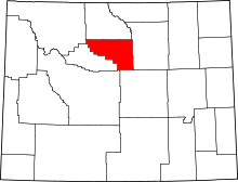 Location in the U.S. state of Wyoming | |
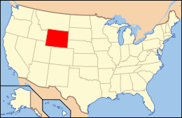 Wyoming's location in the U.S. | |
| Founded | 1913 |
| Named for | Chief Washakie |
| Seat | Worland |
| Largest city | Worland |
| Area | |
| • Total | 2,243 sq mi (5,809 km2) |
| • Land | 2,239 sq mi (5,799 km2) |
| • Water | 4.2 sq mi (11 km2), 0.2% |
| Population (est.) | |
| • (2015) | 8,328 |
| • Density | 3.8/sq mi (1/km²) |
| Congressional district | At-large |
| Time zone | Mountain: UTC-7/-6 |
| Website |
www |
Washakie County is a county located in the U.S. state of Wyoming. As of the 2010 census, the population was 8,533.[1] Its county seat is Worland.[2]
History
Washakie County was created on February 21, 1911 with land detached from Big Horn County and organized in 1913.[3] Washakie County was named for the head chief of the Shoshone people, Chief Washakie, who became an ally of the US Government.[4]
Geography
According to the U.S. Census Bureau, the county has a total area of 2,243 square miles (5,810 km2), of which 2,239 square miles (5,800 km2) is land and 4.2 square miles (11 km2) (0.2%) is water.[5]
Adjacent counties
- Big Horn County, Wyoming (north)
- Johnson County, Wyoming (east)
- Natrona County, Wyoming (southeast)
- Fremont County, Wyoming (south)
- Hot Springs County, Wyoming (west)
- Park County, Wyoming (northwest)
National protected area
- Bighorn National Forest (part)
Demographics
| Historical population | |||
|---|---|---|---|
| Census | Pop. | %± | |
| 1920 | 3,106 | — | |
| 1930 | 4,109 | 32.3% | |
| 1940 | 5,858 | 42.6% | |
| 1950 | 7,252 | 23.8% | |
| 1960 | 8,883 | 22.5% | |
| 1970 | 7,569 | −14.8% | |
| 1980 | 9,496 | 25.5% | |
| 1990 | 8,388 | −11.7% | |
| 2000 | 8,289 | −1.2% | |
| 2010 | 8,533 | 2.9% | |
| Est. 2015 | 8,328 | [6] | −2.4% |
| U.S. Decennial Census[7] 1870–2000[8] 2010–2015[1] | |||
2000 census
As of the census[9] of 2000, there were 8,289 people, 3,278 households, and 2,310 families residing in the county. The population density was 4 people per square mile (1/km²). There were 3,654 housing units at an average density of 2 per square mile (1/km²). The racial makeup of the county was 90.22% White, 0.11% Black or African American, 0.55% Native American, 0.74% Asian, 6.21% from other races, and 2.17% from two or more races. 11.47% of the population were Hispanic or Latino of any race. 27.1% were of German, 13.1% English, 9.9% Irish and 6.2% American ancestry.
There were 3,278 households out of which 32.40% had children under the age of 18 living with them, 59.90% were married couples living together, 7.30% had a female householder with no husband present, and 29.50% were non-families. 26.50% of all households were made up of individuals and 11.90% had someone living alone who was 65 years of age or older. The average household size was 2.47 and the average family size was 3.00.
In the county the population was spread out with 27.20% under the age of 18, 6.40% from 18 to 24, 25.20% from 25 to 44, 25.30% from 45 to 64, and 15.90% who were 65 years of age or older. The median age was 39 years. For every 100 females there were 99.40 males. For every 100 females age 18 and over, there were 96.30 males.
The median income for a household in the county was $34,943, and the median income for a family was $42,584. Males had a median income of $31,633 versus $21,028 for females. The per capita income for the county was $17,780. About 10.00% of families and 14.10% of the population were below the poverty line, including 21.10% of those under age 18 and 12.20% of those age 65 or over.
2010 census
As of the 2010 United States Census, there were 8,533 people, 3,492 households, and 2,395 families residing in the county.[10] The population density was 3.8 inhabitants per square mile (1.5/km2). There were 3,833 housing units at an average density of 1.7 per square mile (0.66/km2).[11] The racial makeup of the county was 91.4% white, 1.1% American Indian, 0.6% Asian, 0.3% black or African American, 4.4% from other races, and 2.4% from two or more races. Those of Hispanic or Latino origin made up 13.6% of the population.[10] In terms of ancestry, 33.1% were German, 17.6% were English, 11.7% were Irish, 6.6% were American, and 5.5% were Norwegian.[12]
Of the 3,492 households, 30.0% had children under the age of 18 living with them, 56.4% were married couples living together, 7.9% had a female householder with no husband present, 31.4% were non-families, and 27.7% of all households were made up of individuals. The average household size was 2.40 and the average family size was 2.93. The median age was 41.8 years.[10]
The median income for a household in the county was $48,379 and the median income for a family was $61,340. Males had a median income of $45,579 versus $30,107 for females. The per capita income for the county was $28,557. About 1.7% of families and 5.6% of the population were below the poverty line, including 1.8% of those under age 18 and 9.9% of those age 65 or over.[13]
Government and infrastructure
The Wyoming Department of Family Services Juvenile Services Division operates the Wyoming Boys' School, located in Mc Nutt,[14] unincorporated Washakie County, near Worland.[15] The facility was operated by the Wyoming Board of Charities and Reform until that agency was dissolved as a result of a state constitutional amendment passed in November 1990.[16]
Communities
City
- Worland (county seat)
Town
Other places
See also
References
- 1 2 "State & County QuickFacts". United States Census Bureau. Retrieved January 25, 2014.
- ↑ "Find a County". National Association of Counties. Retrieved 2011-06-07.
- ↑ Long, John H., ed. (2004). "Wyoming: Individual County Chronologies". Wyoming Atlas of Historical County Boundaries. The Newberry Library. Retrieved August 19, 2015.
- ↑ Urbanek, Mae (1988). Wyoming Place Names. Missoula, MT: Mountain Press Publishing Company. ISBN 0-87842-204-8.
- ↑ "2010 Census Gazetteer Files". United States Census Bureau. August 22, 2012. Retrieved August 18, 2015.
- ↑ "County Totals Dataset: Population, Population Change and Estimated Components of Population Change: April 1, 2010 to July 1, 2015". Retrieved July 2, 2016.
- ↑ "U.S. Decennial Census". United States Census Bureau. Retrieved August 18, 2015.
- ↑ "Historical Decennial Census Population for Wyoming Counties, Cities, and Towns". Wyoming Department of Administration & Information, Division of Economic Analysis. Retrieved January 25, 2014.
- ↑ "American FactFinder". United States Census Bureau. Retrieved 2011-05-14.
- 1 2 3 "DP-1 Profile of General Population and Housing Characteristics: 2010 Demographic Profile Data". United States Census Bureau. Retrieved 2016-01-12.
- ↑ "Population, Housing Units, Area, and Density: 2010 - County". United States Census Bureau. Retrieved 2016-01-12.
- ↑ "DP02 SELECTED SOCIAL CHARACTERISTICS IN THE UNITED STATES – 2006-2010 American Community Survey 5-Year Estimates". United States Census Bureau. Retrieved 2016-01-12.
- ↑ "DP03 SELECTED ECONOMIC CHARACTERISTICS – 2006-2010 American Community Survey 5-Year Estimates". United States Census Bureau. Retrieved 2016-01-12.
- ↑ "Mc Nutt CDP, Wyoming." United States Census Bureau. Retrieved on December 12, 2010.
- ↑ "Wyoming Boys’ School." Wyoming Department of Family Services. Retrieved on August 22, 2010. "Wyoming Boys’ School 1550 Highway 20 South Worland, WY 82401"
- ↑ "About the Department of Corrections." Wyoming Department of Corrections. Retrieved on August 22, 2010.
 |
Park County | Big Horn County | | |
| Hot Springs County | |
Johnson County | ||
| ||||
| | ||||
| Fremont County | Natrona County |
Municipalities and communities of Washakie County, Wyoming, United States | ||
|---|---|---|
| City | | |
| Town | ||
| Unincorporated communities | ||
Cheyenne (capital) | |
| Topics |
|
| Society |
|
| Regions | |
| Cities | |
| Counties | |
Coordinates: 43°55′N 107°41′W / 43.91°N 107.68°W