Waseley Hills Country Park
Waseley Hills Country Park is 150 acres (0.61 km2) a Country Park and Local Nature Reserve[1][2] owned and managed by Worcestershire County Council's Countryside Service.[3] It consists of rolling open hills with old hedgerows, pastures and small pockets of woodland with panoramic views over Worcestershire, England.
It is just south-west of Birmingham, close to Junction 4 of the M5 Motorway, from which it is signposted. The North Worcestershire Path and Illey Way long distance paths run through the park.[3] The park contains the source of the River Rea. The hills form part of the watershed between the Rea valley and that of the river Salwarpe, and thus between the catchments of the rivers Trent and Severn.
Facilities
The park has an information centre, a meeting room and café, all located in a timber-framed threshing barn, which originally stood at Lower Smite Farm in Hindlip. Other facilities include a play area and an orienteering course.[3]
The name
The name may be derived from "Waer" (sheep) and "ley" (field),[3] but the first element could be "weardsetl" (watchplace). If it is the latter, it was one of a chain of four such watchplaces along the northern boundary of the Anglo-Saxon kingdom of the Hwicce, along with Wast Hills in Alvechurch, Wassell Grove to the east of Wychbury Hill in Hagley, and Wassell Wood at the southern end of Shatterford Hill at Trimpley.[4]
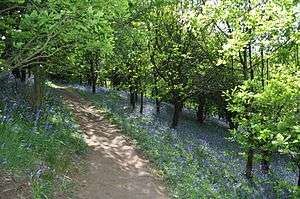
Views
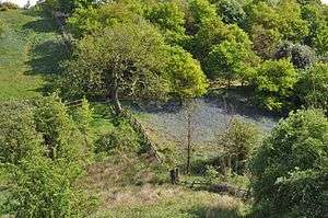 View of Waseley Hills Country Park |
 View of Waseley Hills Country Park |
 View of Waseley Hills Country Park |
External links
References
- ↑ "Waseley Hills Country Park". Local Nature Reserves. Natural England. Retrieved 26 July 2013.
- ↑ "Map of Waseley Hills Country Park". Local Nature Reserves. Natural England. Retrieved 26 July 2013.
- 1 2 3 4 "Waseley Hills Country Park". Worcestershire County Council. Retrieved 6 February 2010. Archived 26 August 2010 at the Wayback Machine.
- ↑ King, P. W. (1996). "The Minster Aet Sture in Husmere and the northern boundary of the Hwicce". Transactions of Worcestershire Archaeological Society. 3. 15 (85): 73–91. ISSN 0143-2389.
Coordinates: 52°24′04″N 2°02′30″W / 52.401214°N 2.041569°W