Warsaw, Missouri
| Warsaw, Missouri | |
|---|---|
| City | |
 Location of Warsaw, Missouri | |
| Coordinates: 38°14′43″N 93°22′38″W / 38.24528°N 93.37722°WCoordinates: 38°14′43″N 93°22′38″W / 38.24528°N 93.37722°W | |
| Country | United States |
| State | Missouri |
| County | Benton |
| Area[1] | |
| • Total | 2.62 sq mi (6.79 km2) |
| • Land | 2.41 sq mi (6.24 km2) |
| • Water | 0.21 sq mi (0.54 km2) |
| Elevation | 715 ft (218 m) |
| Population (2010)[2] | |
| • Total | 2,127 |
| • Estimate (2012[3]) | 2,124 |
| • Density | 882.6/sq mi (340.8/km2) |
| Time zone | Central (CST) (UTC-6) |
| • Summer (DST) | CDT (UTC-5) |
| ZIP code | 65355 |
| Area code(s) | 660 |
| FIPS code | 29-77146[4] |
| GNIS feature ID | 0728365[5] |
| Website | www.welcometowarsaw.com |
Warsaw is a city located in Benton County, Missouri. The population was 2,127 at the 2010 census. It is the county seat of Benton County.[6]
History
The original inhabitants of the area were the Delaware, Shawnee, Sac, Kickapoo, and Osage (namesake of the Osage River which passed by the city). French settlers visited the area as early as 1719.
Warsaw was platted in 1837.[7] The city was incorporated in 1843 and designated as the county seat of Benton County. The city was named after Warsaw, the capital city of Poland, in honor of the Revolutionary War hero Tadeusz Kościuszko, who was of Polish descent. Warsaw was a steamboat port, the furthest point up the Osage River they could navigate.[8]
Permanent immigrants to the area were Germans, Scotch-Irish, and English, as well as transplant farmers from Kentucky, Tennessee, and the Carolinas, first arriving around 1820.
The Upper Bridge was listed on the National Register of Historic Places in 1999.[9]
Geography
Warsaw is located at 38°14'43" North, 93°22'38" West (38.245195, -93.377227).[10] According to the United States Census Bureau, the city has a total area of 2.62 square miles (6.79 km2), of which, 2.41 square miles (6.24 km2) is land and 0.21 square miles (0.54 km2) is water.[1] The total area is 7.6% water, due in part to the construction of the Harry S Truman Reservoir and Dam.
Climate
On July 14, 1954, the temperature in Warsaw rose to 118 °F (48 °C).[11] This remains the hottest temperature ever recorded in the state of Missouri. On February 13, 1905, the temperature at Warsaw fell to -40 °F (-40 °C),[11] the coldest temperature ever recorded in Missouri.
| Climate data for Warsaw, Missouri | |||||||||||||
|---|---|---|---|---|---|---|---|---|---|---|---|---|---|
| Month | Jan | Feb | Mar | Apr | May | Jun | Jul | Aug | Sep | Oct | Nov | Dec | Year |
| Record high °F (°C) | 74 (23) |
81 (27) |
88 (31) |
92 (33) |
96 (36) |
104 (40) |
118 (48) |
109 (43) |
105 (41) |
94 (34) |
86 (30) |
78 (26) |
118 (48) |
| Average high °F (°C) | 41 (5) |
46 (8) |
56 (13) |
66 (19) |
75 (24) |
84 (29) |
89 (32) |
89 (32) |
80 (27) |
69 (21) |
57 (14) |
45 (7) |
66.4 (19.3) |
| Average low °F (°C) | 20 (−7) |
23 (−5) |
33 (1) |
42 (6) |
54 (12) |
64 (18) |
69 (21) |
67 (19) |
57 (14) |
45 (7) |
35 (2) |
24 (−4) |
44.4 (7) |
| Record low °F (°C) | −32 (−36) |
−40 (−40) |
−3 (−19) |
10 (−12) |
25 (−4) |
38 (3) |
53 (12) |
44 (7) |
29 (−2) |
21 (−6) |
5 (−15) |
−20 (−29) |
−40 (−40) |
| Average precipitation inches (mm) | 1.8 (45.72) |
2.24 (56.9) |
2.95 (74.9) |
4.37 (111) |
5.41 (137.4) |
4.99 (126.7) |
4.25 (108) |
3.84 (97.5) |
4.06 (103.1) |
3.56 (90.4) |
3.51 (89.2) |
2.16 (54.9) |
43.14 (1,095.72) |
Demographics
| Historical population | |||
|---|---|---|---|
| Census | Pop. | %± | |
| 1880 | 515 | — | |
| 1890 | 700 | 35.9% | |
| 1900 | 743 | 6.1% | |
| 1910 | 824 | 10.9% | |
| 1920 | 925 | 12.3% | |
| 1930 | 1,102 | 19.1% | |
| 1940 | 957 | −13.2% | |
| 1950 | 936 | −2.2% | |
| 1960 | 1,054 | 12.6% | |
| 1970 | 1,423 | 35.0% | |
| 1980 | 1,494 | 5.0% | |
| 1990 | 1,696 | 13.5% | |
| 2000 | 2,070 | 22.1% | |
| 2010 | 2,127 | 2.8% | |
| Est. 2015 | 2,100 | [12] | −1.3% |
2010 census
As of the census[2] of 2010, there were 2,127 people, 914 households, and 523 families residing in the city. The population density was 882.6 inhabitants per square mile (340.8/km2). There were 1,085 housing units at an average density of 450.2 per square mile (173.8/km2). The racial makeup of the city was 96.3% White, 1.0% African American, 1.1% Native American, 0.2% Asian, 0.4% from other races, and 0.9% from two or more races. Hispanic or Latino of any race were 3.2% of the population.
There were 914 households of which 27.4% had children under the age of 18 living with them, 41.6% were married couples living together, 12.1% had a female householder with no husband present, 3.5% had a male householder with no wife present, and 42.8% were non-families. 37.7% of all households were made up of individuals and 21% had someone living alone who was 65 years of age or older. The average household size was 2.20 and the average family size was 2.88.
The median age in the city was 45 years. 22.7% of residents were under the age of 18; 6% were between the ages of 18 and 24; 21.2% were from 25 to 44; 25.1% were from 45 to 64; and 25% were 65 years of age or older. The gender makeup of the city was 46.7% male and 53.3% female.
2000 census
As of the census[4] of 2000, there were 2,070 people, 923 households, and 539 families residing in the city. The population density was 1,045.5 people per square mile (403.7/km²). There were 1,027 housing units at an average density of 518.7 per square mile (200.3/km²). The racial makeup of the city was 98.36% White, 0.14% African American, 0.43% Native American, 0.05% Asian, 0.05% Pacific Islander, 0.10% from other races, and 0.87% from two or more races. 1.26% of the population were Hispanic or Latino of any race.
There were 923 households out of which 24.2% had children under the age of 18 living with them, 44.7% were married couples living together, 10.7% had a female householder with no husband present, and 41.6% were non-families. 38.6% of all households were made up of individuals and 21.5% had someone living alone who was 65 years of age or older. The average household size was 2.12 and the average family size was 2.78.
In the city the population was spread out with 21.7% under the age of 18, 7.1% from 18 to 24, 22.9% from 25 to 44, 21.2% from 45 to 64, and 27.1% who were 65 years of age or older. The median age was 44 years. For every 100 females there were 79.7 males. For every 100 females age 18 and over, there were 77.7 males.
The median income for a household in the city was $23,583, and the median income for a family was $33,068. Males had a median income of $24,464 versus $19,301 for females. The per capita income for the city was $15,262. 18.5% of the population and 9.5% of families were below the poverty line. 24.7% of those under the age of 18 and 14.2% of those 65 and older were living below the poverty line.
See also
References
- 1 2 "US Gazetteer files 2010". United States Census Bureau. Retrieved 2012-07-08.
- 1 2 "American FactFinder". United States Census Bureau. Retrieved 2012-07-08.
- ↑ "Population Estimates". United States Census Bureau. Retrieved 2013-05-30.
- 1 2 "American FactFinder". United States Census Bureau. Retrieved 2008-01-31.
- ↑ "US Board on Geographic Names". United States Geological Survey. 2007-10-25. Retrieved 2008-01-31.
- ↑ "Find a County". National Association of Counties. Retrieved 2011-06-07.
- ↑ Eaton, David Wolfe (1916). How Missouri Counties, Towns and Streams Were Named. The State Historical Society of Missouri. p. 209.
- ↑ "Warsaw, Missouri History". Warsaw City Government. Retrieved 6 July 2013.
- ↑ National Park Service (2010-07-09). "National Register Information System". National Register of Historic Places. National Park Service.
- ↑ "US Gazetteer files: 2010, 2000, and 1990". United States Census Bureau. 2011-02-12. Retrieved 2011-04-23.
- 1 2 http://www.netstate.com/states/geography/mo_geography.htm
- ↑ "Annual Estimates of the Resident Population for Incorporated Places: April 1, 2010 to July 1, 2015". Retrieved July 2, 2016.
- ↑ "Census of Population and Housing". Census.gov. Retrieved June 4, 2015.
External links
- Historic maps of Warsaw in the Sanborn Maps of Missouri Collection at the University of Missouri
Municipalities and communities of Benton County, Missouri, United States | ||
|---|---|---|
| Cities | 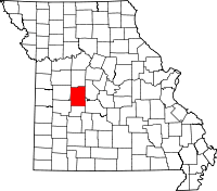 | |
| Village | ||
| Townships |
| |
| Unincorporated communities |
| |
| Former settlements | ||
| Footnotes | ‡This populated place also has portions in an adjacent county or counties | |