Warroad, Minnesota
| Warroad | |
|---|---|
| City | |
| Nickname(s): Hockeytown, USA[1] | |
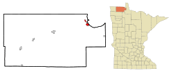 Location of Warroad within Roseau County and state of Minnesota | |
| Coordinates: 48°54′19″N 95°18′52″W / 48.90528°N 95.31444°W | |
| Country | United States |
| State | Minnesota |
| County | Roseau |
| Area[2] | |
| • Total | 2.90 sq mi (7.51 km2) |
| • Land | 2.79 sq mi (7.23 km2) |
| • Water | 0.11 sq mi (0.28 km2) |
| Elevation[3] | 1,066 ft (325 m) |
| Population (2013)[4] | |
| • Total | 1,800 |
| • Estimate (2012[5]) | 1,770 |
| • Density | 638.4/sq mi (246.5/km2) |
| Time zone | Central (CST) (UTC-6) |
| • Summer (DST) | CDT (UTC-5) |
| ZIP code | 56763 |
| Area code(s) | 218 |
| FIPS code | 27-68224[6] |
| GNIS feature ID | 0653790[3] |
Warroad is a city in Roseau County, Minnesota, United States, at the southwest corner of Lake of the Woods. The population was 1,781 at the 2010 census.[7] Warroad was incorporated in 1901.[8]
Minnesota State Highways 11 and 313 are two of the main routes in the community.
History
The name Warroad seems to come from the practice of Indian tribes using the location, which is now the town, as a route to war upon each other. In the 20th century, the town had a strong commercial fishing industry, which gradually turned to sport fishing and tourism. For many years, commercial boats provided regular service to the islands and to Kenora, Ontario at the north end of Lake of the Woods. Several flying services carried sport fishermen and tourists to lodges and fishing camps in Lake of the Woods until economics and increasing regulations drove them out of business. Warroad is known for the great fishing on Lake of the Woods.
Warroad, called "Hockeytown USA",[1] is also noted for its strong hockey tradition. The Warroad High School program has earned four men's state championship titles ('94, '96, '03, '05) and two women's ('10, '11) in the past 20 years, and has produced NHL and Olympic players. No U.S. Hockey team has won a gold medal without a player from Warroad on the roster.[9] Another important piece of Warroad hockey history is the Warroad Lakers amateur team that existed from 1947 to 1997.
Father Aulneau
Warroad is the site of St. Mary's Church, also called the Father Aulneau Memorial Church, which commemorates a French Catholic priest who accompanied French explorers and soldiers in their search for the Northwest Passage and was killed along with several other people, presumably by Native Americans. The Aulneau Peninsula in Lake of the Woods is named after Father Aulneau.
Geography
According to the United States Census Bureau, the city has a total area of 2.90 square miles (7.51 km2); 2.79 square miles (7.23 km2) is land and 0.11 square miles (0.28 km2) is water.[2] The Warroad River flows through town.
Warroad is located along the southwest shore of Lake of the Woods at Muskeg Bay. Warroad is east of Roseau and west of Baudette.
Demographics
| Historical population | |||
|---|---|---|---|
| Census | Pop. | %± | |
| 1900 | 238 | — | |
| 1910 | 927 | 289.5% | |
| 1920 | 1,211 | 30.6% | |
| 1930 | 1,184 | −2.2% | |
| 1940 | 1,309 | 10.6% | |
| 1950 | 1,276 | −2.5% | |
| 1960 | 1,309 | 2.6% | |
| 1970 | 1,086 | −17.0% | |
| 1980 | 1,216 | 12.0% | |
| 1990 | 1,679 | 38.1% | |
| 2000 | 1,722 | 2.6% | |
| 2010 | 1,781 | 3.4% | |
| Est. 2015 | 1,799 | [10] | 1.0% |
| U.S. Decennial Census | |||
2010 census
As of the census[4] of 2010, there were 1,781 people, 764 households, and 452 families residing in the city. The population density was 638.4 inhabitants per square mile (246.5/km2). There were 839 housing units at an average density of 300.7 per square mile (116.1/km2). The racial makeup of the city was 83.3% White, 0.1% African American, 5.7% Native American, 8.5% Asian, and 2.5% from two or more races. Hispanic or Latino of any race were 1.0% of the population.
There were 764 households of which 33.0% had children under the age of 18 living with them, 40.3% were married couples living together, 11.9% had a female householder with no husband present, 6.9% had a male householder with no wife present, and 40.8% were non-families. 36.0% of all households were made up of individuals and 12.1% had someone living alone who was 65 years of age or older. The average household size was 2.27 and the average family size was 2.93.
The median age in the city was 38.9 years. 25% of residents were under the age of 18; 10% were between the ages of 18 and 24; 23.7% were from 25 to 44; 26.2% were from 45 to 64; and 15.2% were 65 years of age or older. The gender makeup of the city was 50.0% male and 50.0% female.
2000 census
As of the census[6] of 2000, there were 1,722 people, 657 households, and 419 families residing in the city. The population density was 254.7/km2 (660/sq mi). There were 766 housing units at an average density of 113.3/km2 (293/sq mi). The racial makeup of the city was 81.65% White, 0.29% Black or African American, 7.38% Native American, 9.18% Asian, 0.00% Pacific Islander, 0.00% from other races, and 1.51% from two or more races. 0.0% of the population were Hispanic or Latino of any race. According to the 2000 US Census, the town had the US's highest percentage of Laotian Americans.
There were 657 households out of which 39.3% had children under the age of 18 living with them, 48.6% were married couples living together, 10.5% had a female householder with no husband present, and 36.1% were non-families. 32.4% of all households were made up of individuals and 9.6% had someone living alone who is 65 years of age or older. The average household size was 2.52 and the average family size is 3.22.
In the city the population was spread out with 31.5% under the age of 18, 7.8% from 18 to 24, 30.3% from 25 to 44, 18.5% from 45 to 64, and 12.0% who were 65 years of age or older. The median age was 33 years. For every 100 females there were 97.7 males. For every 100 females age 18 and over, there were 96.0 males.
The median income for a household in the city was $34,948, and the median income for a family was $44,667. Males had a median income of $27,123 versus $22,465 for females. The per capita income for the city was $16,412. 8.8% of the population and 7.3% of families were below the poverty line. Out of the total population, 10.7% of those under the age of 18 and 7.8% of those 65 and older were living below the poverty line.
Local media
- Newspaper
Warroad Pioneer
- Radio
- KKWQ-FM 92.5 and KRWB (AM) 1410, both owned by Border Broadcasting in Warroad
- KCAJ FM 102.1, operated by North Country Media in Roseau.
Notable people
- Henry Boucha,[1] former NHL player and 1972 Winter Olympic Silver Medalist, hockey. Born and raised in Warroad. Member of the U.S. Hockey Hall of Fame.
- Bill Christian,[1] 1960 Winter Olympian, Gold Medalist, hockey. Member of the U.S. Hockey Hall of Fame and the IIHF Hall of Fame.
- Dave Christian,[1][11] former NHL player and 1980 Winter Olympic Gold Medalist, hockey. Member of the U.S. Hockey Hall of Fame.
- Gordon Christian,[1] 1956 Winter Olympian, Silver Medalist, hockey.
- Roger Christian,[1] 1960 Winter Olympian, Gold Medalist, hockey. Member of the U.S. Hockey Hall of Fame.
- Alan Hangsleben, former NHL player born in Warroad.
- Gisele Marvin,[1] member of the U.S. national women's ice hockey team. Marvin won a silver medal at the 2010 and 2014 Olympic Winter Games. Her grandfather is Cal Marvin, the coach of the 1958 United States Men's National Ice Hockey Team.
- Brock Nelson, NHL player (New York Islanders)
- T. J. Oshie,[1] NHL player Washington Capitals,[12] helped Warroad's high school hockey team win the state championship. Scored winning goal in eighth round of shootout in 2014 Winter Olympics for the U.S., beating Team Russia in a preliminary game.
- Sheila Terry, actress, 1910–1957
Popular culture
In the television show The West Wing, character Donna Moss claims to be from Warroad in the episode "Dead Irish Writers". In the episode, she becomes classified as a non-U.S. citizen when the Canada–US border is moved south such that Warroad is in Canada.
References
- 1 2 3 4 5 6 7 8 9 Associated Press (February 15, 2014). "Oshie latest success story from tiny Minn. town". Archived from the original on March 15, 2014.
- 1 2 "US Gazetteer files 2010". United States Census Bureau. Retrieved 2012-11-13.
- 1 2 "US Board on Geographic Names". United States Geological Survey. 2007-10-25. Retrieved 2008-01-31.
- 1 2 "American FactFinder". United States Census Bureau. Retrieved 2012-11-13.
- ↑ "Population Estimates". United States Census Bureau. Retrieved 2013-05-28.
- 1 2 "American FactFinder". United States Census Bureau. Retrieved 2008-01-31.
- ↑ "2010 Census Redistricting Data (Public Law 94-171) Summary File". American FactFinder. U.S. Census Bureau, 2010 Census. Retrieved 23 April 2011.
- ↑ Upham, Warren (1920). Minnesota Geographic Names: Their Origin and Historic Significance. Minnesota Historical Society. p. 475.
- ↑ http://www.nytimes.com/2014/02/05/sports/olympics/minnesotas-olympic-hockey-cradle-pop-1781.html?referrer=. Missing or empty
|title=(help) - ↑ "Annual Estimates of the Resident Population for Incorporated Places: April 1, 2010 to July 1, 2015". Retrieved July 2, 2016.
- ↑ NHL Players from Warroad, Minnesota | QuantHockey.com
- ↑ http://www.nhl.com/ice/trades.htm
External links
| Wikimedia Commons has media related to Warroad, Minnesota. |
Municipalities and communities of Roseau County, Minnesota, United States | ||
|---|---|---|
| Cities |  | |
| Townships | ||
| Unorganized territories | ||
| Unincorporated communities | ||
| Ghost town | ||
| Indian reservation | ||
| Footnotes | ‡This populated place also has portions in an adjacent county or counties | |
Coordinates: 48°54′19″N 95°18′52″W / 48.90528°N 95.31444°W