Ward's Point
|
Ward's Point Archeological Site | |
|
New York City Parks Department "South Pole" marker at Ward's Point | |
| Location | Tottenville, Staten Island, New York |
|---|---|
| NRHP Reference # | 93000609 [1] |
| Significant dates | |
| Added to NRHP | April 19, 1993[1] |
| Designated NHL | April 19, 1993[2] |

|
Ward's Point Conservation Area | |
   | |
| Area | 33.5 acres (13.6 ha) |
|---|---|
| NRHP Reference # | 82003402[3] |
| Added to NRHP | September 29, 1982 |
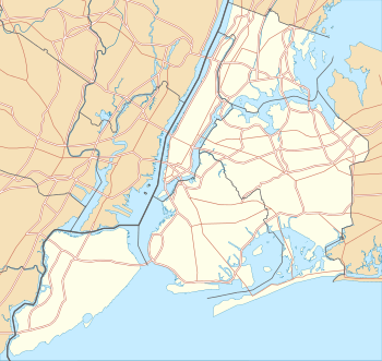
Ward's Point is the southernmost point of New York State in Tottenville, Staten Island, across Arthur Kill from Perth Amboy, New Jersey at the head of Raritan Bay.
Ward's Point Archeological Site
Near Ward's Point is the Ward's Point Archeological Site, an archaeological site within Conference House Park. It was declared a National Historic Landmark in 1993. The site has been known since 1858, when human remains were first unearthed in the area. It is one of the largest and best preserved sites for studying American Indian people in the New York area.[2]
Ward's Point Conservation Area
Ward's Point Conservation Area is a historic archaeological site and national historic district. The district encompasses nine contributing sites. It includes the property on which the Conference House sits. The Conference House was listed as a National Historic Landmark in 1966. The conservation area was specifically identified for preservation based on "the information it may provide on prehistoric and historic Indian subsistence and settlement on Staten Island." A number of prehistoric remains have been located on the site.[4] It was added to the National Register of Historic Places in 1982.[3]
See also
References
- 1 2 National Park Service (2007-01-23). "National Register Information System". National Register of Historic Places. National Park Service.
- 1 2 "Ward's Point Archeological Site". National Historic Landmark summary listing. National Park Service. 2007-09-23.
- 1 2 National Park Service (2009-03-13). "National Register Information System". National Register of Historic Places. National Park Service.
- ↑ Charles A. Florence (June 1982). "National Register of Historic Places Registration: Ward's Point Conservation Area". New York State Office of Parks, Recreation and Historic Preservation. Retrieved 2010-12-06. See also: "Accompanying 13 photos".
| Topics |   | |
|---|---|---|
| Lists by county |
| |
| Lists by city | ||
| Other lists | ||
| ||
Coordinates: 40°29′56″N 74°15′07″W / 40.49889°N 74.25194°W