Wardell, Missouri
| Wardell, Missouri | |
|---|---|
| City | |
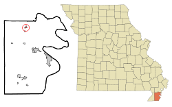 Location of Wardell, Missouri | |
| Coordinates: 36°21′7″N 89°48′52″W / 36.35194°N 89.81444°WCoordinates: 36°21′7″N 89°48′52″W / 36.35194°N 89.81444°W | |
| Country | United States |
| State | Missouri |
| County | Pemiscot |
| Area[1] | |
| • Total | 0.28 sq mi (0.73 km2) |
| • Land | 0.28 sq mi (0.73 km2) |
| • Water | 0 sq mi (0 km2) |
| Elevation | 276 ft (84 m) |
| Population (2010)[2] | |
| • Total | 427 |
| • Estimate (2012[3]) | 419 |
| • Density | 1,525.0/sq mi (588.8/km2) |
| Time zone | Central (CST) (UTC-6) |
| • Summer (DST) | CDT (UTC-5) |
| ZIP code | 63879 |
| Area code(s) | 573 |
| FIPS code | 29-76966[4] |
| GNIS feature ID | 0728342[5] |
Wardell is a city in Pemiscot County, Missouri, United States. The population was 427 at the 2010 census.
It annexed North Wardell in 2007.[6]
History
A post office called Wardell has been in operation since 1902.[7] The community's name is derived from the last name of R. L. Warren, an early citizen, and a dell near the original town site.[8]
Geography
Wardell is located at 36°21′7″N 89°48′52″W / 36.35194°N 89.81444°W (36.351983, -89.814559).[9]
According to the United States Census Bureau, the city has a total area of 0.28 square miles (0.73 km2), all of it land.[1]
Demographics
| Historical population | |||
|---|---|---|---|
| Census | Pop. | %± | |
| 1930 | 272 | — | |
| 1940 | 430 | 58.1% | |
| 1950 | 454 | 5.6% | |
| 1960 | 331 | −27.1% | |
| 1970 | 275 | −16.9% | |
| 1980 | 299 | 8.7% | |
| 1990 | 325 | 8.7% | |
| 2000 | 278 | −14.5% | |
| 2010 | 427 | 53.6% | |
| Est. 2015 | 402 | [10] | −5.9% |
2010 census
As of the census[2] of 2010, there were 427 people, 172 households, and 123 families residing in the city. The population density was 1,525.0 inhabitants per square mile (588.8/km2). There were 195 housing units at an average density of 696.4 per square mile (268.9/km2). The racial makeup of the city was 95.32% White, 3.51% Black or African American, 0.23% Native American, and 0.94% from two or more races. Hispanic or Latino of any race were 0.70% of the population.
There were 172 households of which 37.8% had children under the age of 18 living with them, 42.4% were married couples living together, 20.9% had a female householder with no husband present, 8.1% had a male householder with no wife present, and 28.5% were non-families. 27.9% of all households were made up of individuals and 11.1% had someone living alone who was 65 years of age or older. The average household size was 2.48 and the average family size was 2.97.
The median age in the city was 37.6 years. 27.9% of residents were under the age of 18; 8.4% were between the ages of 18 and 24; 23.7% were from 25 to 44; 25.6% were from 45 to 64; and 14.5% were 65 years of age or older. The gender makeup of the city was 48.9% male and 51.1% female.
2000 census
As of the census[4] of 2000, there were 278 people, 110 households, and 77 families residing in the town. The population density was 1,423.3 people per square mile (536.7/km²). There were 119 housing units at an average density of 609.3 per square mile (229.7/km²). The racial makeup of the town was 93.53% White, 4.32% African American, 2.16% from other races. Hispanic or Latino of any race were 2.16% of the population.
There were 110 households out of which 33.6% had children under the age of 18 living with them, 48.2% were married couples living together, 18.2% had a female householder with no husband present, and 29.1% were non-families. 26.4% of all households were made up of individuals and 15.5% had someone living alone who was 65 years of age or older. The average household size was 2.53 and the average family size was 3.01.
In the town the population was spread out with 27.3% under the age of 18, 11.2% from 18 to 24, 21.9% from 25 to 44, 24.5% from 45 to 64, and 15.1% who were 65 years of age or older. The median age was 37 years. For every 100 females there were 90.4 males. For every 100 females age 18 and over, there were 82.0 males.
The median income for a household in the town was $20,208, and the median income for a family was $25,357. Males had a median income of $27,083 versus $15,000 for females. The per capita income for the town was $9,829. About 14.3% of families and 22.0% of the population were below the poverty line, including 29.8% of those under the age of eighteen and 20.5% of those sixty five or over.
Notable residents
- Jeff Stone, Professional Baseball player
References
- 1 2 "US Gazetteer files 2010". United States Census Bureau. Retrieved 2012-07-08.
- 1 2 "American FactFinder". United States Census Bureau. Retrieved 2012-07-08.
- ↑ "Population Estimates". United States Census Bureau. Retrieved 2013-05-30.
- 1 2 "American FactFinder". United States Census Bureau. Retrieved 2008-01-31.
- ↑ "US Board on Geographic Names". United States Geological Survey. 2007-10-25. Retrieved 2008-01-31.
- ↑ "Boundary Changes".
- ↑ "Post Offices". Jim Forte Postal History. Retrieved 29 November 2016.
- ↑ "Pemiscot County Place Names, 1928–1945". The State Historical Society of Missouri. Archived from the original on June 24, 2016. Retrieved November 29, 2016.
- ↑ "US Gazetteer files: 2010, 2000, and 1990". United States Census Bureau. 2011-02-12. Retrieved 2011-04-23.
- ↑ "Annual Estimates of the Resident Population for Incorporated Places: April 1, 2010 to July 1, 2015". Retrieved July 2, 2016.
- ↑ "Census of Population and Housing". Census.gov. Retrieved June 4, 2015.
Municipalities and communities of Pemiscot County, Missouri, United States | ||
|---|---|---|
| Cities | 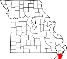 | |
| Villages | ||
| Townships | ||
| CDP | ||
| Other unincorporated communities | ||
| Ghost towns | ||
| Footnotes | ‡This populated place also has portions in an adjacent county or counties | |