Wanaku (Potosí)
This article is about the mountain in the Potosí Department, Bolivia. For other uses, see Wanaku.
| Wanaku | |
|---|---|
 Ollagüe (Ullawi) and Wanaku | |
| Highest point | |
| Elevation | 4,700 m (15,400 ft) [1] |
| Coordinates | 21°19′37″S 68°5′39″W / 21.32694°S 68.09417°WCoordinates: 21°19′37″S 68°5′39″W / 21.32694°S 68.09417°W |
| Geography | |
 Wanaku Location in Bolivia | |
| Location | Bolivia, Potosí Department, Nor Lípez Province |
| Parent range | Andes |
Wanaku (Quechua for guanaco,[2] hispanicized spelling Huanaco, Huanacu) is a mountain in the Andes of Bolivia, about 4,700 metres (15,420 ft) high. It is situated in the Potosí Department, Nor Lípez Province, Quemes Municipality, Pelcoya Canton. Wanaku lies southeast of the Ollagüe (Ullawi) volcano and northeast of Ch'aska Urqu.[3]
References
- ↑ "South America Maps". Joint Operations Graphic. Retrieved August 14, 2014.
- ↑ Teofilo Laime Ajacopa, Diccionario Bilingüe Iskay simipi yuyayk'ancha, La Paz, 2007 (Quechua-Spanish dictionary)
- ↑ "San Pedro de Quemes". Retrieved August 14, 2014.
Capital: Potosí | ||
| Provinces | 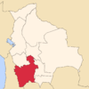 | |
| Municipalities (and seats) |
| |
This article is issued from Wikipedia - version of the 6/10/2016. The text is available under the Creative Commons Attribution/Share Alike but additional terms may apply for the media files.