Walnut, California
| Walnut, California | |
|---|---|
| General law city | |
| City of Walnut | |
|
Street sign in Walnut | |
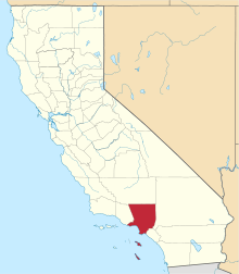
 Location of Walnut in Los Angeles County, California | |
 Walnut, California Location in the United States | |
| Coordinates: 34°2′N 117°52′W / 34.033°N 117.867°WCoordinates: 34°2′N 117°52′W / 34.033°N 117.867°W | |
| Country |
|
| State |
|
| County |
|
| Incorporated (city) | January 19, 1959[1] |
| Government | |
| • Mayor | Robert Pacheco[2] |
| • Mayor Pro Tem | Mary Su[2] |
| • Council Member | Nancy Tragarz[2] |
| • Council Member | Eric Ching[2] |
| • Council Member | Antonio Cartagena[2] |
| Area[3] | |
| • Total | 8.996 sq mi (23.300 km2) |
| • Land | 8.992 sq mi (23.290 km2) |
| • Water | 0.004 sq mi (0.010 km2) 0.04% |
| Elevation[4] | 561 ft (171 m) |
| Population (April 1, 2010)[5] | |
| • Total | 29,172 |
| • Estimate (2013)[5] | 30,065 |
| • Density | 3,200/sq mi (1,300/km2) |
| Time zone | PST (UTC-8) |
| • Summer (DST) | PDT (UTC-7) |
| ZIP Codes | 91788, 91789, 91795[6] |
| Area code(s) | 909, 626 |
| FIPS code | 06-83332 |
| GNIS feature IDs | 1652808, 2412173 |
| Website |
www |
Walnut is a suburban city in the eastern part of Los Angeles County in California.[7] Money's Best Places to Live ranked Walnut #70 in 2009[8] and #57 in 2011,[9] the highest ranking for a Californian city both years.
The greater Walnut Valley is located between the steep San Jose Hills mountain range to the north, and the gentle Puente Hills to the south. Quality housing consists of master-planned single family homes ranging in size from 1,800 to 11,200 square feet. The city hosts a highly ranked public school system - the Walnut Valley Unified School District, which has been ranked by numerous sources as one of the top public school districts in Southern California.[10] as well as Mt. San Antonio Community College. Walnut is one of the cities with the lowest crime rates in the San Gabriel Valley.[7]
The city covers nearly nine square miles (23 km2) and is home to hundreds of businesses. Its 2012 population was estimated at 29,661 by the United States Census Bureau. According to the 2010 United States Census, Walnut has a median household income at one of the top earning percentiles in the country at $101,250.[11]
The city's name is derived from the Rancho Los Nogales Mexican land grant: nogales being the Spanish word for "walnut trees". The native California black walnut is a common tree of the San Jose Hills. The City of Walnut is a general law city incorporated on January 19, 1959. It is governed by a city council/city manager form of government. A five-member city council is elected by the residents, and a mayor is elected annually by the council to serve a twelve-month term. A city manager is appointed by the council to oversee the daily activities of the city.
Geography
Walnut is located on the southern slopes of the San Jose Hills, with West Covina to the north and west, Pomona to the east, Diamond Bar, Rowland Heights, and the City of Industry to the south, and La Puente to the west. Several small creeks (i.e. Snow Creek, Lemon Creek) run mostly to the south toward the valley of San Jose Creek, which runs west to the San Gabriel River.
History
The history of Walnut dates back to the indigenous Tongva people. Spanish missionaries who arrived in the 18th century called the indigenes Gabrieleño, because the area where they lived was controlled by the San Gabriel Mission. The Walnut area was part of the network of outlying ranches used for the grazing of cattle and sheep by the Mission.
Following secularization of the missions in the 1830s, former mission lands were divided into ranchos, and given away as land grants by the Mexican government of Alta California. In the Walnut area, the first grants were Rancho San Jose (granted to Ricardo Vejar and Ygnacio Palomares in 1837); Rancho Los Nogales (granted to Jose De La Cruz Linares in 1840); and Rancho La Puente (granted to John Rowland and William Workman in 1842). In 1868, John Rowland and William Workman divided Rancho La Puente, leaving Rowland the eastern half and Workman the western half. Rowland’s land included the western portion of Walnut and the adjacent community now called Rowland Heights. The land was used mainly for raising cattle and growing wheat, grapes, and fruit trees (mostly citrus).
In 1895, the first U.S. post office was established and given the name "Lemon". In 1908, the post office name was changed to Walnut.[12] As a reminder of those early days, the U.S. Post Office is on Lemon Avenue, one of the town's main streets.
The City of Walnut’s Bicentennial Commission selected the construction of Lemon Creek Park and the restoration of the William R. Rowland Adobe Redwood Ranch House as Walnut’s bicentennial project. In 1872, the Lemon Creek Park area became the property of Sheriff William Rowland, who inherited the 29,000-acre (120 km2) ranch from his father, John Rowland. The modest structure built in 1883 served as the home of Mr. Meridith, ranch foreman for William Rowland. The adobe redwood ranch house is one of the few remaining original ranch style redwood and adobe structures in the area. On October 1, 1975, the State Landmark Committee placed the W.R. Rowland ranch house in the National Registry of Historical Places.
Walnut, California, is sometimes confused with the city of Walnut Creek in Northern California.
Walnut Family Festival
Walnut holds an annual "Walnut Family Festival." On the day of festival, several streets in the area (such as portions of Lemon and La Puente) are closed in the morning and a parade is held in which many local clubs and groups participate. Later in the afternoon, a fair with booths, games, food, and activities is held in Suzanne Park, adjacent to Suzanne Middle School. The Walnut Family Festival usually occurs in early or mid-October.
Mt. SAC Relays

Started in 1959, the Mt. SAC Relays is an annual track and field festival held primarily at Hilmer Lodge Stadium on the Mt. San Antonio College campus. The April festival attracts many elite athletes from around the world to the city of Walnut. This meet and other elite track meets held at the stadium, including the 1968 Olympic Trials and two editions of the USA Outdoor Track and Field Championships have emblazoned the identification of "Walnut, California" in numerous national records in athletics around the world. At various points in time, many world records were set at the Mt. SAC Relays.
The October Mt. SAC Cross Country Invitational, run in the hills surrounding the stadium, proclaims itself to be the largest Cross Country meeting in the world. Much of the same course is used as the annual CIF Southern Section championships and the western qualifier for the Foot Locker Cross Country Championships.
Economy
Shea Homes, and the United States divisions of the Filipino home video company Viva Video, Inc. and the Japanese card game company Bushiroad are based in Walnut.
According to the 2010 United States Census, Walnut had a median household income of $101,250, with 6.2% of the population living below the federal poverty line.[11]
Infrastructure
The Los Angeles County Sheriff's Department (LASD) operates the Walnut/Diamond Bar Station in Walnut.[13]
The Los Angeles County Department of Health Services operates the Pomona Health Center in Pomona, serving Walnut.[14]
Government and politics
In the California State Legislature, Walnut is in the 29th Senate District, represented by Democrat Josh Newman, and in the 55th Assembly District, represented by Republican Phillip Chen.[15]
In the United States House of Representatives, Walnut is in California's 39th congressional district, represented by Republican Ed Royce.[16]
While the Congressional, State Senate, and State Assembly districts that Walnut is located in may have tendencies to vote for Republican candidates, over the last decade Walnut has mostly voted for Democratic presidential, gubernatorial, and senatorial candidates, with the exceptions of 2003 and 2006 when they voted for Arnold Schwarzenegger.[17] Walnut voters break down by party affiliation 63.102% Democratic and 35.598% Republican.[18]
| Election Results from Statewide Races | ||
|---|---|---|
| Year | Office | Results |
| 2012 | President | Obama 57.8 - 40.1%[19] |
| Senator | Feinstein 61.9 - 38.1%[20] | |
| 2010 | Governor | Brown 48.8 - 46.5%[21] |
| Senator | Boxer 48.4 - 46.8%[22] | |
| 2008 | President | Obama 56.2 - 42.0%[23] |
| 2006 | Governor | Schwarzenegger 60.3 - 36.1%[24] |
| Senator | Feinstein 58.6 - 37.5% | |
| 2004 | President | Kerry 51.1 - 48.0%[25] |
| Senator | Boxer 57.6 - 38.2%[26] | |
| 2003 | Recall | Yes 64.0 - 36.0%[27] |
| Schwarzenegger 60.1 - 24.2%[28] | ||
| 2002 | Governor | Davis 47.5 - 45.9%[29] |
| 2000 | President | Gore 53.4 - 43.6%[30] |
| Senator | Feinstein 55.1 - 38.1%[31] | |
| 1998 | Governor | Davis 47.5 - 45.9%[32] |
| Senator | Fong 51.2 - 45.7%[33] | |
| 1996 | President | Clinton 50.0 - 40.1%[34] |
| 1994 | Governor | Wilson 57.6 - 38.9%[35] |
| Senator | Huffington 50.4 - 40.8%[35] | |
Education
Primary education in Walnut is generally served by the prestigious Walnut Valley Unified School District (WVUSD), which has been ranked by numerous sources to be one of the top public school districts in all of Southern California.[10] , which also serves parts of the city of Diamond Bar. Schools located in and around Walnut include:
- C.J. Morris Elementary School
- Collegewood Elementary School
- Oswalt Academy (Formerly known as Oswalt Elementary School) (Rowland Unified School District)
- Vejar Elementary School
- Walnut Elementary School
- Westhoff Elementary School
- Suzanne Middle School
- Southlands Christian Schools
- South Pointe Middle School[36]
- Ronald Hockwalt Academies (Formerly known as Del Paso High School)[37]
- Walnut High School
- Diamond Bar High School
Portions of the western side of Walnut are also served by the Rowland Unified School District.
In addition, Mt. San Antonio College, one of the California Community Colleges, is also located in Walnut near its border with Pomona.
Surrounding suburban cities
-
 Diamond Bar, California (which shares the same school district with Walnut)
 - City of Industry, California
- Pomona, California
Demographics
| Historical population | |||
|---|---|---|---|
| Census | Pop. | %± | |
| 1960 | 934 | — | |
| 1970 | 5,992 | 541.5% | |
| 1980 | 12,478 | 108.2% | |
| 1990 | 29,105 | 133.3% | |
| 2000 | 30,004 | 3.1% | |
| 2010 | 29,172 | −2.8% | |
| Est. 2015 | 30,237 | [38] | 3.7% |
2010 census
According to the 2010 United States Census, Walnut had a median household income of $101,250, with 6.2% of the population living below the federal poverty line.[11]
The 2010 United States Census[40] reported that Walnut had a population of 29,172. The population density was 3,242.8 people per square mile (1,252.0/km²). The racial makeup of Walnut was 18,567 (63.6%) Asian, 6,913 (23.7%) White (12.5% Non-Hispanic White),[11] 824 (2.8%) African American, 69 (0.2%) Native American, 28 (0.1%) Pacific Islander, 1,750 (6.0%) from other races, and 1,021 (3.5%) from two or more races. Hispanic or Latino of any race were 5,575 persons (19.1%).
The Census reported that 29,138 people (99.9% of the population) lived in households, 22 (0.1%) lived in non-institutionalized group quarters, and 12 (0%) were institutionalized.
There were 8,533 households, out of which 3,492 (40.9%) had children under the age of 18 living in them, 6,298 (73.8%) were opposite-sex married couples living together, 985 (11.5%) had a female householder with no husband present, 394 (4.6%) had a male householder with no wife present. There were 163 (1.9%) unmarried opposite-sex partnerships, and 26 (0.3%) same-sex married couples or partnerships. 627 households (7.3%) were made up of individuals and 237 (2.8%) had someone living alone who was 65 years of age or older. The average household size was 3.41. There were 7,677 families (90.0% of all households); the average family size was 3.55.
The population was spread out with 6,088 people (20.9%) under the age of 18, 3,092 people (10.6%) aged 18 to 24, 6,089 people (20.9%) aged 25 to 44, 10,339 people (35.4%) aged 45 to 64, and 3,564 people (12.2%) who were 65 years of age or older. The median age was 43.1 years. For every 100 females there were 96.2 males. For every 100 females age 18 and over, there were 93.6 males.
There were 8,753 housing units at an average density of 973.0 per square mile (375.7/km²), of which 7,536 (88.3%) were owner-occupied, and 997 (11.7%) were occupied by renters. The homeowner vacancy rate was 0.8%; the rental vacancy rate was 4.4%. 25,504 people (87.4% of the population) lived in owner-occupied housing units and 3,634 people (12.5%) lived in rental housing units.
2000 census
As of the census[41] of 2000, there were 8,260 households out of which 50.6% had children under the age of 18 living with them, 77.1% were married couples living together, 9.9% had a female householder with no husband present, and 8.2% were non-families. 5.8% of all households were made up of individuals and 1.3% had someone living alone who was 65 years of age or older. The average household size was 3.63 and the average family size was 3.74.
In the city the population was spread out with 27.8% under the age of 18, 9.8% from 18 to 24, 27.2% from 25 to 44, 28.4% from 45 to 64, and 6.9% who were 65 years of age or older. The median age was 37 years. For every 100 females there were 96.7 males. For every 100 females age 18 and over, there were 93.5 males.
[42] Males had a median income of $51,944 versus $36,197 for females. The per capita income for the city was $31,196. About 5.8% of families and 6.5% of the population were below the poverty line, including 7.8% of those under age 18 and 6.3% of those age 65 or over.
The city was recognized in 1999 by CNN as a model of diversity.[43]
As of the census[41] of 2000, there were 30,004 people, 8,260 households, and 7,582 families residing in the city. The population density was 3,340.5 inhabitants per square mile (1,290.0/km²). There were 8,395 housing units at an average density of 934.6 per square mile (360.9/km²). The racial makeup of the city was 55.75% Asian, 28.37% White, 4.20% African American, 0.24% Native American, 0.08% Pacific Islander, 7.65% from other races, and 3.71% from two or more races. Hispanic or Latino of any race were 19.34% of the population.
Notable people
- Evelyn Ashford, 1984 Olympic champion in 100 m; arguably greatest female sprinter ever; career spanned unprecedented five Olympic Games
- Charlie Beck, current LAPD Police Chief and former chief of detectives
- Paul Caligiuri, retired soccer player; formerly with Los Angeles Galaxy, inducted into National Soccer Hall of Fame in 2004
- Gerardo, rapper and singer who later became a recording-industry executive
- Alan Haskvitz, National Teachers Hall of Fame, Reader's Digest Hero in Education, NCSS National Teacher of the Year, International Teacher of the Year (Cherry Award), Learning Magazine Best Teacher in America, three Golden Bell Awards, George Washington Medal
- Ricky Lawson, famous drummer of such artists as Michael Jackson, Whitney Houston, Eric Clapton, etc.
- Tod McBride, former NFL player with Green Bay Packers, Atlanta Falcons and St. Louis Rams; standout wide receiver at Walnut High School and defensive back at UCLA
- Darius McCrary, actor; known most for playing Eddie Winslow on the television show Family Matters
- Lance Parrish, eight-time All-Star (1980, 1982–86, 1988, 1990) who won three Gold Glove Awards (1983–85); ranks fifth in Major League history in home runs by a catcher with 299
- Natasha Paracha Former Miss Pakistan World 2008
- Gary Zimmerman, retired NFL player; played for Los Angeles Express (USFL), Minnesota Vikings from 1986–1992 and Denver Broncos from 1993-1997; selected to Pro Bowl seven times, All-Pro selection eight times; inducted into Pro Football Hall of Fame on February 2, 2008; attended Walnut High School and University of Oregon
- Aja Naomi King, actress best known for her role as Michaela Pratt in the television show How to Get Away with Murder[44]
- Kyle Mackinnon, ice hockey Centerman. Currently playing for the San Diego Gulls.
Proposed NFL Stadium
In April 2008, billionaire-land developer and co-owner of the Los Angeles Lakers and Kings, Edward P. Roski, unveiled plans for the construction of an $800 million NFL stadium in the neighboring City of Industry.[45] In March 2009, Walnut filed a lawsuit opposing construction of the stadium, but dropped those charges in September.[46][47]
On October 23, 2009, California governor Arnold Schwarzenegger signed a bill allowing the 75,000-seat stadium to be built in neighboring Industry in hopes of attracting an NFL team there.[48] This bill would also nullify a lawsuit filed by local residents over the project's environmental impact report.
References
- ↑ "California Cities by Incorporation Date" (Word). California Association of Local Agency Formation Commissions. Retrieved August 25, 2014.
- 1 2 3 4 5 "City of Walnut - City Council". Retrieved 2010-10-27.
- ↑ "2010 Census U.S. Gazetteer Files – Places – California". United States Census Bureau.
- ↑ "Walnut". Geographic Names Information System. United States Geological Survey. Retrieved February 23, 2015.
- 1 2 "Walnut (city) QuickFacts". United States Census Bureau. Retrieved March 18, 2015.
- ↑ "USPS - ZIP Code Lookup - Find a ZIP+ 4 Code By City Results". Retrieved 2007-01-18.
- 1 2 "About the City of Walnut".
- ↑ "Best Places to Live 2009". CNN.
- ↑ "Best Places to Live 2011". CNN.
- 1 2 https://www.nerdwallet.com/blog/cities/best-school-districts-southern-california-2015/. Missing or empty
|title=(help) - 1 2 3 4 http://quickfacts.census.gov/qfd/states/06/0683332.html. Missing or empty
|title=(help) - ↑ Gudde, Erwin G. (1969). California Place Names. Berkeley: UC Press. p. 176. ISBN 0520015746.
- ↑ "Walnut/Diamond Bar Station." Los Angeles County Sheriff's Department. Retrieved on January 21, 2010.
- ↑ "Pomona Health Center." Los Angeles County Department of Health Services. Retrieved on March 27, 2010.
- ↑ "Statewide Database". UC Regents. Retrieved November 18, 2014.
- ↑ "California's 39th Congressional District - Representatives & District Map". Civic Impulse, LLC.
- ↑ Data compiled and calculated based on election results from "Political Districts within Counties" results for Walnut , All percentages are rounded to nearest tenth place
- ↑ Best Places to Live in Walnut, California
- ↑ http://elections.cdn.sos.ca.gov/sov/2012-general/ssov/pres-by-political-districts.xls
- ↑ http://elections.cdn.sos.ca.gov/sov/2012-general/ssov/us-senate-by-political-districts.xls
- ↑ http://elections.cdn.sos.ca.gov/sov/2010-general/ssov/governor-all.xls
- ↑ http://elections.cdn.sos.ca.gov/sov/2010-general/ssov/us-senate-all.xls
- ↑ http://www.sos.ca.gov/elections/sov/2008_general/ssov/5-pres-by-political-districts.pdf
- ↑ http://www.sos.ca.gov/elections/sov/2006_general/ssov/gov_by_all.pdf
- ↑ pres_general_ssov_for_all.xls
- ↑ us_senate_ssov_for_all.xls
- ↑ http://www.sos.ca.gov/elections/sov/2003_special/ssov/recall_ques_pol_dis.pdf
- ↑ gov ssov alpha for all a-z.xls
- ↑ http://www.sos.ca.gov/elections/sov/2002_general/ssov/gov_pol_dis.pdf
- ↑ http://www.sos.ca.gov/elections/sov/2000_general/ssov/pol_dis.pdf
- ↑ http://www.sos.ca.gov/elections/sov/2000_general/ssov/us_senate_pol_dis.pdf
- ↑ http://vote98.sos.ca.gov/Final/ssov/gov-ps.pdf
- ↑ http://vote98.sos.ca.gov/Final/ssov/sen-ps.pdf
- ↑ http://www.sos.ca.gov/elections/sov/1996-general/1996-general-ssov.pdf
- 1 2 http://www.sos.ca.gov/elections/sov/1994-general/1994-general-ssov.pdf
- ↑ South Pointe Middle
- ↑ Ron Hockwalt Academies
- ↑ "Annual Estimates of the Resident Population for Incorporated Places: April 1, 2010 to July 1, 2015". Retrieved July 2, 2016.
- ↑ "Census of Population and Housing". Census.gov. Retrieved June 4, 2015.
- ↑ "2010 Census Interactive Population Search: CA - Walnut city". U.S. Census Bureau. Retrieved July 12, 2014.
- 1 2 "American FactFinder". United States Census Bureau. Retrieved 2008-01-31.
- ↑ Walnut city, California - Fact Sheet - American FactFinder
- ↑ Moret, Jim (December 17, 1999). "California town hailed as model of diversity". Walnut, California: CNN. Retrieved 2009-11-01.
- ↑ Magazine, Glamour. "Want to Know More About the Cast of How to Get Away With Murder? We Have the Info!". Glamour. Retrieved 2016-03-06.
- ↑ "NFL stadium set for industry". Retrieved 2009-08-23.
- ↑ "Walnut files Lawsuit over NFL Stadium". Retrieved 2009-08-23.
- ↑ "Plan for NFL site in City of Industry clears major legal hurdle". Los Angeles Times. 2009-09-24. Retrieved 2009-09-24.
- ↑ Governor approves LA-area football stadium waiver
External links
- Official website
- Regional Chamber of Commerce - San Gabriel Valley
- LA County Disaster Communications Service ( DCS ) Walnut Sheriff Station