Wallingford, Vermont
| Wallingford, Vermont | |
|---|---|
| Town | |
|
Wallingford town offices | |
 Wallingford, Vermont | |
| Coordinates: 43°27′28″N 72°56′49″W / 43.45778°N 72.94694°WCoordinates: 43°27′28″N 72°56′49″W / 43.45778°N 72.94694°W | |
| Country | United States |
| State | Vermont |
| County | Rutland |
| Area | |
| • Total | 43.4 sq mi (112.5 km2) |
| • Land | 43.2 sq mi (112.0 km2) |
| • Water | 0.2 sq mi (0.5 km2) |
| Elevation | 1,673 ft (510 m) |
| Population (2010) | |
| • Total | 2,079 |
| • Density | 48/sq mi (18/km2) |
| Time zone | Eastern (EST) (UTC-5) |
| • Summer (DST) | EDT (UTC-4) |
| ZIP code | 05773 |
| Area code(s) | 802 |
| FIPS code | 50-75925[1] |
| GNIS feature ID | 1462239[2] |
| Website | www.wallingfordvt.com |

Wallingford is a town in Rutland County, Vermont, United States. The population was 2,079 at the 2010 census.[3] Wallingford also contains the villages of East Wallingford and South Wallingford.
Geography
According to the United States Census Bureau, the town has a total area of 43.5 square miles (113 km2), of which 43.2 square miles (112 km2) is land and 0.2 square miles (0.52 km2), or 0.48%, is water.
Demographics
| Historical population | |||
|---|---|---|---|
| Census | Pop. | %± | |
| 1790 | 536 | — | |
| 1800 | 912 | 70.1% | |
| 1810 | 1,386 | 52.0% | |
| 1820 | 1,570 | 13.3% | |
| 1830 | 1,740 | 10.8% | |
| 1840 | 1,608 | −7.6% | |
| 1850 | 1,688 | 5.0% | |
| 1860 | 1,747 | 3.5% | |
| 1870 | 2,023 | 15.8% | |
| 1880 | 1,846 | −8.7% | |
| 1890 | 1,733 | −6.1% | |
| 1900 | 1,575 | −9.1% | |
| 1910 | 1,719 | 9.1% | |
| 1920 | 1,581 | −8.0% | |
| 1930 | 1,564 | −1.1% | |
| 1940 | 1,450 | −7.3% | |
| 1950 | 1,482 | 2.2% | |
| 1960 | 1,439 | −2.9% | |
| 1970 | 1,676 | 16.5% | |
| 1980 | 1,893 | 12.9% | |
| 1990 | 2,184 | 15.4% | |
| 2000 | 2,274 | 4.1% | |
| 2010 | 2,079 | −8.6% | |
| Est. 2014 | 2,041 | [4] | −1.8% |
| U.S. Decennial Census[5] | |||
As of the census[1] of 2000, there were 2,274 people, 905 households, and 651 families residing in the town. The population density was 52.6 people per square mile (20.3/km2). There were 1,040 housing units at an average density of 24.1 per square mile (9.3/km2). The racial makeup of the town was 98.86% White, 0.13% Black or African American, 0.22% Asian, 0.04% Pacific Islander, 0.04% from other races, and 0.70% from two or more races. Hispanic or Latino of any race were 0.53% of the population.
There were 905 households out of which 30.8% had children under the age of 18 living with them, 59.0% were married couples living together, 9.1% had a female householder with no husband present, and 28.0% were non-families. 22.9% of all households were made up of individuals and 10.6% had someone living alone who was 65 years of age or older. The average household size was 2.49 and the average family size was 2.92.
In the town the population was spread out with 23.4% under the age of 18, 5.8% from 18 to 24, 27.0% from 25 to 44, 30.3% from 45 to 64, and 13.7% who were 65 years of age or older. The median age was 42 years. For every 100 females there were 96.2 males. For every 100 females age 18 and over, there were 94.1 males.
The median income for a household in the town was $42,417, and the median income for a family was $47,007. Males had a median income of $33,162 versus $24,141 for females. The per capita income for the town was $19,570. About 3.8% of families and 5.9% of the population were below the poverty line, including 5.1% of those under age 18 and 11.4% of those age 65 or over.
Notable people
- Samuel T. Douglass, Michigan Supreme Court justice[6]
- Paul P. Harris, lawyer and founder of Rotary International[7]
- Matthew Lyon, lawyer, soldier, and United States Representative-Kentucky and Vermont
References
- 1 2 "American FactFinder". United States Census Bureau. Retrieved 2008-01-31.
- ↑ "US Board on Geographic Names". United States Geological Survey. 2007-10-25. Retrieved 2008-01-31.
- ↑ "Profile of General Population and Housing Characteristics: 2010 Demographic Profile Data (DP-1): Wallingford town, Vermont". U.S. Census Bureau, American Factfinder. Retrieved November 15, 2011.
- ↑ "Annual Estimates of the Resident Population for Incorporated Places: April 1, 2010 to July 1, 2014". Retrieved June 4, 2015.
- ↑ "U.S. Decennial Census". United States Census Bureau. Retrieved May 16, 2015.
- ↑ Michigan Supreme Court-Samuel Douglass
- ↑ Historic Vermont Roadside Markers
External links
Municipalities and communities of Rutland County, Vermont, United States | ||
|---|---|---|
| City | 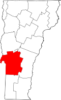 | |
| Towns | ||
| Village | ||
| CDPs | ||
| Other communities | ||