Waldron, Kansas
| Waldron, Kansas | |
|---|---|
| City | |
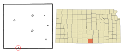 Location within Harper County and Kansas | |
 KDOT map of Harper County (legend) | |
| Coordinates: 37°0′14″N 98°10′59″W / 37.00389°N 98.18306°WCoordinates: 37°0′14″N 98°10′59″W / 37.00389°N 98.18306°W | |
| Country | United States |
| State | Kansas |
| County | Harper |
| Area[1] | |
| • Total | 0.31 sq mi (0.80 km2) |
| • Land | 0.31 sq mi (0.80 km2) |
| • Water | 0 sq mi (0 km2) |
| Elevation | 1,250 ft (381 m) |
| Population (2010)[2] | |
| • Total | 11 |
| • Estimate (2015)[3] | 10 |
| • Density | 35/sq mi (14/km2) |
| Time zone | Central (CST) (UTC-6) |
| • Summer (DST) | CDT (UTC-5) |
| ZIP code | 67150 |
| Area code | 620 |
| FIPS code | 20-74625 [4] |
| GNIS feature ID | 0470556 [5] |
Waldron is a city in Harper County, Kansas, United States. As of the 2010 census, the city population was 11.[6]
History
Waldron was founded about 1900.[7] The first post office in Waldron was established in 1902.[8]
The ashes of evangelist Tammy Faye Messner were interred in the Messner family plot in Waldron in 2007.[9]
Geography
Waldron is located at 37°0′14″N 98°10′59″W / 37.00389°N 98.18306°W (37.003860, -98.183165).[10] According to the United States Census Bureau, the city has a total area of 0.31 square miles (0.80 km2), all of it land.[1]
Demographics
| Historical population | |||
|---|---|---|---|
| Census | Pop. | %± | |
| 1910 | 262 | — | |
| 1920 | 225 | −14.1% | |
| 1930 | 182 | −19.1% | |
| 1940 | 163 | −10.4% | |
| 1950 | 83 | −49.1% | |
| 1960 | 38 | −54.2% | |
| 1970 | 24 | −36.8% | |
| 1980 | 29 | 20.8% | |
| 1990 | 19 | −34.5% | |
| 2000 | 17 | −10.5% | |
| 2010 | 11 | −35.3% | |
| Est. 2015 | 10 | [3] | −9.1% |
| U.S. Decennial Census | |||
2010 census
As of the census[2] of 2010, there were 11 people, 7 households, and 3 families residing in the city. The population density was 35.5 inhabitants per square mile (13.7/km2). There were 15 housing units at an average density of 48.4 per square mile (18.7/km2). The racial makeup of the city was 81.8% White and 18.2% from two or more races.
There were 7 households of which 42.9% were married couples living together and 57.1% were non-families. 57.1% of all households were made up of individuals and 42.9% had someone living alone who was 65 years of age or older. The average household size was 1.57 and the average family size was 2.33.
The median age in the city was 63.5 years. 0.0% of residents were under the age of 18; 0.0% were between the ages of 18 and 24; 9.1% were from 25 to 44; 45.5% were from 45 to 64; and 45.5% were 65 years of age or older. The gender makeup of the city was 45.5% male and 54.5% female.
2000 census
As of the census[4] of 2000, there were 17 people, 10 households, and 5 families residing in the city. The population density was 55.2 people per square mile (21.2/km²). There were 13 housing units at an average density of 42.2 per square mile (16.2/km²). The racial makeup of the city was 88.24% White and 11.76% Native American.
There were 10 households out of which none had children under the age of 18 living with them, 50.0% were married couples living together, and 50.0% were non-families. 50.0% of all households were made up of individuals and 40.0% had someone living alone who was 65 years of age or older. The average household size was 1.70 and the average family size was 2.40.
In the city the population was spread out with 35.3% from 45 to 64, and 64.7% who were 65 years of age or older. The median age was 76 years. For every 100 females there were 70.0 males. For every 100 females age 18 and over, there were 70.0 males.
The median income for a household in the city was $11,250, and the median income for a family was $36,250. Males had a median income of $46,250 versus $0 for females. The per capita income for the city was $15,350. There were no families and 28.6% of the population living below the poverty line, including no under eighteens and 44.4% of those over 64.
References
- 1 2 "US Gazetteer files 2010". United States Census Bureau. Retrieved 2012-07-06.
- 1 2 "American FactFinder". United States Census Bureau. Retrieved 2012-07-06.
- 1 2 "Annual Estimates of the Resident Population for Incorporated Places: April 1, 2010 to July 1, 2015". Retrieved July 2, 2016.
- 1 2 "American FactFinder". United States Census Bureau. Retrieved 2008-01-31.
- ↑ "US Board on Geographic Names". United States Geological Survey. 2007-10-25. Retrieved 2008-01-31.
- ↑ "2010 City Population and Housing Occupancy Status". U.S. Census Bureau. Retrieved March 6, 2011.
- ↑ Kansas State Historical Society (1916). Biennial Report of the Board of Directors of the Kansas State Historical Society. Kansas State Printing Plant. p. 202.
- ↑ "Kansas Post Offices, 1828-1961 (archived)". Kansas Historical Society. Archived from the original on October 9, 2013. Retrieved 11 June 2014.
- ↑ Larry King interview with Roe Messner on CNN on August 7, 2007
- ↑ "US Gazetteer files: 2010, 2000, and 1990". United States Census Bureau. 2011-02-12. Retrieved 2011-04-23.
External list
| Wikimedia Commons has media related to Waldron, Kansas. |
- City
- Schools
- USD 361, local school district
- Historical
- Historic Images of Waldron, Special Photo Collections at Wichita State University Library
- Maps
- Waldron City Map, KDOT
Municipalities and communities of Harper County, Kansas, United States | ||
|---|---|---|
| Cities | 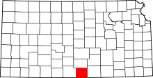 | |
| Unincorporated communities | ||
| Townships | ||
| Ghost town | ||