Walcheren
| Walcheren | |
|---|---|
| Former Island | |
 | |
| Country | Netherlands |
| Province | Zeeland |
| Municipality |
Middelburg Veere Vlissingen |
| Population (2003) | 113.546 |
| Postal code | 4330-4399 |
| COROP | Walcheren |
| Major roads | A58, N57, Zeeuwse lijn |
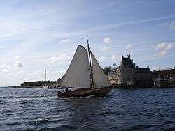
![]() Walcheren is a former island in the province of Zeeland in the Netherlands at the mouth of the Scheldt estuary. It lies between the Oosterschelde in the north and the Westerschelde in the south and is roughly the shape of a rhombus. The two sides facing the North Sea consist of dunes; the rest of its coastline is made up of dykes. Middelburg lies at its centre; this city is the provincial capital and Vlissingen 9 kilometres (5.6 mi) to the south is the main harbour. The third municipality is Veere.
Walcheren is a former island in the province of Zeeland in the Netherlands at the mouth of the Scheldt estuary. It lies between the Oosterschelde in the north and the Westerschelde in the south and is roughly the shape of a rhombus. The two sides facing the North Sea consist of dunes; the rest of its coastline is made up of dykes. Middelburg lies at its centre; this city is the provincial capital and Vlissingen 9 kilometres (5.6 mi) to the south is the main harbour. The third municipality is Veere.
Originally, Walcheren was an island, but polders and a dam across the Oosterschelde have connected it to the (former) island of Zuid-Beveland, which in turn has been connected to the North Brabant mainland.
History
Early history
As early as Roman times, the island functioned as a point of departure for ships going to Britain; it had a temple of the goddess Nehalennia who was popular with those who braved the waters of the North Sea. The Romans called it "Wallacra", a term most likely associated with Walha, the name Germans used for all foreign peoples.
Walcheren became the seat of the Danish Viking Harald (fl. 841-842), who conquered what would become the Netherlands together with his brother Rorik (fl. 842-873) (or Rurik) in the ninth century. One fringe theory has it that Ibn Rustah (fl 10th century) described Walcheren when reporting on the seat of the khagan of the Rus'.[1] Another fringe theory mentions Walcheren as the seat of Hades, described by Homer.[2]
Napoleonic Wars
Starting on 30 July 1809, a British armed force of 39,000 men landed on Walcheren, the Walcheren Campaign, with a view to assisting the Austrians in their war against Napoleon, and attacking the French fleet moored at Flushing (Vlissingen). The expedition turned into a disaster – although Flushing surrendered the Austrians had already been decisively defeated at the Battle of Wagram in early July and were suing for peace. Meanwhile, the French fleet had moved to Antwerp, and the British lost over 4,000 men to a disease called "Walcheren Fever", thought to be a combination of malaria and typhus, as well as to enemy action. The French suffered some 4000 dead, wounded and captured. With the strategic reasons for the campaign gone and the worsening conditions, the British force was withdrawn in December.
World War II
Strategically placed at the mouth of the River Scheldt, Walcheren was the key that allowed use of the deep-water port of Antwerp, located further upstream on the right bank of the southern estuary of the river. It was fought over during World War II in 1940 between Dutch and German troops in the Battle of the Netherlands, and again in 1944 in the Battle of Walcheren Island, the fourth and final stage of the Battle of the Scheldt. On 3 October 1944 the RAF bombed the sea wall at Westkapelle causing flooding. The 2nd Canadian Infantry Division cleared South Beveland to the east and approached the island on 31 October 1944. The plan was to cross the Sloe Channel, but leading troops of the 5th Canadian Infantry Brigade found that assault boats were useless in the deep mud of the channel. The only route open was the 40 metre wide Walcheren Causeway, a mile-long land bridge from South Beveland to the island. The Canadian Black Watch sent a company across on the evening of 31 October, but were stopped. The Calgary Highlanders sent two companies over in succession, the second attack opening up a bridgehead on the island. The Highlanders were eventually thrown back, having lost 64 killed and wounded. Le Régiment de Maisonneuve relieved them on the causeway, followed by the 1st Battalion, Glasgow Highlanders of the British 52nd Infantry Division. Meanwhile, on 1 November 1944, the British Commandos landed in the village of Westkapelle in order to silence the German coastal batteries looking out over the Scheldt. The amphibious assault (Operation Infatuate) proved a success and by 8 November, all German resistance on the island had ceased.
Topography

Topographic map of Walcheren, 2010-2011. Click to enlarge.
See also
References
| Wikivoyage has a travel guide for Walcheren. |
- ↑ Aleksandrov, A. A. (1997). Остров руссов [The island of the Rus'] (in Russian). St. Petersburg-Kishinev. pp. 222–224.
- ↑ Geography of the Odyssey according to I. Wilkens
Coordinates: 51°31′17″N 3°34′56″E / 51.52139°N 3.58222°E