Waeng Yai District
| Waeng Yai แวงใหญ่ | |
|---|---|
| Amphoe | |
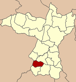 Amphoe location in Khon Kaen Province | |
| Coordinates: 15°57′34″N 102°32′52″E / 15.95944°N 102.54778°ECoordinates: 15°57′34″N 102°32′52″E / 15.95944°N 102.54778°E | |
| Country |
|
| Province | Khon Kaen |
| Seat | Waeng Yai |
| Area | |
| • Total | 189.069 km2 (73.000 sq mi) |
| Population (2005) | |
| • Total | 29,424 |
| • Density | 155.6/km2 (403/sq mi) |
| Time zone | THA (UTC+7) |
| Postal code | 40330 |
| Geocode | 4013 |
Waeng Yai (Thai: แวงใหญ่, pronounced [wɛ̄ːŋ jàj]) is a district (Amphoe) of Khon Kaen Province, northeastern Thailand.
Geography
Neighboring districts are (from the north clockwise) Khok Pho Chai, Chonnabot, Phon and Waeng Noi of Khon Kaen Province, and Khon Sawan of Chaiyaphum Province.
History
The minor district (King Amphoe) Waeng Yai was established on January 3, 1977, when the three tambon Khon Chim, Non Thong and Mai Na Phiang were split off from Phon district.[1] It was upgraded to a full district on May 26, 1980.[2]
Administration
The district is subdivided into 5 subdistricts (tambon), which are further subdivided into 50 villages (muban). Waeng Yai is a township (thesaban tambon) which covers the whole tambon Wang Yai. There are further 4 Tambon administrative organizations (TAO).
| No. | Name | Thai name | Villages | Inh. | |
|---|---|---|---|---|---|
| 1. | Khon Chim | คอนฉิม | 9 | 4,673 | |
| 2. | Mai Na Phiang | ใหม่นาเพียง | 14 | 7,912 | |
| 3. | Non Thong | โนนทอง | 11 | 5,588 | |
| 4. | Waeng Yai | แวงใหญ่ | 7 | 5,259 | |
| 5. | Non Sa-at | โนนสะอาด | 9 | 5,992 |
References
- ↑ ประกาศกระทรวงมหาดไทย เรื่อง แบ่งท้องที่อำเภอพล จังหวัดขอนแก่น ตั้งเป็นกิ่งอำเภอแวงใหญ่ (PDF). Royal Gazette (in Thai). 94 (6 ง): 191. January 18, 1977.
- ↑ พระราชกฤษฎีกาตั้งอำเภอแวงใหญ่ อำเภอหนองบุนนาก อำเภอโพนทราย อำเภอท่าหลวง และอำเภอศรีรัตนะ พ.ศ. ๒๕๓๒ (PDF). Royal Gazette (in Thai). 106 (83 ก special): 249–251. May 25, 1989.