Wadi al-Arayis
| Wadi al-Arayis | |
|---|---|
| Other transcription(s) | |
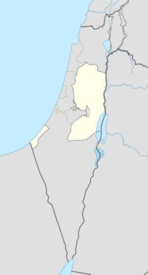 Wadi al-Arayis Location of Wadi al-Arayis within the Palestinian territories | |
| Coordinates: 31°42′44.72″N 35°16′22.62″E / 31.7124222°N 35.2729500°ECoordinates: 31°42′44.72″N 35°16′22.62″E / 31.7124222°N 35.2729500°E | |
| Governorate | Bethlehem |
| Government | |
| • Type | Village council |
| Population (2006) | |
| • Jurisdiction | 2,169 |
Wadi al-Arayis (Arabic: ) is a Palestinian village located ten kilometers east of Bethlehem.The village is in the Bethlehem Governorate Southern West Bank. According to the Palestinian Central Bureau of Statistics, the village had a population of 2,169 in mid-year 2006.[1] The primary healthcare is obtained in al 'Ubeidiya where the Ministry of Heath have classified the care facilities as level 3.[2]
Since the Six-Day War in 1967, the town has been under Israeli occupation. The population in the 1967 census conducted by the Israeli authorities was 501.[3]
Footnotes
- ↑ Projected Mid -Year Population for Bethlehem Governorate by Locality 2004- 2006 Palestinian Central Bureau of Statistics
- ↑ West Bank Healthcare
- ↑ Perlmann, Joel (November 2011 – February 2012). "The 1967 Census of the West Bank and Gaza Strip: A Digitized Version" (PDF). Levy Economics Institute. Retrieved 24 June 2016.
External links
| Cities |  | |
|---|---|---|
| Municipalities | ||
| Villages |
| |
| Refugee camps | ||
This article is issued from Wikipedia - version of the 6/24/2016. The text is available under the Creative Commons Attribution/Share Alike but additional terms may apply for the media files.