Wadern
| Wadern | ||
|---|---|---|
 | ||
| ||
 Wadern | ||
Location of Wadern within Merzig-Wadern district 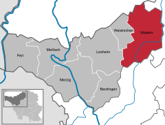
 | ||
| Coordinates: 49°31′N 6°52′E / 49.517°N 6.867°ECoordinates: 49°31′N 6°52′E / 49.517°N 6.867°E | ||
| Country | Germany | |
| State | Saarland | |
| District | Merzig-Wadern | |
| Government | ||
| • Mayor | Jochen Kuttler (ProHochwald) | |
| Area | ||
| • Total | 111.17 km2 (42.92 sq mi) | |
| Population (2015-12-31)[1] | ||
| • Total | 15,809 | |
| • Density | 140/km2 (370/sq mi) | |
| Time zone | CET/CEST (UTC+1/+2) | |
| Postal codes | 66680–66687 | |
| Dialling codes | 06871, 06874 (Büschfeld + Nunkirchen) | |
| Vehicle registration | MZG | |
| Website | www.wadern.de | |

Wadern is a municipality in the German federal state Saarland which is situated in the southwest of Germany. It is part of the district Merzig-Wadern. Wadern consists of 14 villages with approximately 16.000 inhabitants. In terms of surface Wadern is the third largest municipality in Saarland after Saarbrücken and St. Wendel.
Geography
Wadern is located at the foot of the Schwarzwälder Hochwald
Villages
Bardenbach, Büschfeld, Dagstuhl, Gehweiler, Krettnich, Lockweiler, Löstertal, Morscholz, Noswendel, Nunkirchen, Steinberg, Wadern, Wadrill, Wedern.
Villages
Altland, Bardenbach, Büschfeld, Buweiler, Dagstuhl, Gehweiler, Kostenbach, Krettnich, Lockweiler, Morscholz, Münchweiler, Niederlöstern, Noswendel, Nuhweiler, Nunkirchen, Oberlöstern, Rathen, Reidelbach, Steinberg, Überlosheim, Vogelsbüsch, Wadern, Wadrill, Wedern
The largest village within the municipality of Wadern is Nunkirchen, which is situated in the very south of the municipality.
Education
Wadern is home to the Hochwald-Gymnasium Wadern
See also
- Schloss Dagstuhl, just outside Wadern
- Stadt Wadern
- Stadtteil Nunkirchen
- Marienhauskliniken St. Elisabeth
- Hochwald-Gymnasium Wadern
Towns and municipalities in Merzig-Wadern | ||
|---|---|---|
References
- ↑ "Fläche und Bevölkerung - Stand: 31.12.2015 (Basis Zensus 2011)" (PDF). Statistisches Amt des Saarlandes (in German). July 2016.