Waddingham
| Waddingham | |
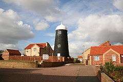 Andersons mill, Waddingham |
|
 Waddingham |
|
| Population | 601 (2011) |
|---|---|
| OS grid reference | SK984961 |
| – London | 145 mi (233 km) S |
| District | West Lindsey |
| Shire county | Lincolnshire |
| Region | East Midlands |
| Country | England |
| Sovereign state | United Kingdom |
| Post town | GAINSBOROUGH |
| Postcode district | DN21 |
| Police | Lincolnshire |
| Fire | Lincolnshire |
| Ambulance | East Midlands |
| EU Parliament | East Midlands |
| UK Parliament | Gainsborough (UK Parliament constituency) |
|
|
Coordinates: 53°27′12″N 0°31′09″W / 53.453234°N 0.519252°W
Waddingham is a village and civil parish in the West Lindsey district of Lincolnshire, England.[1] It is geographically situated 1.5 miles (2.4 km) to the east of the A15 road, 10 miles (16 km) south-east from Scunthorpe[1] and 16 miles (26 km) north from Lincoln. According to the United Kingdom Census 2001 Waddingham (including Brandy Wharf) had a population of 548;[2] by the time of the United Kingdom Census 2011, the population had increased to 601.[2]
History
Originally there were two settlements, Stainton (where the present church is) and Wadingham, which were on either side of the Waddingham Beck which runs through the village. Both settlements are mentioned in the Domesday Book of 1086.[3] Both places have Anglo Saxon names: Stainton is derived from The Old English "Stan" (stone), and the Old English "Tun" (farm), meaning stony farm.[4] Waddingham is derived from two common OE suffixes: "ing" (person), or "ingas" (people), and "ham" (village or settlement), meaning the village of, or belonging to, the Wada family or tribe.[5]

St Mary & St Peter (originally St Peter) church chancel arch is 13th-century, the tower being a 15th-century addition. The church was largely rebuilt in 1862.
Culture and community
Waddingham has a post office, a village shop, and a Methodist chapel. Opposite the Jubilee Hall (built to commemorate HM Queen Elizabeth II's Silver Jubilee in 1977), which houses a doctor's surgery, is Waddingham Primary School. The village public house is the Marquis of Granby.
References
- 1 2 Ordnance Survey: Landranger map sheet 112 Scunthorpe & Gainsborough (Map). Ordnance Survey. 2012. ISBN 9780319229361.
- 1 2 "Area: Waddingham (Parish), Key Figures for 2001 Census". Neighbourhood Statistics. Office for National Statistics. Retrieved 10 April 2016.
- ↑ Professor J.J.N.Palmer. "Open Domesday: Stainton". www.opendomesday.org. Anna Powell-Smith. Retrieved 10 April 2016.
- ↑ Mills, 2011, p. 431
- ↑ Mills, 2011, p. 479
Sources
- Mills, A.D. (2011) [first published 1991]. A Dictionary of British Place Names (First edition revised 2011 ed.). Oxford: Oxford University Press. ISBN 9780199609086.
External links
 Media related to Waddingham at Wikimedia Commons
- St Mary & St Peter's Church web site
- Waddingham Primary School web site
- Waddingham Parish Council web site
England Portal | |
| Unitary authorities | |
| Boroughs or districts | |
| Major settlements |
|
| Topics | |