Vrede
For other uses, see Vrede (disambiguation).
| Vrede | |
|---|---|
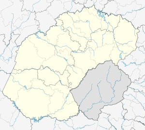
 Vrede  Vrede  Vrede
| |
| Coordinates: 27°25′48″S 29°9′36″E / 27.43000°S 29.16000°ECoordinates: 27°25′48″S 29°9′36″E / 27.43000°S 29.16000°E | |
| Country | South Africa |
| Province | Free State |
| District | Thabo Mofutsanyane |
| Municipality | Phumelela |
| Established | 1876[1] |
| Government | |
| • Councillor | Motaung (ANC) |
| Area[2] | |
| • Total | 50.1 km2 (19.3 sq mi) |
| Elevation | 1,675 m (5,495 ft) |
| Population (2011)[2] | |
| • Total | 17,689 |
| • Density | 350/km2 (910/sq mi) |
| Racial makeup (2011)[2] | |
| • Black African | 93.1% |
| • Coloured | 0.4% |
| • Indian/Asian | 0.5% |
| • White | 5.7% |
| • Other | 0.4% |
| First languages (2011)[2] | |
| • Zulu | 53.4% |
| • Sotho | 36.5% |
| • Afrikaans | 6.0% |
| • English | 1.1% |
| • Other | 3.1% |
| Postal code (street) | 9835 |
| PO box | 9835 |
| Area code | 058 |
Vrede is a town in the Free State province of South Africa that is the agricultural hub of a 100 km² region. Maize, wheat, mutton, wool, beef, dairy products and poultry are farmed in the region.
History
The town lies 60 km south of Standerton and 216 km south-east of Johannesburg. It was founded on the Krynauwslust farm in 1863 and proclaimed a town in June 1879. The name is Afrikaans for ‘peace’, which refers to the settlement of a dispute over the proposed site of the town.[3]
Education among the youth (even from poorer background) of Vrede is on the rise, especially due to high schools such as Katleho and Evungwini.
Notable people
- André Brink (1935–2015), novelist, born in Vrede but moving to Lydenburg in childhood
- Sid Kiel (1916–2007), doctor, athlete, and cricketer, born on a Vrede sheep farm but moving to Cape Town in childhood
References
- ↑ "Chronological order of town establishment in South Africa based on Floyd (1960:20-26)" (PDF). pp. xlv–lii.
- 1 2 3 4 Sum of the Main Places Thembalihle and Vrede from Census 2011.
- ↑ "Dictionary of Southern African Place Names (Public Domain)". Human Science Research Council. p. 463.
This article is issued from Wikipedia - version of the 8/19/2016. The text is available under the Creative Commons Attribution/Share Alike but additional terms may apply for the media files.
.svg.png)