Volokolamsky District
| Volokolamsky District Волоколамский район (Russian) | |
|---|---|
.svg.png) Location of Volokolamsky District in Moscow Oblast (before July 2012) | |
| Coordinates: 56°02′N 35°57′E / 56.033°N 35.950°ECoordinates: 56°02′N 35°57′E / 56.033°N 35.950°E | |
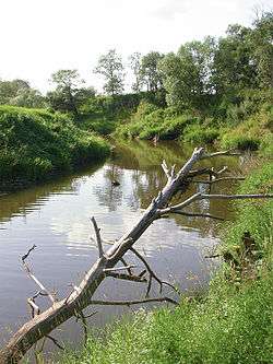 The Lama River near Yaropolets in Volokolamsky District | |
.png) | |
|
| |
| Location | |
| Country | Russia |
| Federal subject | Moscow Oblast[1] |
| Administrative structure (as of January 2013) | |
| Administrative center | town of Volokolamsk[1] |
| Administrative divisions:[2] | |
| Towns | 1 |
| Work settlements | 1 |
| Rural settlements | 6 |
| Inhabited localities:[2] | |
| Cities/towns | 1 |
| Urban-type settlements[3] | 1 |
| Rural localities | 267 |
| Municipal structure (as of October 2010) | |
| Municipally incorporated as | Volokolamsky Municipal District[4] |
| Municipal divisions:[4] | |
| Urban settlements | 2 |
| Rural settlements | 6 |
| Statistics | |
| Area (municipal district) (October 2010) | 1,683.51 km2 (650.01 sq mi)[4] |
| Population (2010 Census) | 53,244 inhabitants[5] |
| • Urban | 49.8% |
| • Rural | 50.2% |
| Density | 31.63/km2 (81.9/sq mi)[6] |
| Time zone | MSK (UTC+03:00)[7] |
| Established | 1929 |
| Official website | |
| Volokolamsky District on WikiCommons | |
Volokolamsky District (Russian: Волокола́мский райо́н) is an administrative[1] and municipal[4] district (raion), one of the thirty-six in Moscow Oblast, Russia. It is located in the west of the oblast and borders with Mozhaysky District in the south, Shakhovskoy District in the west, Lotoshinsky District in the northwest, Klinsky District in the northeast, and with Istrinsky and Ruzsky Districts in the east. The area of the district is 1,683.51 square kilometers (650.01 sq mi).[4] Its administrative center is the town of Volokolamsk.[1] Population: 53,244 (2010 Census);[5] 49,032 (2002 Census);[8] 37,863 (1989 Census).[9] The population of Volokolamsk accounts for 44.0% of the district's total population.[5]
Geography
Forests cover about 40% of the district's territory. Main rivers include the Ruza and the Lama.
History
The district was established in 1929 and its territory was significantly expanded in 1957.
Attractions
The main attractions include the Volokovamsk Kremlin, the Joseph-Volokolamsk Monastery in the selo of Teryayevo located 17 kilometers (11 mi) from Volokolamsk and Moscow Raceway circuit.
References
Notes
- 1 2 3 4 Law #11/2013-OZ
- 1 2 Resolution #123-PG
- ↑ The count of urban-type settlements may include the work settlements, the resort settlements, the suburban (dacha) settlements, as well as urban-type settlements proper.
- 1 2 3 4 5 Law #1/2005-OZ
- 1 2 3 Russian Federal State Statistics Service (2011). "Всероссийская перепись населения 2010 года. Том 1" [2010 All-Russian Population Census, vol. 1]. Всероссийская перепись населения 2010 года (2010 All-Russia Population Census) (in Russian). Federal State Statistics Service. Retrieved June 29, 2012.
- ↑ The value of density was calculated automatically by dividing the 2010 Census population by the area specified in the infobox. Please note that this value is only approximate as the area specified in the infobox does not necessarily correspond to the area of the entity proper or is reported for the same year as the population.
- ↑ Правительство Российской Федерации. Федеральный закон №107-ФЗ от 3 июня 2011 г. «Об исчислении времени», в ред. Федерального закона №271-ФЗ от 03 июля 2016 г. «О внесении изменений в Федеральный закон "Об исчислении времени"». Вступил в силу по истечении шестидесяти дней после дня официального опубликования (6 августа 2011 г.). Опубликован: "Российская газета", №120, 6 июня 2011 г. (Government of the Russian Federation. Federal Law #107-FZ of June 31, 2011 On Calculating Time, as amended by the Federal Law #271-FZ of July 03, 2016 On Amending Federal Law "On Calculating Time". Effective as of after sixty days following the day of the official publication.).
- ↑ Russian Federal State Statistics Service (May 21, 2004). "Численность населения России, субъектов Российской Федерации в составе федеральных округов, районов, городских поселений, сельских населённых пунктов – районных центров и сельских населённых пунктов с населением 3 тысячи и более человек" [Population of Russia, Its Federal Districts, Federal Subjects, Districts, Urban Localities, Rural Localities—Administrative Centers, and Rural Localities with Population of Over 3,000] (XLS). Всероссийская перепись населения 2002 года [All-Russia Population Census of 2002] (in Russian). Retrieved August 9, 2014.
- ↑ Demoscope Weekly (1989). "Всесоюзная перепись населения 1989 г. Численность наличного населения союзных и автономных республик, автономных областей и округов, краёв, областей, районов, городских поселений и сёл-райцентров" [All Union Population Census of 1989: Present Population of Union and Autonomous Republics, Autonomous Oblasts and Okrugs, Krais, Oblasts, Districts, Urban Settlements, and Villages Serving as District Administrative Centers]. Всесоюзная перепись населения 1989 года [All-Union Population Census of 1989] (in Russian). Институт демографии Национального исследовательского университета: Высшая школа экономики [Institute of Demography at the National Research University: Higher School of Economics]. Retrieved August 9, 2014.
Sources
- Московская областная Дума. Закон №11/2013-ОЗ от 31 января 2013 г. «Об административно-территориальном устройстве Московской области», в ред. Закона №72/2015-ОЗ от 5 мая 2015 г. «Об отнесении города Озёры Озёрского района Московской области к категории города областного подчинения Московской области, упразднении Озёрского района Московской области и внесении изменений в Закон Московской области "Об административно-территориальном устройстве Московской области"». Вступил в силу на следующий день после официального опубликования (13 января 2013 г.). Опубликован: "Ежедневные Новости. Подмосковье", №24, 12 февраля 2013 г. (Moscow Oblast Duma. Law #11/2013-OZ of January 31, 2013 On the Administrative-Territorial Structure of Moscow Oblast, as amended by the Law #72/2015-OZ of May 5, 2015 On Re-Classifying the Town of Ozyory in Ozyorsky District of Moscow Oblast as the Town Under Oblast Jurisdiction, on Abolishing Ozyorsky District of Moscow Oblast, and on Amending the Law of Moscow Oblast "On the Administrative-Territorial Structure of Moscow Oblast". Effective as of the day following the day of the official publication (January 13, 2013).).
- Губернатор Московской области. Постановление №123-ПГ от 28 сентября 2010 г. «Об учётных данных административно-территориальных и территориальных единиц Московской области», в ред. Постановления №252-ПГ от 26 июня 2015 г. «О внесении изменения в учётные данные административно-территориальных и территориальных единиц Московской области». Опубликован: "Информационный вестник Правительства МО", №10, 30 октября 2010 г. (Governor of Moscow Oblast. Resolution #123-PG of September 28, 2010 On the Inventory Data of the Administrative-Territorial and Territorial Units of Moscow Oblast, as amended by the Resolution #252-PG of June 26, 2015 On Amending the Inventory Data of the Administrative-Territorial and Territorial Units of Moscow Oblast. ).
- Московская областная Дума. Закон №1/2005-ОЗ от 11 января 2005 г. «О статусе и границах Волоколамского муниципального района и вновь образованных в его составе муниципальных образований», в ред. Закона №127/2010-ОЗ от 29 октября 2010 г. «О внесении изменений в Закон Московской области "О статусе и границах Волоколамского муниципального района и вновь образованных в его составе муниципальных образований"». Вступил в силу со дня официального опубликования. Опубликован: "Ежедневные Новости. Подмосковье", №20, 4 февраля 2005 г. (Moscow Oblast Duma. Law #1/2005-OZ of January 11, 2005 On the Status and the Borders of Volokolamsky Municipal District and the Newly Established Municipal Formations Comprising It, as amended by the Law #127/2010-OZ of October 29, 2010 On Amending the Law of Moscow Oblast "On the Status and the Borders of Volokolamsky Municipal District and the Newly Established Municipal Formations Comprising It". Effective as of the day of the official publication.).