Cayambe (volcano)
| Cayambe | |
|---|---|
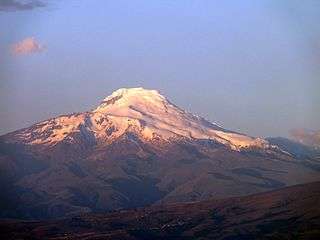 Cayambe in August 2009 | |
| Highest point | |
| Elevation | 5,790 m (19,000 ft) |
| Prominence | 2,075 m (6,808 ft) |
| Listing | Ultra |
| Coordinates | 0°1′30″N 77°59′20″W / 0.02500°N 77.98889°WCoordinates: 0°1′30″N 77°59′20″W / 0.02500°N 77.98889°W |
| Geography | |
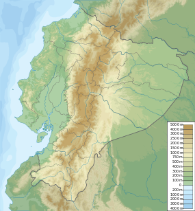
| Location | Pichincha, Ecuador |
| Parent range | Andes |
| Geology | |
| Mountain type | Compound volcano |
| Volcanic arc/belt | North Volcanic Zone |
| Last eruption | 1785 to 1786 |
| Climbing | |
| First ascent | 1880 by Edward Whymper |
| Easiest route | rock/snow climb |
Cayambe (or Volcán Cayambe) is the name of a volcano located in the Cordillera Central, a range of the Ecuadorian Andes. It is located in Pichincha province some 70 km (43 mi) northeast of Quito. It is the third highest mountain in Ecuador.
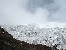
Cayambe, which has a permanent snow cap, is a Holocene compound volcano which last erupted in March 1786.[1] At 4,690 metres (15,387 ft) on its south slope is the highest point in the world crossed by the Equator and the only point on the Equator with snow cover. The volcano and most of its slopes are within the Cayambe Coca Ecological Reserve.
Cayambe was first climbed by British adventurer Edward Whymper and his two Italian guides and companions Juan Antonio and Luis Carrel in 1880, and it is a favourite of mountain climbers today.
 Cayambe Volcano |
Major volcanoes in Ecuador |
See also
References
- Cayambe, Instituto Geofísico de la Escuela Politécnica Nacional
- Cayambe: Etymology
External links
| Wikimedia Commons has media related to Cayambe. |