Virginia Capes
Coordinates: 37°1′44″N 76°4′5″W / 37.02889°N 76.06806°W
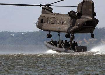
A CH-47 Chinook helicopter in a training exercise with U.S. Navy Special Warfare 159th Aviation Regiment personnel and a rigid hull inflatable boat. Virginia Capes near Fort Eustis, Virginia, July 16, 2008.
The Virginia Capes are the two capes, Cape Charles to the north and Cape Henry to the south, that define the entrance to Chesapeake Bay on the eastern coast of North America.
The importance of Chesapeake Bay in American history has long made the Capes strategically significant, most notably in the naval Battle of the Chesapeake that was a crucial step in winning the American Revolutionary War.
More recently, because of the proximity of the naval yards at Norfolk and Newport News, the Capes area has often been used for the initial trials of new Navy ships.
This article is issued from Wikipedia - version of the 2/19/2014. The text is available under the Creative Commons Attribution/Share Alike but additional terms may apply for the media files.