Vintar
| Vintar | ||
|---|---|---|
| Municipality | ||
| ||
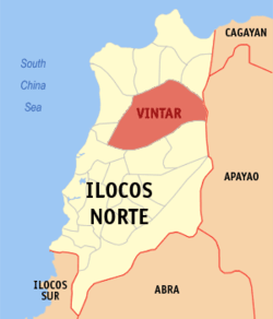 Map of Ilocos Norte showing the location of Vintar | ||
.svg.png) Vintar Location within the Philippines | ||
| Coordinates: 18°13′48″N 120°38′31″E / 18.23000°N 120.64194°ECoordinates: 18°13′48″N 120°38′31″E / 18.23000°N 120.64194°E | ||
| Country | Philippines | |
| Region | Ilocos (Region I) | |
| Province | Ilocos Norte | |
| District | 1st District | |
| Established | 1909 | |
| Barangays | 34 | |
| Government[1] | ||
| • Mayor | Larissa Cadavona Foronda | |
| Area[2] | ||
| • Total | 614.35 km2 (237.20 sq mi) | |
| Population (2010)[3] | ||
| • Total | 31,448 | |
| • Density | 51/km2 (130/sq mi) | |
| Time zone | PST (UTC+8) | |
| ZIP code | 2915 | |
| Dialing code | 77 | |
| Income class | 5th class; urban | |
| Website | vintar.com | |
Vintar is a first class and the largest municipality (in terms of area) in the province of Ilocos Norte, Philippines. According to the 2010 census, it has a population of 31,448 people.[3] Its patron saint is Saint Nicholas de Tolentino.
The town is home to one of the biggest convents in the Province of Ilocos Norte. The convent houses the Saint Nicolas Institute. It is also the site of the Governor’s Resthouse, the town’s popular resort. Vintar is one of the most environment friendly town in Ilocos Norte.
History
Vintar derived its name from the Ilocano word, intar, which used to describe the formation or order taken by the subject from their ruler whenever the chief called them to attention. It is said that a visiting Spanish missionary named Leano heard the word and add the letter V.
The town earliest settlers are believed to be Indonesian. They first settled on a hill overlooking the Vintar River where its huge dam is located. In the early 16th century, the town was founded by a Catholic missionary who got lost in the woods while hunting between Sarrat and Piddig. Vintar was made the visita of Bacarra in 1600. Ten years later, it was established as a parish os San Nicolas de Tolentino. Earlier in 1763, Vintar was reverted to a visita until it became independent in 1774.
In 1903, Vintar was annexed as a barrio Bacarra. It gained its separation and independence in 1909.
In 1931, an earthquake partially destroyed its church. Five years later, it was restored and so was its convent in 1982.
Vintar celebrates its town fiesta every 10 September. A religious tradition inherited from the Augustinians lives on-the distribution of San Nicolas biscuits.
The people of Vintar are engage in farming, fishing and herding. The town is generally rural.
Geography
Area and location
Vintar is located on a plain land surrounded by mountains. Vintar is surrounded and bordered by:
- Bangui, Adams, Dumalneg, Burgos and Pagudpud in the North
- Laoag City, Sarrat, Piddig, and Carasi in the South
- Pasuquin and Bacarra in the West
- Calanasan, Apayao in the East
The town is considered as the sixth major river system in the region. Its head waters are on the western Cordillera slopes at the Kalinga and Apayao borders. It flows eastward and irrigates most of the flat lands of Ilocos Norte before making its exit into the China Sea. Vintar has the largest land area in Ilocos Norte.
Note: The town of Sigay was created last 2008,carving out from the territory of Vintar, but was amended September 2009 because of poor economy.
Climate
Vintar is divided into two types of climate:
- 90% or the Western Part: Two pronounced seasons, dry from December to May and wet from June to November. Maximum rain period is from June to September.
- 10% or the Eastern Part: No very pronounced maximum rain period, with a short dry season lasting only from one to three months.
Average rainfall per month:
- January: 0 to 50 millimetres (0.0 to 2.0 in)
- February: 0 to 50 millimetres (0.0 to 2.0 in)
- March: 0 to 50 millimetres (0.0 to 2.0 in)
- April: 0 to 100 millimetres (0.0 to 3.9 in)
- May: 100 to 200 millimetres (3.9 to 7.9 in)
- June: 200 to 400 millimetres (7.9 to 15.7 in)
- July: 200 to 500 millimetres (7.9 to 19.7 in)
- August: more than 500 millimetres (20 in)
- September: 400 to 500 millimetres (16 to 20 in)
- October: 100 to 300 millimetres (3.9 to 11.8 in)
- November: 200 to 400 millimetres (7.9 to 15.7 in)
- December: 0 to 100 millimetres (0.0 to 3.9 in)
Barangays
Vintar is politically subdivided into 34 barangays.[2]
- 1- San Roque (Poblacion)
- 2- San Nicolas (Poblacion)
- 3- San Pedro (Poblacion)
- 4- Santa Maria (Poblacion)
- 5- San Ramon (Poblacion)
- 6- Parut (Poblacion)
- 7- Alejo Malasig/Pait(Burdo)
- 8- Margaay (Pallas)
- 9- Lubnac (Pallas)
- 10- Parparoroc (Pallas)
- 11- Bulbulala (Pallas)
- 12- Namoroc (Pallas)
- 13- Mabanbanag (Pallas)
- 14- Ester (Pallas)
- 15- Visaya (Salsalamagui)
- 16- Salsalamagui (Salsalamagui)
- 17- P.F. Alviar (Amian)
- 18- Abkir (Amian)
- 19- Columbia (Amian)
- 20- Cabisuculan (Amian)
- 21- Malampa (Amian)
- 22- Manarang (Amian)
- 23- Dipilat (Amian)
- 24- Alsem (Patpatani)
- 25- Tamdagan (Patpatani)
- 26- Canaam (Patpatani)
- 27- Esperanza (Patpatani)
- 28- Bago (Patpatani)
- 29- San Jose/ Lipay (Patpatani)
- 30- Santo Tomas/ Saricao (Surong)
- 31- Danao/Dagupan(Surong)
- 32- Cabangaran (Surong)
- 33- Cabayo (Surong)
- 34- Isic Isic (Surong)
Sub-divisions
Poblacion
Poblacion is the center-most subdivision of Vintar. Poblacion is composed of 5 barangays namely:
- 1- San Roque
- 2- San Nicolas
- 3- San Pedro
- 4- Sta. Maria
- 5- San Ramon
Burdo
Burdo is a mountainous place south of Vintar. This sub-division of Vintar is only composed of 2 barangays namely:
- 6- Parut
- 7- Alejo Malasig
Pallas Valley
Pallas Valley is considered the longest valley in the Philippines. It is located at the north-east of Vintar. Pallas Valley is composed of 7 barangays namely:
- 8- Margaay
- 9- Lubnac
- 10- Parparoroc
- 11- Bulbulala
- 12- Namoroc
- 13- Mabanbanag
- 14- Ester
Salsalamagui
Salsalamagui is at the north of Vintar. Salsalamagui is composed of 2 barangays namely:
- 15- Visaya
- 16- Salsalamagui
Amian Valley
Amian Valley is located north of Vintar. It is called so after the Ilocano word "Amian" which means north. Amian Valley is composed of 7 barangays namely:
- 17- P.F. Alviar
- 18- Abkir
- 19- Columbia
- 20- Cabisuculan
- 21- Malampa
- 22- Manarang
- 23- Dipilat
Patpatani
Patpatani is at the east of Vintar. It is composed of 6 barangays namely:
- 24- Alsem
- 25- Tamdagan
- 26- Canaam
- 27- Esperanza
- 28- Bago
- 29- San Jose/ Lipay
Surong Valley
Surong Valley is located at the north-west direction of Vintar. It is composed of the Upper Surong and Lower Surong valleys. Surong Valley is composed of 5 barangays namely:
- 30- Sto. Tomas/ Saricao
- 31- Danao/Dagupan
- 32- Cabangaran
- 33- Cabayo
- 34- Isic Isic
Mount Baguinsuso
Mount Baguinsuso, also known as Mount Masadsada (Ilocano which means "passable valley"), is an active volcano located in Barangay 14- Ester. Mount Baguinsuso is a historical place for Vintar because it is where the town's name came from. Mount Baguinsuso is a big landform which stretches across the barangays of Lubnac, Parparoroc, Bulbulala, and Namoroc.
Government seal

The shield is derived from the provincial seal of Ilocos Norte.
The letter V stands for the word Vintar, the name of the municipality.
The eagle represents the native hawk, commonly called Siwawer by the old folks and after which the people of Vintar are referred to.
Landscape, plow, rice stalk, onion, garlic, mango, eggplant and tobacco leaf, at the left side of the shield representing the municipality’s principal farming industries.
Dam, gate valve, water and fish at the right side of the shield represent Vintar-Laoag-Bacarra irrigation system. The dam also stands for the Siwawers, a resort the town is famous for; the fish symbolizes one of the main income-generating products of the locality.
Demographics
| Population census of Vintar | ||
|---|---|---|
| Year | Pop. | ±% p.a. |
| 1990 | 27,084 | — |
| 1995 | 27,460 | +0.26% |
| 2000 | 29,031 | +1.20% |
| 2007 | 29,405 | +0.18% |
| 2010 | 31,448 | +2.47% |
| Source: National Statistics Office[3][4] | ||
Festival
Siwawer Festival is the annual festival of Vintar. This festival of the town is being celebrated in honor of the siwawer and canaoay birds that only live in the area of Vintar. It is celebrated for 12 days every December 19 to December 30.
- December 19 - San Nicholas de Tolentino Parish Parade, opening of the Annual Vintar Arcade
- December 20 - Rambak ti Laod Parade
- December 21 - "Parada ti Bab-baket ken Lal-lakay" (translates as "Parade of the Old Women and Men")
- December 22 - "Parada ti Ub-ubing"" (translates as "Parade of the Children")
- December 23 - Presentation of the Candidates for the Ms. Teen Vintar of the 34 Barangays
- December 24 and 26 - Christmas Parade
- December - "Dudol" Festival recently celebrated (Rice Cake Festival)
- December 27 - All-Schools Dance Parade and Dance Showdown, Balikbayans of Vintar Night
- December 28 - Gays of Vintar Pageant
- December 29 - Search for the Ms. Teen Vintar Night
- December 30 - Coronation and Awarding Ceremonies
Products
- Bibingka or tubung cake is made from desiccated coconut, sweetened molasses (or tagapulot in local dialect) and glutinous rice flour, topped with grated cheese, covered by a wood or a trunk of a tree. Vintarinians (people from Vintar) had a spot on the Guinness World for making the longest Tubung in the whole world, which fed almost all of the Vintarinians. (Clarification: Bibingka is different from tubong or Tinubong. Bibingka is wrapped with banana leaves, while tubong is cooked in a bamboo or "bolo" (local name)Lawthee Ramos.
- Tupig is a native rice cake wrapped with a leaf of banana, and grilled
- Bagnet is a crispy chicaron, famous in Ilocos region, usually eaten alone or mixed with vegetables (called pinakbet in local dialect)
- Pinakbet (or pakbet) is a mix of different vegetables, usually beans, eggplant, beans and bitter gourd, with bagoong
- Sukang Ilokano or Ilocano vinegar
- Crops such as onion, garlic, corn, rice, tobacco and others
- Shrimps and ipon, or salted shrimp
- Brownies, cassava cake, pichi-pichi, suman and other desserts
- Chicacorn (cornick), deep-fried, flavored, or salted corn kernels
- Bagoong (not applicable).
Nicknames of Vintar
- "The Territory of Siwawers" (Siwawer is a high-flying, black and orange-colored bird)
- "Municipality of Canaoays" (Canaoay is a low-flying, black and white-colored bird)
- "Center Municipality of Ilocos Norte"
- "Area of Mighty Eagles"
Transportation
Vintar can be reached through air via Laoag International Airport at Laoag City, then hiring a tricycle or any other public transportation. From Manila by bus, it will take about 10 to 12 hours in reaching the center of Vintar. Farinas and Maria De Leon are the major companies that have a daily trip to Vintar.
References
- ↑ "Official City/Municipal 2013 Election Results". Intramuros, Manila, Philippines: Commission on Elections (COMELEC). 11 September 2013. Retrieved 3 October 2013.
- 1 2 "Province: ILOCOS NORTE". PSGC Interactive. Makati City, Philippines: National Statistical Coordination Board. Retrieved 3 October 2013.
- 1 2 3 "Total Population by Province, City, Municipality and Barangay: as of May 1, 2010" (PDF). 2010 Census of Population and Housing. National Statistics Office. Retrieved 3 October 2013.
- ↑ "Province of Ilocos Norte". Municipality Population Data. LWUA Research Division. Retrieved 3 October 2013.
External links
- Pasyalan Ilocos Norte
- Philippine Standard Geographic Code
- Philippine Census Information
- Local Governance Performance Management System
 |
Burgos | Bangui / Dumalneg / Adams | | |
| Pasuquin Bacarra |
|
Calanasan, Apayao | ||
| ||||
| | ||||
| Laoag | Piddig / Carasi |
Laoag (capital) | |
| Municipalities | |
| Component cities | |
| Barangays | |