Vincent, Alabama
| Vincent, Alabama | |
|---|---|
| City | |
 Location in Alabama | |
| Coordinates: 33°23′9″N 86°24′36″W / 33.38583°N 86.41000°W | |
| Country | United States |
| State | Alabama |
| Counties | Shelby, St. Clair, Talladega |
| Area | |
| • Total | 20.0 sq mi (51.7 km2) |
| • Land | 19.6 sq mi (50.7 km2) |
| • Water | 0.4 sq mi (1.0 km2) |
| Elevation | 453 ft (138 m) |
| Population (2010) | |
| • Total | 1,988 |
| • Density | 102/sq mi (39.2/km2) |
| Time zone | CST (UTC-6) |
| • Summer (DST) | CDT (UTC-5) |
| ZIP code | 35178 |
| Area code(s) | 205 Exchange: 672 |
| FIPS code | 01-79008 |
| GNIS feature ID | 0153852 |
Vincent, originally known as Propell or Propel, is a city in Shelby, St. Clair, and Talladega counties in the U.S. state of Alabama. At the 2010 census the population was 1,988.[1] The community was first known as Propell, but later named Vincent in honor of the Vincent family, who were early settlers of the area.[2] It was incorporated in 1897.[3]
Geography
Vincent is located at 33°23′9″N 86°24′36″W / 33.38583°N 86.41000°W (33.385719, -86.409919).[4]
According to the U.S. Census Bureau, the town has a total area of 20.0 square miles (51.7 km2), of which 19.6 square miles (50.7 km2) is land and 0.39 square miles (1.0 km2), or 1.90%, is water.[1]
Demographics
| Historical population | |||
|---|---|---|---|
| Census | Pop. | %± | |
| 1900 | 765 | — | |
| 1910 | 995 | 30.1% | |
| 1920 | 1,034 | 3.9% | |
| 1930 | 1,192 | 15.3% | |
| 1940 | 1,108 | −7.0% | |
| 1950 | 1,240 | 11.9% | |
| 1960 | 1,402 | 13.1% | |
| 1970 | 1,419 | 1.2% | |
| 1980 | 1,652 | 16.4% | |
| 1990 | 1,767 | 7.0% | |
| 2000 | 1,853 | 4.9% | |
| 2010 | 1,988 | 7.3% | |
| Est. 2015 | 2,120 | [5] | 6.6% |
| U.S. Decennial Census[6] 2013 Estimate[7] | |||
As of the census of 2010, there were 1,988 people, 802 households, and 575 families residing in the town. The population density was 101.4 people per square mile (39.2/km²). There were 895 housing units at an average density of 45.7 per square mile (17.7/km²). The racial makeup of the town was 78.7% White, 19.8% Black or African American, 0.4% Native American, 0.1% Asian, 0.1% some other race, and 1.0% from two or more races. 0.7% of the population were Hispanic or Latino of any race.[8]
There were 802 households, out of which 31.7% had children under the age of 18 living with them, 52.1% were headed by married couples living together, 16.7% had a female householder with no husband present, and 28.3% were non-families. 25.4% of all households were made up of individuals, and 9.2% were someone living alone who was 65 years of age or older. The average household size was 2.48 and the average family size was 2.95.[1]
In the town the population was spread out with 22.7% under the age of 18, 7.4% from 18 to 24, 23.9% from 25 to 44, 31.2% from 45 to 64, and 14.6% who were 65 years of age or older. The median age was 42.0 years. For every 100 females there were 87.9 males. For every 100 females age 18 and over, there were 84.0 males.[1]
For the period 2007-2011, the estimated median annual income for a household in the town was $43,125, and the median income for a family was $54,640. Male full-time workers had a median income of $44,310 versus $31,467 for females. The per capita income for the town was $22,782. About 2.7% of families and 6.2% of the population were below the poverty line, including 0% of those under age 18 and 14.4% of those age 65 or over.[9]
See also
References
- 1 2 3 4 "Geographic Identifiers: 2010 Demographic Profile Data (G001): Vincent town, Alabama". U.S. Census Bureau, American Factfinder. Retrieved January 28, 2013.
- ↑ Foscue, Virginia (1989). Place Names in Alabama. Tuscaloosa: The University of Alabama Press. p. 143. ISBN 0-8173-0410-X.
- ↑ http://www.encyclopediaofalabama.org/article/h-3309
- ↑ "US Gazetteer files: 2010, 2000, and 1990". United States Census Bureau. 2011-02-12. Retrieved 2011-04-23.
- ↑ "Annual Estimates of the Resident Population for Incorporated Places: April 1, 2010 to July 1, 2015". Retrieved July 2, 2016.
- ↑ "U.S. Decennial Census". Census.gov. Retrieved June 6, 2013.
- ↑ "Annual Estimates of the Resident Population: April 1, 2010 to July 1, 2013". Retrieved June 3, 2014.
- ↑ "Profile of General Population and Housing Characteristics: 2010 Demographic Profile Data (DP-1): Vincent town, Alabama". U.S. Census Bureau, American Factfinder. Retrieved January 28, 2013.
- ↑ "Selected Economic Characteristics: 2007-2011 American Community Survey 5-Year Estimates (DP03): Vincent town, Alabama". U.S. Census Bureau, American Factfinder. Retrieved January 28, 2013.
Coordinates: 33°23′09″N 86°24′36″W / 33.385719°N 86.409919°W
Municipalities and communities of St. Clair County, Alabama, United States | ||
|---|---|---|
| Cities | 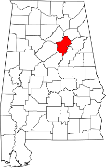 | |
| Towns | ||
| Unincorporated communities | ||
| Former towns | ||
| Footnotes | ‡This populated place also has portions in an adjacent county or counties | |
Municipalities and communities of Shelby County, Alabama, United States | ||
|---|---|---|
| Cities |  | |
| Towns | ||
| CDPs | ||
| Unincorporated communities | ||
| Footnotes | ‡This populated place also has portions in an adjacent county or counties | |
Municipalities and communities of Talladega County, Alabama, United States | ||
|---|---|---|
| Cities | 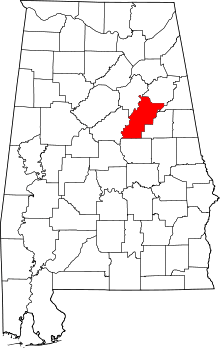 | |
| Towns | ||
| CDPs | ||
| Unincorporated communities | ||
| Ghost town | ||
| Footnotes | ‡This populated place also has portions in an adjacent county or counties | |