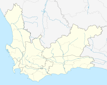
Villiersdorp
| Villiersdorp | |
|---|---|
|
View of Villersdorp from the surrounding mountains | |
 Villiersdorp  Villiersdorp  Villiersdorp
| |
| Coordinates: 33°59′S 19°17′E / 33.983°S 19.283°ECoordinates: 33°59′S 19°17′E / 33.983°S 19.283°E | |
| Country | South Africa |
| Province | Western Cape |
| District | Overberg |
| Municipality | Theewaterskloof |
| Established | 1841[1] |
| Area[2] | |
| • Total | 2.89 km2 (1.12 sq mi) |
| Population (2011)[2] | |
| • Total | 10,004 |
| • Density | 3,500/km2 (9,000/sq mi) |
| Racial makeup (2011)[2] | |
| • Black African | 40.3% |
| • Coloured | 44.7% |
| • Indian/Asian | 0.2% |
| • White | 12.5% |
| • Other | 2.3% |
| First languages (2011)[2] | |
| • Afrikaans | 56.5% |
| • Xhosa | 24.6% |
| • Sotho | 12.8% |
| • English | 3.4% |
| • Other | 2.7% |
| Postal code (street) | 6848 |
| PO box | 6848 |
| Area code | 028 |
Villiersdorp is a town of approximately 10,000 people located in the Western Cape province of South Africa in the Overberg region.
Unlike most of the geographical region which specialises in wheat and canola farming, the Villiersdorp Valley is now agriculturally and micro-climatatically more similar to the Elgin Valley and Grabouw since the building of the Theewaterskloof Dam, and thus also specialises in deciduous fruit farming and viticulture. The Theewaterskloof Dam, the largest dam in the Western Cape and 7th largest in South Africa and important water supply to Cape Town fills the majority of the valley floor. The Villiersdorp Co-Op is also the only place in South Africa that processes and dries persimmons. The 3 big packsheds in Villiersdorp, Betko, Arbeidsvreugd and Ideafruit, as well as the Villiersdorp Co-Op process the fruit grown in the area for export and transport to other parts of South Africa. The town is named after Field Cornet Pieter de Villiers, a local farmer who founded the settlement in 1843.
Notable people

- Sir David Graaff, 1st Baronet and his younger brother Jacobus Arnoldus Graaff were born in Villiersdorp. After making their fortune in Cape Town they went on to found the De Villiers Graaff High School in Villiersdorp in 1907 with an endowment of £100 000 (equivalent to £41,100,000[3] or R471,195,167 in 2010[4])
References
- ↑ "Chronological order of town establishment in South Africa based on Floyd (1960:20-26)" (PDF). pp. xlv–lii.
- 1 2 3 4 "Main Place Villiersdorp". Census 2011.
- ↑ Measuring Worth, Relative Value of a UK Pound Amount - average earnings, retrieved on the 26 June 2010
- ↑ EX, Universal Currency Converter, retrieved on the 26 June 2010

.svg.png)