Villepinte, Seine-Saint-Denis
For other places with the same name, see Villepinte (disambiguation).
| Villepinte | ||
|---|---|---|
|
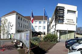
Villepinte town hall | ||
| ||
 Paris and inner ring departments | ||
| Coordinates: 48°57′18″N 2°32′28″E / 48.955°N 2.541°ECoordinates: 48°57′18″N 2°32′28″E / 48.955°N 2.541°E | ||
| Country | France | |
| Region | Île-de-France | |
| Department | Seine-Saint-Denis | |
| Arrondissement | Le Raincy | |
| Canton | Sevran | |
| Government | ||
| • Mayor (2014–2020) | Martine Valleton | |
| Area1 | 10.37 km2 (4.00 sq mi) | |
| Population (2006)2 | 35,639 | |
| • Density | 3,400/km2 (8,900/sq mi) | |
| Time zone | CET (UTC+1) | |
| • Summer (DST) | CEST (UTC+2) | |
| INSEE/Postal code | 93078 / 93420 | |
|
1 French Land Register data, which excludes lakes, ponds, glaciers > 1 km² (0.386 sq mi or 247 acres) and river estuaries. 2 Population without double counting: residents of multiple communes (e.g., students and military personnel) only counted once. | ||
Villepinte is a commune in the northeastern suburbs of Paris, France. It is located 18.3 km (11.4 mi) from the center of Paris.
Heraldry
 |
The arms of Villepinte are blazoned : Azure, a Passion nail argent between 3 fleurs de lys Or, on a chaussé of the same, 2 plow points sable, point up. |
Transport
Villepinte is served by three stations on Paris RER line B: Villepinte, Parc des Expositions, and Vert-Galant.
Personalities
- Bira Dembele footballer
- Alou Diarra footballer
- Boukary Drame footballer
- Sacha Petshi footballer
- Alassane També footballer
- Diandra Tchatchouang, basketball player
- Ibrahima Traore footballer
- Saïd Taghmaoui actor
Education
The commune has ten preschools (maternelles),[1] as well as 11 elementary schools.[2]
Secondary schools:
- Four junior high schools: Collège Françoise Dolto, Collège Camille Claudel, Collège Jean Jaurès, Collège Les Mousseaux[3]
- Two senior high schools/sixth-form colleges: Lycée Jean Rostand and Lycée Georges Brassens[4]
See also
References
- ↑ "Les écoles maternelles." Villepinte. Retrieved on September 9, 2016.
- ↑ "Les écoles élémentaires." Villepinte. Retrieved on September 9, 2016.
- ↑ "Les collègiens." Villepinte. Retrieved on September 9, 2016.
- ↑ "Les lycéens." Villepinte. Retrieved on September 9, 2016.
External links
| Wikimedia Commons has media related to Villepinte, Seine-Saint-Denis. |
- Official website (in French)
This article is issued from Wikipedia - version of the 9/8/2016. The text is available under the Creative Commons Attribution/Share Alike but additional terms may apply for the media files.