Việt Trì
| Việt Trì | |
|---|---|
| City | |
 | |
| Nickname(s): Lâm Thao City | |
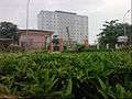
 Việt Trì Location of in Vietnam | |
| Coordinates: 21°18′N 105°26′E / 21.300°N 105.433°E | |
| Country |
|
| Province | Phú Thọ |
| Established city | 1962 |
| Area | |
| • Total | 111.75 km2 (43.15 sq mi) |
| Population (2013) | |
| • Total | 283,995 |
| • Density | 2,541.3/km2 (6,582/sq mi) |
Việt Trì is the capital city of Phú Thọ Province in the north-east region of Vietnam. In 2010, the district had a population of 260,288.[1] The district covers an area of 110 square kilometres (42 sq mi).[1] Việt Trì is also the economic centre of the province and contains many industrial firms and service industries.[2]
Geography
Geographical position
Maintenance of Hanoi Vietnam 70 kilometres (43 mi) north-west Located in "Nga Ba Crane" on the Red River, where the Red River Alluvial Sports confluence with the Lot river blue. So Vietnamese Trì is also known under the name City of Confluence.
Administrative boundaries
To the east is Lập Thạch District, District Lot River, Vĩnh Tường District (Vĩnh Phúc Province), west of Lâm Thao town or township Hùng Sơn, Tien Kien Commune, Thạch Sơn, Lâm Thao District, Nam Cao Xa borders, Son Vi Commune, Lâm Thao District (along the Phú Thọ) and Ba Vì District, Hanoi, north of Phu Ninh commune, Vĩnh Phúc Province, Phú Ninh District.
Area
11,175.11 hectares.
Administrative divisions
The township contains 13 wards: Bạch Hạc, Thanh Miếu, Thọ Sơn, Tiên Cát, Nông Trang, Vân Cơ, Bến Gót, Gia Cẩm, Tân Dân, Dữu Lâu, Minh Nông, Minh Phương, Vân Phú and 10 communes: Thuỵ Vân, Phượng Lâu, Sông Lô, Trưng Vương, Hy Cương, Chu Hoá, Thanh Đình, Hùng Lô, Kim Đức, Tân Đức.
Economy
Việt Trì is one of the first industrial cities of northern Vietnam. The city has great potential for industrial development, agriculture, trade and services. Development of industries including: chemical, paper, apparel, ...On the city focused factories, enterprises, companies with industrial scale production with a large proportion, every year that contribute a large amount of provincial funding and jobs for many workers. A number of factories, companies such as:
- Việt Trì Paper Factory Maintenance
- Red River Steel Plant
- Vietnam Chemical Plant Maintenance
- CMC tiles factory
- Lot River Shipyard
- JSC Hanoi-Hong Ha Beer
- Company shares rose Aluminum River
And many factories and companies focused in the industrial zone:
- Thuy Van industrial park
- Dong Lang Industrial Park
- White Industrial Park
- South Vietnamese Accounting Maintenance Industrial Park
- Dong Lang Industrial Park


Education
University-level colleges-Maintenance in Việt Trì city:
- Hung Vuong University (Multi-level universities, multi-disciplinary)including:
- Faculty of Mathematics-Technology
- Faculty of Economics-Business Management
- Faculty of Agriculture - Forestry - Fishing
- Faculty of Foreign Languages+Faculty of Social Sciences - Humanities
- Faculty of Primary Education - Kindergarten
- Faculty of Natural Sciences
- Faculty of Music Art
- University Preparatory School national central of Việt Trì
- Viet Tri University of Industry
- College of Pharmacy-Fushico (become University Pharmacy-Fushico in 2012)
- Medical College ( become Nursing University in 2013)
- College of Engineering-Economics
- College of Food Industry
- College of Mechanical and Electrical
- College of arts and culture
- Red River Intermediate occupations
- Provincial Center KTTHHN
- Center for continuing education of Việt Trì
secondary education system of Việt Trì city:
- Specialist secondary schools Hung Vuong
- Việt Trì secondary schools
- Nguyễn Tất Thành
secondary schools
- Việt Trì Industrial's secondary school
- Herman secondary school+Việt Trì Engineer's secondary school
- Vũ Thê Lang secondary school
- Lê Quý Đôn secondary school
- Âu Cơ Private schools
- Việt Trì Private school
- Vân Phú Private school
Health care system
- PHU THO PROVINCIAL HOSPITAL
- HOSPITAL BUILDING CORPORATION RED RIVER
- Hospital of Traditional Medicine
- FACULTY OF OCCUPATIONAL DISEASES HOSPITAL OF VIET TRI
- Việt Trì TEXTILE MAINTENANCE CLINIC HOSPITAL
- VIET TRI HOSPITAL ENGINEERING
- CHILDREN'S HOSPITAL
- HOSPITAL CARE AND THE REHABILITATION
- THE BOARD, DEPARTMENT OF HEALTH IN THE COMPANY

Transport
Việt Trì prime responsibility as an industrial city, is located down three rivers and the city, became city roots festival in 2015, so in prior years Recent infrastructure investment the city is fairly uniform construction. Many roads are of the renovation, upgrading and new construction to the standards of inner city roads to ensure smooth traffic always. the convenient transportation of goods across the motorways, railways, rivers, etc.
The national route 2 and 32 are important for transportation from Việt Trì city to other cities/provinces in Vietnam
Urban areas are performing
In 2012, Việt Trì city was designated as a class 1 of provincial city in Vietnam city classification criteria.
References
- 1 2 "Districts of Vietnam". Statoids. Retrieved March 23, 2009.
- ↑ Hy V. Luong Tradition, Revolution, and Market Economy in a North Vietnamese Village-- 2010 Page 217 "... industry in Việt Trì or in the new industrial zone on the border between Lâm Thao district and Việt Trì township.4 A number of commuting villagers worked in a cement factory set up in 2002 by a Sơn Dương native in this new industrial zone"
| Wikimedia Commons has media related to Viet Tri. |
Coordinates: 21°18′N 105°26′E / 21.300°N 105.433°E
