Vienna, Louisiana
| Town of Vienna | |
| Town | |
| Country | United States |
|---|---|
| State | Louisiana |
| Parish | Lincoln |
| Elevation | 262 ft (79.9 m) |
| Coordinates | 32°36′24″N 92°39′03″W / 32.60667°N 92.65083°WCoordinates: 32°36′24″N 92°39′03″W / 32.60667°N 92.65083°W |
| Area | 3.5 sq mi (9.1 km2) |
| - land | 3.5 sq mi (9 km2) |
| - water | 0.0 sq mi (0 km2), 0% |
| Population | 424 (2000) |
| Density | 122.6/sq mi (47.3/km2) |
| Mayor | Walter Carpenter (R) |
| Timezone | CST (UTC-6) |
| - summer (DST) | CDT (UTC-5) |
| Area code | 318 |
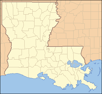 Location of Vienna in Louisiana | |
 Location of Louisiana in the United States | |
Vienna is a town in Lincoln Parish, Louisiana, United States. The population was 424 at the 2000 census. It is part of the Ruston Micropolitan Statistical Area.
During the American Civil War, Confederate troops drilled at a new camp established in 1862 in Vienna. Later in the war, a parolee camp was established at Vienna.[1]
Geography
Vienna is located at 32°36′24″N 92°39′3″W / 32.60667°N 92.65083°W (32.606779, -92.650746).[2]
According to the United States Census Bureau, the town has a total area of 3.5 square miles (9.0 km²), all of it land.
Demographics
| Historical population | |||
|---|---|---|---|
| Census | Pop. | %± | |
| 1880 | 358 | — | |
| 1970 | 59 | — | |
| 1980 | 519 | 779.7% | |
| 1990 | 404 | −22.2% | |
| 2000 | 424 | 5.0% | |
| 2010 | 386 | −9.0% | |
| Est. 2015 | 389 | [3] | 0.8% |
As of the census[5] of 2000, there were 424 people, 157 households, and 124 families residing in the town. The population density was 122.6 people per square mile (47.3/km²). There were 167 housing units at an average density of 48.3 per square mile (18.6/km²). The racial makeup of the town was 97.64% White, 1.18% African American, 0.47% Asian, and 0.71% from other races. Hispanic or Latino of any race were 0.71% of the population.
There were 157 households out of which 34.4% had children under the age of 18 living with them, 69.4% were married couples living together, 6.4% had a female householder with no husband present, and 21.0% were non-families. 18.5% of all households were made up of individuals and 6.4% had someone living alone who was 65 years of age or older. The average household size was 2.70 and the average family size was 3.07.
In the town the population was spread out with 26.2% under the age of 18, 7.8% from 18 to 24, 26.9% from 25 to 44, 32.8% from 45 to 64, and 6.4% who were 65 years of age or older. The median age was 39 years. For every 100 females there were 110.9 males. For every 100 females age 18 and over, there were 104.6 males.
The median income for a household in the town was $58,438, and the median income for a family was $61,000. Males had a median income of $43,542 versus $25,625 for females. The per capita income for the town was $26,013. About 5.2% of families and 6.7% of the population were below the poverty line, including 6.5% of those under age 18 and none of those age 65 or over.
References
- ↑ John D. Winters, The Civil War in Louisiana, Baton Rouge: Louisiana State University Press, 1963, ISBN 0-8071-0834-0, pp. 152, 384
- ↑ "US Gazetteer files: 2010, 2000, and 1990". United States Census Bureau. 2011-02-12. Retrieved 2011-04-23.
- ↑ "Annual Estimates of the Resident Population for Incorporated Places: April 1, 2010 to July 1, 2015". Retrieved July 2, 2016.
- ↑ "Census of Population and Housing". Census.gov. Retrieved June 4, 2015.
- ↑ "American FactFinder". United States Census Bureau. Retrieved 2008-01-31.
Municipalities and communities of Lincoln Parish, Louisiana, United States | ||
|---|---|---|
| Cities |  | |
| Towns | ||
| Villages | ||
| Unincorporated communities | ||
| Footnotes | ‡This populated place also has portions in an adjacent parish or parishes | |