Victoria Falls, Zimbabwe
| Victoria Falls, Zimbabwe | ||
|---|---|---|
| ||
 | ||
| Coordinates: 17°56′S 25°50′E / 17.933°S 25.833°ECoordinates: 17°56′S 25°50′E / 17.933°S 25.833°E | ||
| Country |
| |
| Province | Matabeleland North | |
| District | Hwange | |
| Population (2012) | ||
| • Total | 33,660 | |
| Time zone | CAT (UTC+2) | |
| Climate | BSh | |
Victoria Falls is a town in the province of Matabeleland North, Zimbabwe. It lies on the southern bank of the Zambezi River at the western end of the Victoria Falls themselves. It is connected by road and railway to Hwange (109 km away) and Bulawayo (440 km away), both to the south-east.
According to the 2012 Population Census, the town had a population of 33,060. Victoria Falls Airport is located 18 km south of the town and has international services to Johannesburg and Namibia.
The settlement began in 1901 when the possibility of using the waterfall for hydro-electric power was explored, and expanded when the railway from Bulawayo reached the town shortly before the Victoria Falls Bridge was opened in April 1905, connecting Zimbabwe to what is now Zambia. It became the principal tourism centre for the Falls, experiencing economic booms from the 1930s to the 1960s and in the 1980s and early 1990s.
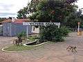 Baboons at Victoria Falls station, Zimbabwe
 Victoria Falls Public Library
 Victoria Falls, Zimbabwe, looking eastwards