Via Tiburtina

Via Tiburtina is an ancient road in Italy leading east-northeast from Rome to Tivoli (Latin, Tibur) and then on to Pescara (Latin, Aternum).
Historical road
It was built by the Roman consul Marcus Valerius Maximus around 286 BC and later lengthened to the territories of the Marsi and the Aequi, in the Abruzzo, as Via Valeria. Its total length was approximately 200 km from Rome to Aternum (the modern Pescara). It exited Rome through the Aurelian Wall at the Porta Tiburtina, and through the Servian Wall at the Porta Esquilina. Historians assert that the Via Tiburtina must have come into existence as a trail during the establishment of the Latin League. Though afterward it became an important thoroughfare, the first portion of the Via Tiburtina always retained its original name of Via Valeria, which applied only to the portion of the road beyond Tibur. It is difficult to determine the last portion of the course of the Via Tiburtina from the Albulae Aquae to Tibur.[1]
Roman bridges

- For an overview of the location of Roman bridges, see List of Roman bridges.
There are the remains of several Roman bridges along the road, including the Ponte Lucano and Ponte Mammolo.
Contemporary road
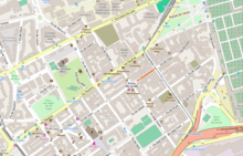
A former state road with the same name exists today and follows the same path.
See also
References
- Attribution
 This article incorporates text from a publication now in the public domain: Chisholm, Hugh, ed. (1911). "Tiburtina, Via". Encyclopædia Britannica. 26 (11th ed.). Cambridge University Press.