Vesper, Wisconsin
| Vesper, Wisconsin | |
|---|---|
| Village | |
 Location of Vesper, Wisconsin | |
| Coordinates: 44°28′52″N 89°58′3″W / 44.48111°N 89.96750°WCoordinates: 44°28′52″N 89°58′3″W / 44.48111°N 89.96750°W | |
| Country | United States |
| State | Wisconsin |
| County | Wood |
| Area[1] | |
| • Total | 1.16 sq mi (3.00 km2) |
| • Land | 1.16 sq mi (3.00 km2) |
| • Water | 0 sq mi (0 km2) |
| Elevation[2] | 1,096 ft (334 m) |
| Population (2010)[3] | |
| • Total | 584 |
| • Estimate (2012[4]) | 576 |
| • Density | 503.4/sq mi (194.4/km2) |
| Time zone | Central (CST) (UTC-6) |
| • Summer (DST) | CDT (UTC-5) |
| Area code(s) | 715 & 534 |
| FIPS code | 55-82650[5] |
| GNIS feature ID | 1576070[2] |
| Website | http://www.villageofvesper.com/ |
Vesper is a village in Wood County, Wisconsin, United States. The population was 584 at the 2010 census.
History

A post office called Vesper has been in operation since 1878.[6] The village was named for vesper sparrows native to the area.[7]
Geography
Vesper is located at 44°28′52″N 89°58′3″W / 44.48111°N 89.96750°W (44.481016, -89.967423).[8]
According to the United States Census Bureau, the village has a total area of 1.16 square miles (3.00 km2), all of it land.[1]
Demographics
| Historical population | |||
|---|---|---|---|
| Census | Pop. | %± | |
| 1950 | 342 | — | |
| 1960 | 351 | 2.6% | |
| 1970 | 355 | 1.1% | |
| 1980 | 554 | 56.1% | |
| 1990 | 598 | 7.9% | |
| 2000 | 541 | −9.5% | |
| 2010 | 584 | 7.9% | |
| Est. 2015 | 559 | [9] | −4.3% |
2010 census
As of the census[3] of 2010, there were 584 people, 246 households, and 160 families residing in the village. The population density was 503.4 inhabitants per square mile (194.4/km2). There were 264 housing units at an average density of 227.6 per square mile (87.9/km2). The racial makeup of the village was 96.7% White, 0.7% Native American, 0.3% Asian, 0.2% from other races, and 2.1% from two or more races. Hispanic or Latino of any race were 1.0% of the population.
There were 246 households of which 28.0% had children under the age of 18 living with them, 52.8% were married couples living together, 6.5% had a female householder with no husband present, 5.7% had a male householder with no wife present, and 35.0% were non-families. 26.8% of all households were made up of individuals and 11.8% had someone living alone who was 65 years of age or older. The average household size was 2.37 and the average family size was 2.84.
The median age in the village was 36.4 years. 22.4% of residents were under the age of 18; 9.4% were between the ages of 18 and 24; 28% were from 25 to 44; 24.5% were from 45 to 64; and 15.6% were 65 years of age or older. The gender makeup of the village was 49.8% male and 50.2% female.
2000 census
As of the census[5] of 2000, there were 541 people, 234 households, and 153 families residing in the village. The population density was 482.2 people per square mile (186.5/km²). There were 243 housing units at an average density of 216.6 per square mile (83.8/km²). The racial makeup of the village was 98.71% White, 0.18% Native American, 0.18% Asian, 0.18% from other races, and 0.74% from two or more races. Hispanic or Latino of any race were 0.74% of the population.
There were 234 households out of which 29.5% had children under the age of 18 living with them, 52.6% were married couples living together, 10.3% had a female householder with no husband present, and 34.2% were non-families. 30.3% of all households were made up of individuals and 14.5% had someone living alone who was 65 years of age or older. The average household size was 2.31 and the average family size was 2.88.
In the village the population was spread out with 25.0% under the age of 18, 6.8% from 18 to 24, 29.0% from 25 to 44, 23.3% from 45 to 64, and 15.9% who were 65 years of age or older. The median age was 39 years. For every 100 females there were 90.5 males. For every 100 females age 18 and over, there were 89.7 males.
The median income for a household in the village was $38,750, and the median income for a family was $45,000. Males had a median income of $36,161 versus $20,833 for females. The per capita income for the village was $19,327. About 6.6% of families and 7.2% of the population were below the poverty line, including 7.6% of those under age 18 and 8.1% of those age 65 or over.
Notable people
- Clifford R. Goldsworthy, Wisconsin State Assemblyman, farmer, and businessman, lived in Vesper; Goldsworthy was the town chairman and postmaster in Vesper.[11]
References
- 1 2 "US Gazetteer files 2010". United States Census Bureau. Archived from the original on January 24, 2012. Retrieved 2012-11-18.
- 1 2 "US Board on Geographic Names". United States Geological Survey. 2007-10-25. Retrieved 2008-01-31.
- 1 2 "American FactFinder". United States Census Bureau. Retrieved 2012-11-18.
- ↑ "Population Estimates". United States Census Bureau. Archived from the original on June 17, 2013. Retrieved 2013-06-24.
- 1 2 "American FactFinder". United States Census Bureau. Archived from the original on September 11, 2013. Retrieved 2008-01-31.
- ↑ "Wood County". Jim Forte Postal History. Retrieved 30 March 2015.
- ↑ Chicago and North Western Railway Company (1908). A History of the Origin of the Place Names Connected with the Chicago & North Western and Chicago, St. Paul, Minneapolis & Omaha Railways. p. 134.
- ↑ "US Gazetteer files: 2010, 2000, and 1990". United States Census Bureau. 2011-02-12. Retrieved 2011-04-23.
- ↑ "Annual Estimates of the Resident Population for Incorporated Places: April 1, 2010 to July 1, 2015". Retrieved July 2, 2016.
- ↑ "Census of Population and Housing". Census.gov. Archived from the original on May 11, 2015. Retrieved June 4, 2015.
- ↑ 'Wisconsin Blue Book 1907,' Biographical Sketch of Clifford R. Goldsworthy, pg. 1177
External links
- Vesper Photograph Collection, McMillan Memorial Library
- History of Wood County CHAPTER XVIII Vesper
- 1909 plat map of Vesper
- 1928 plat map
Municipalities and communities of Wood County, Wisconsin, United States | ||
|---|---|---|
| Cities | 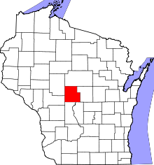 | |
| Villages | ||
| Towns | ||
| CDPs | ||
| Unincorporated communities | ||
| Indian reservation | ||
| Footnotes | ‡This populated place also has portions in an adjacent county or counties | |