Vermont Route 8
| ||||
|---|---|---|---|---|
|
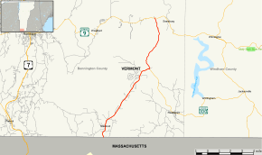
Map of Bennington County in southwestern Vermont with VT 8 highlighted in red | ||||
| Route information | ||||
| Maintained by VTrans | ||||
| Length: | 13.155 mi[1] (21.171 km) | |||
| Major junctions | ||||
| South end: |
| |||
|
| ||||
| North end: |
| |||
| Location | ||||
| Counties: | Bennington | |||
| Highway system | ||||
| ||||

Vermont Route 8 (VT 8) is a state highway in the U.S. state of Vermont. The highway runs 13.155 miles (21.171 km) from the Massachusetts state line in Stamford, where it continues south as Massachusetts Route 8, to VT 9 in Searsburg. VT 8 connects the southeastern Bennington County towns of Stamford, Readsboro, and Searsburg.
Route description
VT 8 begins at the Massachusetts state line in the town of Stamford. The highway continues south as Massachusetts Route 8 toward North Adams. The state line is also the southern terminus of VT 100; the two routes head north along two-lane Main Road parallel to the North Branch of the Hoosic River through the town center of Stamford. VT 8 and VT 100 enter the town of Readsboro just before reaching the source of the river. The highways curve east to the headwaters of the West Branch of the Deerfield River at Heartwellville. There, VT 100 continues southeast along that river. VT 8 turns north along an unnamed tributary of the river, which the highway follows to its source at the Readsboro–Searsburg town line. The highway continues north to the town center of Searsburg, where it reaches its northern terminus at VT 9 (Molly Stark Highway) between Bennington to the west and Brattleboro to the east.
History

Much of Route 8 follows the course of the 1920s era New England Interstate Route 8, a part of the New England road marking system that ran from Bridgeport, Connecticut, through Pittsfield, Massachusetts, to Wilmington, Vermont.
Major intersections
The entire route is in Bennington County.
| Location | mi[1] | km | Destinations | Notes | |
|---|---|---|---|---|---|
| Stamford | 0.000 | 0.000 | Southern termini of VT 8 and VT 100; Massachusetts state line | ||
| Readsboro | 7.945 | 12.786 | North end of concurrency with VT 100 | ||
| Searsburg | 13.155 | 21.171 | Northern terminus | ||
1.000 mi = 1.609 km; 1.000 km = 0.621 mi
| |||||
See also
-
 Vermont portal
 -
 U.S. Roads portal
References
- 1 2 "2010 (Route Log) AADTs - State Highways" (PDF). Vermont Agency of Transportation. May 2011. Retrieved May 10, 2013.