Veregava Ridge
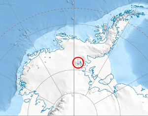
Veregava Ridge (Bulgarian: хребет Верегава, ‘Hrebet Veregava’ \'hre-bet ve-re-'ga-va\) is the ridge rising to 3100 m at Mount Waldron and including Kushla Peak, Sipey Peak and Parangalitsa Peak, in the northeast foothills of Vinson Massif in Sentinel Range, Ellsworth Mountains in Antarctica. The feature extends 15.7 km in southwest-northeast direction and 6 km in southeast-northwest direction, and has its interior drained by Berisad Glacier and Orizari Glacier. It is bounded by Dater Glacier to the west and north, and its tributary Hansen Glacier to the southeast, and separated from Doyran Heights to the south by Manole Pass.
The ridge is named after the eastern Balkan Mountains (old Bulgarian name Veregava).
Location
Veregava Ridge is centred at 78°26′30″S 84°55′00″W / 78.44167°S 84.91667°WCoordinates: 78°26′30″S 84°55′00″W / 78.44167°S 84.91667°W. US mapping in 1961, updated in 1988.
Maps
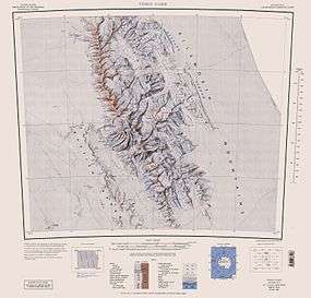
- Vinson Massif. Scale 1:250 000 topographic map. Reston, Virginia: US Geological Survey, 1988.
References
- Veregava Ridge. SCAR Composite Antarctic Gazetteer.
- Bulgarian Antarctic Gazetteer. Antarctic Place-names Commission. (details in Bulgarian, basic data in English)
This article includes information from the Antarctic Place-names Commission of Bulgaria which is used with permission.