Venkatagiri
| Venkatagiri వేంకటగిరి | |
|---|---|
| Town | |
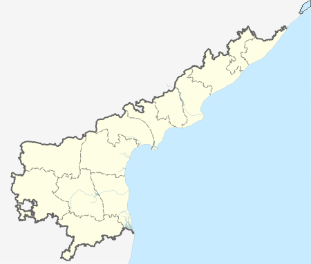
 Venkatagiri Location in Andhra Pradesh, India | |
| Coordinates: 13°58′00″N 79°35′00″E / 13.9667°N 79.5833°ECoordinates: 13°58′00″N 79°35′00″E / 13.9667°N 79.5833°E | |
| Country | India |
| State | Andhra Pradesh |
| District | Nellore |
| Area[1] | |
| • Total | 25.43 km2 (9.82 sq mi) |
| Elevation | 60 m (200 ft) |
| Population (2011)[2] | |
| • Total | 51,708 |
| • Density | 2,000/km2 (5,300/sq mi) |
| Languages | |
| • Official | Telugu |
| Time zone | IST (UTC+5:30) |
Venkatagiri is a town in Nellore district of the Indian state of Andhra Pradesh. It is a municipality and mandals headquarters of Venkatagiri mandal.[3] Venkatagiri's old name is "Kali Mili". It is famous for its Handloom Cotton Sarees. Venkatagiri is a place for history and handlooms. It was part of a small kingdom that was integrated into the Indian Republic.
Geography
Venkatagiri is located at 13°58′00″N 79°35′00″E / 13.9667°N 79.5833°E.[4] It has an average elevation of 60 metres (197 feet).
Demographics
As of 2001 India census,[5] Venkatagiri Mandal had a population of 80,000. Venkatagiri Rural consists of 58 Revenue Villages. Venkatagiri became municipality in 6-1-2005 by merging Venkatagiri,ChevireddiPalli,Periyavaram,Bangarupet,Ammavaripet and Manulalapet Panchayats.Total population of municipality is 52,478.Venkatagiri has an average literacy rate of 67%,higher than the national average of 59.5%.Total area of municipality is 23.50 km2.
Governance
Civic administration
The Piduguralla municipality was formed as a Grade–III municipality in 2005 and has an extent of 25.43 km2 (9.82 sq mi).[6][1]
Economy
Venkatagiri Sari woven in and around the town is one of the geographical indication from Andhra Pradesh and got registered by Geographical Indications of Goods (Registration and Protection) Act, 1999.[7][8]
Politics
Venkatagiri falls under Venkatagiri (Assembly constituency) of Andhra Pradesh Legislative Assembly. It is in turn a apart of Tirupati (Lok Sabha constituency).
Education
The primary and secondary school education is imparted by government, aided and private schools, under the School Education Department of the state.[9][10] The medium of instruction followed by different schools are English, Telugu.
Transport
Venkatagiri railway station is located on Gudur–Renigunta section. APSRTC buses, run by state government provide transport to the nearby and long distance travel.
References
- 1 2 "Municipalities, Municipal Corporations & UDAs" (PDF). Directorate of Town and Country Planning. Government of Andhra Pradesh. Archived from the original (PDF) on 28 January 2016. Retrieved 29 January 2016.
- ↑ "Census 2011". The Registrar General & Census Commissioner, India. Retrieved 7 August 2014.
- ↑ "Revenue Setup". Official website of Sri Potti Sri Ramulu Nellore District. National Informatics Centre. Retrieved 10 June 2015.
- ↑ Falling Rain Genomics, Inc - Venkatagiri Town
- ↑ "Census of India 2001: Data from the 2001 Census, including cities, villages and towns (Provisional)". Census Commission of India. Archived from the original on 2004-06-16. Retrieved 2008-11-01.
- ↑ "Brief about Municipality". Commissioner and Director of Municipal Administration. Government of Andhra Pradesh. Retrieved 19 February 2015.
- ↑ "Geographical Indication". The Hans India. 23 January 2016. Retrieved 29 January 2016.
- ↑ "State Wise Registration Details of G.I Applications" (PDF). Geographical Indication Registry. p. 5. Retrieved 28 January 2016.
- ↑ "School Eduvation Department" (PDF). School Education Department, Government of Andhra Pradesh. Retrieved 7 November 2016.
- ↑ "The Department of School Education - Official AP State Government Portal | AP State Portal". www.ap.gov.in. Retrieved 7 November 2016.
External links
| Wikimedia Commons has media related to Venkatagiri. |