Vejer de la Frontera
Vejer de la Frontera is a Spanish hilltop town and municipality in the province of Cádiz, Andalusia, on the right bank of the river Barbate. The town of Vejer de la Frontera occupies a low hill overlooking the Straits of Gibraltar and surrounded by orchards and orange groves. It contains several ancient churches and convents, and the architecture of many of its houses recalls the period of Moorish rule, which lasted from 711 until the town was captured by Saint Ferdinand of Castile in 1248. Agriculture and fruit-farming are the chief industries; fighting bulls are also bred in the neighborhood and a running of the bulls is held annually.
Demographics
| Historical population |
|---|
| Year | Pop. | ±% |
|---|
| 1999 | 12,731 | — |
|---|
| 2000 | 12,674 | −0.4% |
|---|
| 2001 | 12,729 | +0.4% |
|---|
| 2002 | 12,727 | −0.0% |
|---|
| 2003 | 12,690 | −0.3% |
|---|
| 2004 | 12,685 | −0.0% |
|---|
| 2005 | 12,776 | +0.7% |
|---|
| Source: INE (Spain) |
Sister cities
Gallery
References
- ↑ Chaouen está hermanada con Vejer de la Frontera (Cádiz), que a su vez estuvo bajo el dominio musulmán durante cinco siglos.
 This article incorporates text from a publication now in the public domain: Chisholm, Hugh, ed. (1911). "article name needed". Encyclopædia Britannica (11th ed.). Cambridge University Press.
External links

.png)
.svg.png)

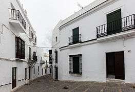 Street in Vejer.
 Vejer is a classic Andalusian Pueblo Blanco.
 View of the mill.
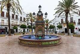 Main square.
 Church of the Conception.
 Mayorazgo Tower.